SFMTA Presents Design Options for a More Livable Polk Street

Planners at the SF Municipal Transportation Agency this Saturday unveiled options for redesigning Polk Street as a better place for walking, biking, socializing, and transit. The proposed concepts [PDF] show different ways to arrange the limited amount of street space for traffic lanes (which serve buses on Muni's 19-Polk line), bike lanes, expanded pedestrian areas, and spots for vehicle loading and parking.
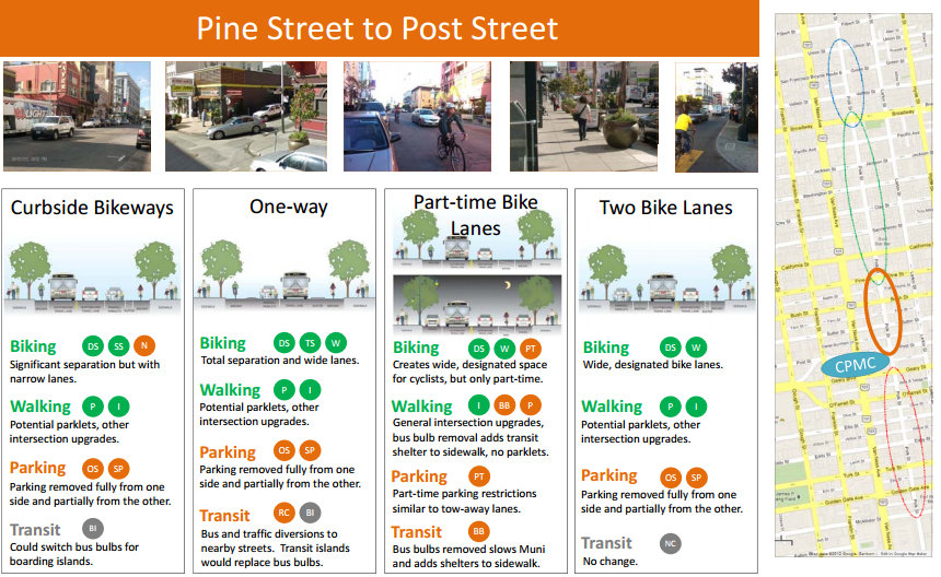
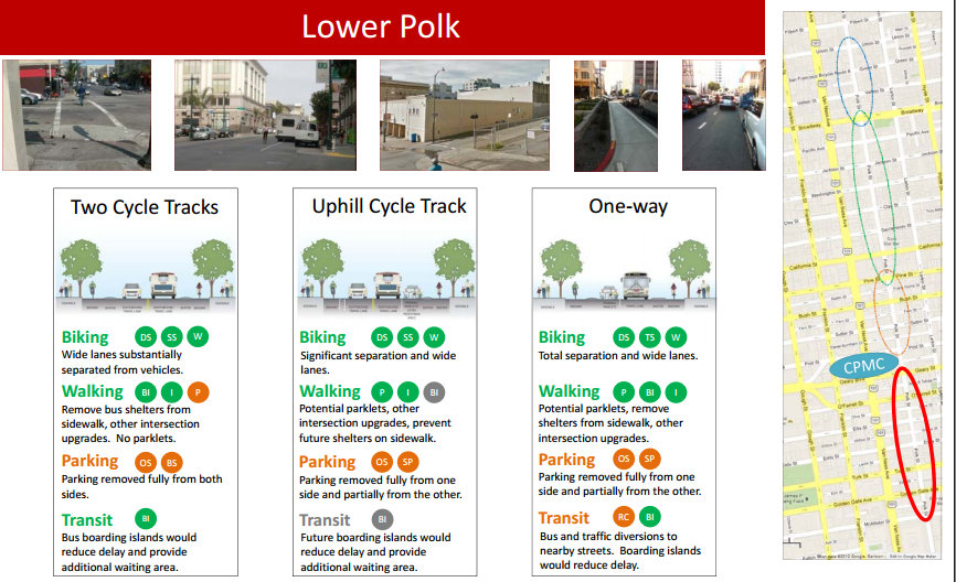
Planners divided Polk into four sections, each with a set of possible configurations, and listed each proposal's pros and cons for the different modes of transport. Proposals include curbside bike lanes separated from motor traffic by parklets, buffer zones, and boarding islands (though some proposals include removing the bike lanes or making them part-time only on the calmer stretches). Pedestrian space could be expanded by adding "mega parklets," like the one spanning several blocks of Powell Street, and re-making intersecting alleys to "activate" them as pedestrianized public spaces. Corner bulb-outs would also be added at the most dangerous intersections along lower Polk. Transit could be sped up with more bus bulb-outs and boarding islands, though one proposal would actually convert Polk to a one-way street and re-route one direction of Muni's 19 bus onto a parallel street, an idea transit advocates are still debating.
"Polk has been identified by the city as a high-injury corridor for pedestrians," said Walk SF Executive Director Elizabeth Stampe. "It has many wide, one-way cross-streets whose high-speed traffic poses the greatest risk. There are many opportunities for bulb-outs and other traffic calming. You can see how much more pleasant the street is where there are bus bulbs now. Traffic calming, greening, and more sidewalk space were the priorities our members identified on our walk along Polk."
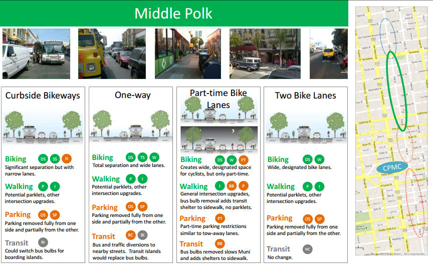
SFMTA planners said traffic signals could also be re-timed for slower speeds to calm traffic, and that each intersection along the corridor would receive pedestrian countdown signals. Although there's interest in diverting car traffic off the street to decrease congestion and speed up the 19, they said physical barriers couldn't be used without also impeding buses, and that forced turns which rely solely on signs and enforcement (like those currently in place on Market Street) are too ineffective to be considered. However, planners did say bus-only, car-free zones, perhaps with more visible design treatments to deter cars, could be proposed later in the process.
Unlike the popular proposal for Second Street, which includes raised bike lanes separated by planted buffer zones and boarding islands, Polk isn't wide enough to use the same design and provide buffer zones wide enough to fit curb ramps, SFMTA staff said. As one possible solution, the proposals show hump-shaped buffer zones that could be mounted by wheelchairs.
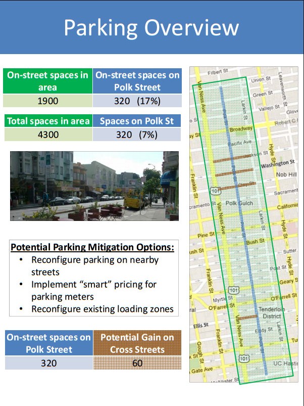
Planners said the proposals were developed based on input from community meetings and walking tours over the past two months. Given the limited amount of space, all of the concepts would remove car parking from one or both sides of the streets for at least part of the day. According to the SFMTA, the on-street parking on Polk between McAllister and Union Streets (the project area) makes up just 7 percent of the parking supply along the corridor, defined as the area within one block of the street.
Planners expect to present a preferred design concept early next year, and may propose a pilot project that could be implemented by next summer, though it's not clear what that would look like yet. Construction of the finished capital project is scheduled to begin by early 2015.
The SFMTA has posted an online survey on the proposals where you can submit feedback until December 28. The agency will also hold a second open house to explain the proposals this Friday, from 9 a.m. to 11 a.m. at Velvet Da Vinci, located at 2015 Polk Street between Pacific and Broadway.
Stay in touch
Sign up for our free newsletter