Eyes on the Street: A Livable Street Emerges Next to the Central Freeway
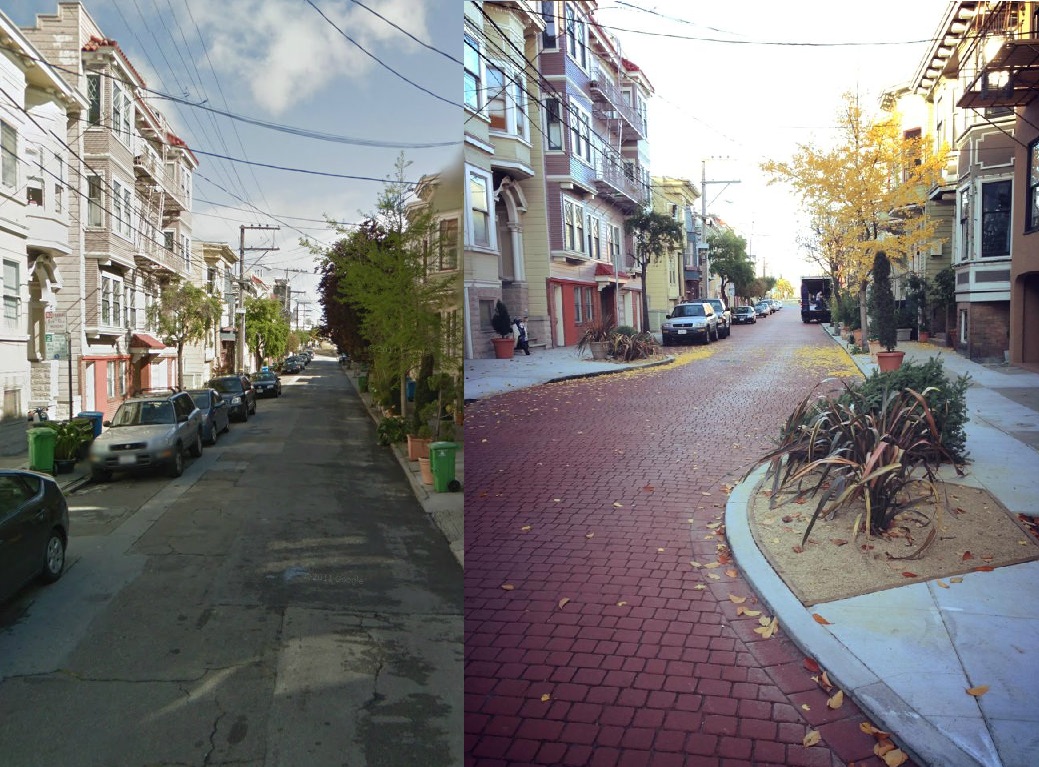
A nice little transformation has taken place on Elgin Park, a one-block residential street next to the Central Freeway touchdown at Market Street and Octavia Boulevard.
Streetsblog reader Mark Dreger sent in the above photo of the makeover, noting that "it looks like SF's version of a woonerf" -- the Dutch term for the pedestrianized streets common in the Netherlands, where cars are allowed, but priority is given to people on foot and children playing.
The project is a piece of the Department of Public Works' West SoMa Improvements, which set out to create greener, calmer streets in the neighborhood around McCoppin Street, where the Central Freeway spur was reconstructed in the middle of the last decade. While the removal of the freeway north of Market revitalized Hayes Valley, Caltrans insisted on rebuilding the freeway on the south side of Market, despite a city-backed plan to remove it further south.
Elgin Park, which lies west of Valencia between Duboce Avenue and Market (where there's a bike/ped-only entrance ramp from Market), is one of several alleyways that are being revamped with new pavement and greening, as well as traffic-calming chicanes and raised crosswalks. At the west end of McCoppin (on the opposite side of the freeway), which has been re-paved with planted medians, chicanes, and bike lanes, the McCoppin Hub plaza is set to be constructed by summer, according to the DPW website.
Stay in touch
Sign up for our free newsletter
More from Streetsblog San Francisco
Commentary: Make Bay Area Transit Seamless as Condition of New Funding


SFMTA Starts West Portal Outreach
Agency presents plans to block traffic from crossing in front of the train station