Transit to Trails Site Debuted And SF Announces Digital App Showcase

We all know that you don't have to go far from Bay Area cities to find some of the most beautiful mountains and epic beaches in the country, but you might be surprised how easy it is to get to those hikes and natural wonders without a car. Thanks to a beta website called Transit and Trails, hosted by the Bay Area Open Space Council, you can ditch your ride and plan your next adventure taking public transportation to Mt. Tam or Stinson Beach or Briones.
Though the site reminds you that it's still in beta and needs your feedback to make it better, they've done a great job linking you to beautiful hikes and day trips without the need to sit in bridge traffic. By partnering with 511.org, the site uses up-to-the-minute transit information to make your trip planning as convenient as possible. Please check it out and let the site managers know if there are bugs to work out or content they are missing.
Also, if you're headed out this weekend for a hike, why don't you see how well the route planner works and let us know the results.
Data SF App Showcase
Not to be outdone in the cool use of data department, San Francisco Mayor Gavin Newsom announced a new facet of the city's Data SF website, this one showcasing the various applications that have been created for computers and mobile devices using city data sources.
"We are trying to turn San Francisco’s government into an organizing platform for civic engagement by giving our residents the tools to build the kind of government that works for them," said Mayor Newsom. "This is just the beginning. We hope creative developers will build countless more apps never dreamed of in City Hall."
In addition to faves like Routesy, the app showcase has several applications that map crime data and one that tracks cabs. Pretty good use of city data so far, though we're still anxious to see a cool application expanding on the city's bicycle map, perhaps featuring user feedback on routes, major potholes, etc. Does that already exist, Streetsbloggers?
Stay in touch
Sign up for our free newsletter
More from Streetsblog San Francisco
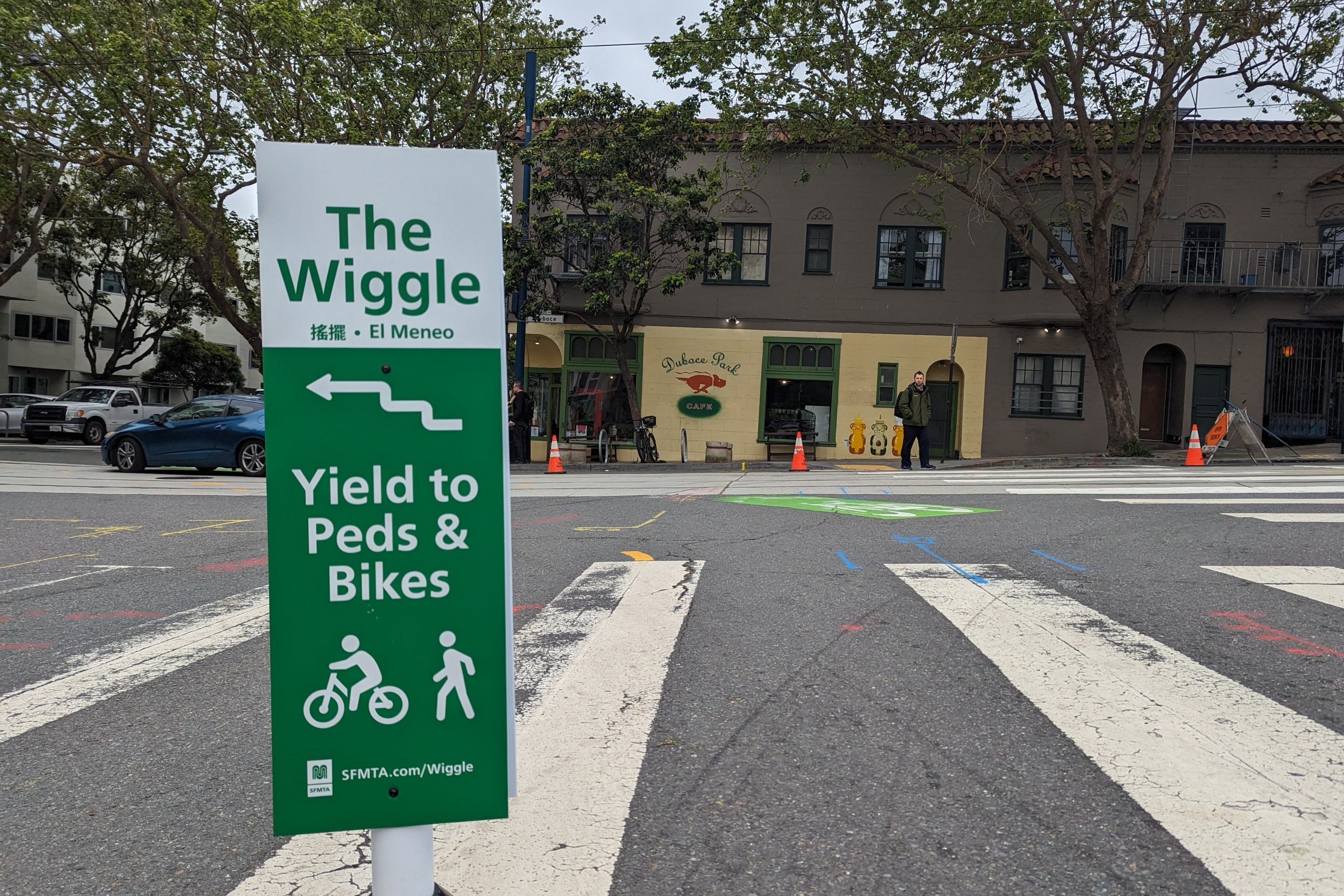
Independent Safety Advocates Beef up the Wiggle
Signs and soft-hit posts installed by advocates make the Wiggle bike route calmer and safer for cyclists and pedestrians