East San Jose Bikeway Plan Scrutinized, Park Avenue Parking Debate Begins
About two dozen residents attended a San Jose Department of Transportation (SJDOT) community meeting last Wednesday, where staff gathered public input on four upcoming bike lane and sharrow projects planned for east San Jose streets. Five other projects, which will add bike lanes and sharrows to streets west of downtown -- and, to the chagrin of some, replace some parking along Park and Lincoln avenues with continuous bike lanes -- will be presented at a community meeting this Wednesday at Gardner Community Center, 520 West Virginia Street, at 6 pm.
Improvements planned for Jackson Avenue, Madden Avenue, Sunset Avenue/Hopkins Drive, and Ocala Avenue will add or upgrade three miles of bike lanes, sharrows, and signage. These will connect to San Antonio Street, one of the Primary Bikeways identified by the city's Bike Plan 2020 as a core network of high-quality bikeways.
"The Primary Bikeway Network is designed in a similar way for biking as our highway system is for moving cars," explained Deputy Director of Transportation Paul Smith. "To go all the way across the city, there need to be routes that everyone can use safely and conveniently -- routes that have some type of enhanced treatment, like the green buffered bike lanes on Hedding Street."
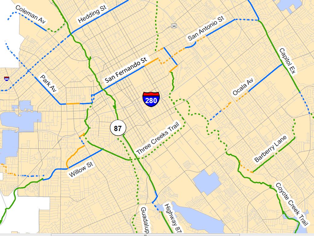
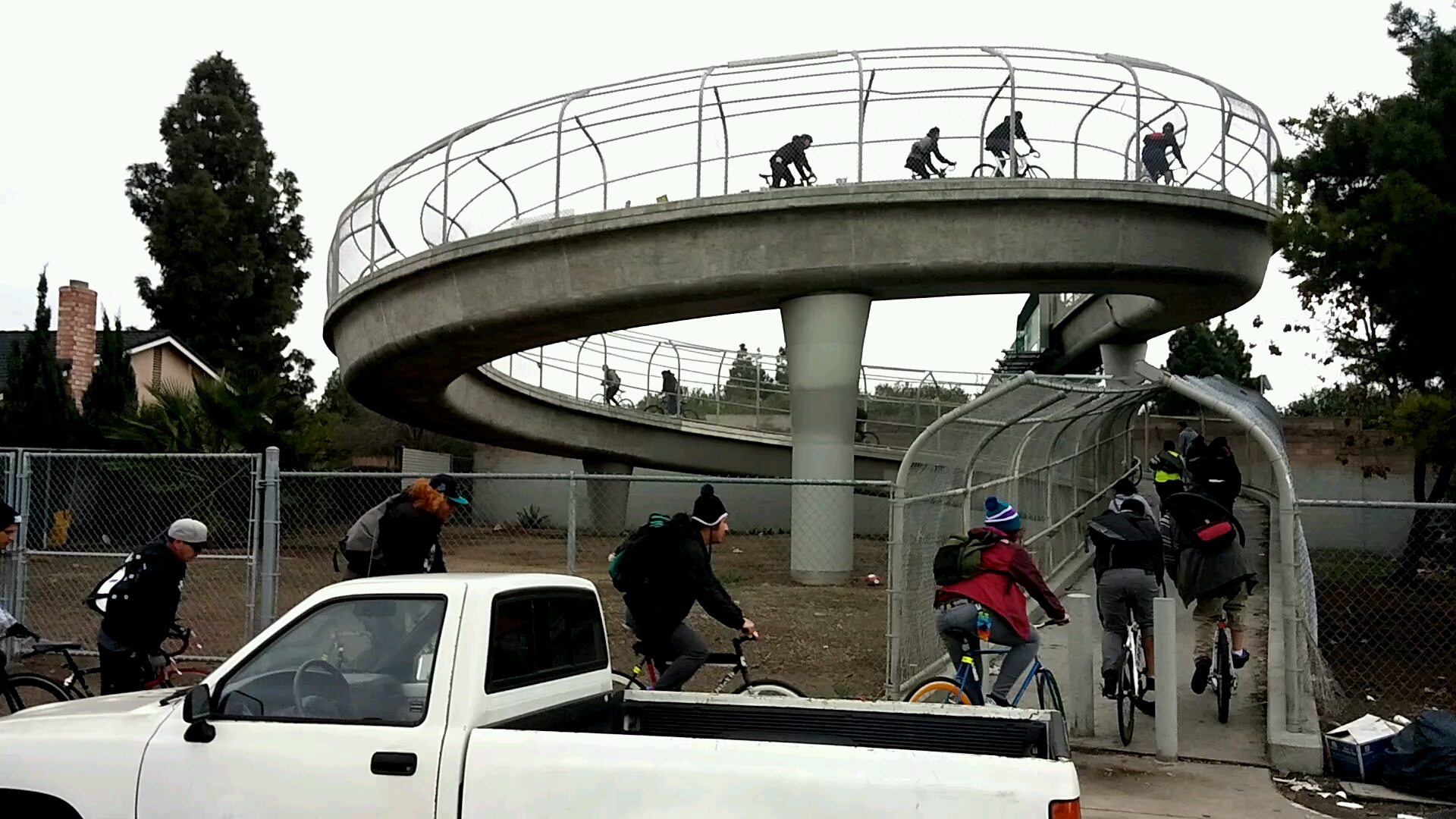
The four bike lane and sharrow projects proposed at the community meeting last week will connect bicyclists in many east San Jose neighborhoods to San Antonio Street, and then across town via San Fernando and Park. San Antonio itself could be upgraded to a bicycle boulevard, by minimizing stop signs and adding traffic calming features. These new bike routes, marked with sharrows and signage, will guide cyclists over Highway 280 via existing pedestrian bridges at Madden Avenue and at Sunset Avenue.
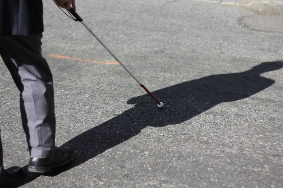
Residents complained that many cyclists have been hurt by the bollards located at the entrances to those bridges, and that they're forced to ride on the sidewalks leading to the bridges. Curb cuts were never constructed at the bridge's entrances, and parked vehicles often block the entrances anyways.
The 1.5-mile long sharrow route along Sunset Avenue/Hopkins Drive, which will connect San Antonio Street with bike lanes on Ocala Avenue, also lacks a crucial curb cut. Bicyclists often use a sidewalk to cross Story Road, whose six lanes of traffic are divided by narrow median.
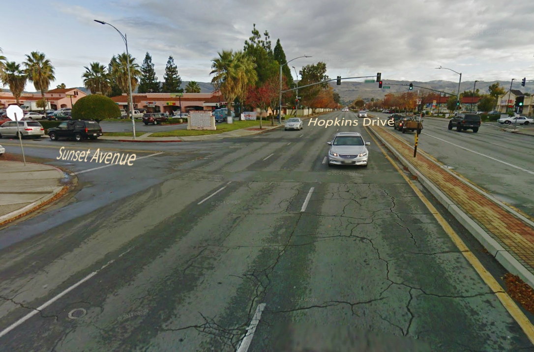
SJDOT Active Transportation Program Planner Ryan Smith explained that the city is considering reconfiguring the traffic signal at Hopkins Drive and Story Road to include Sunset Avenue, and adding an opening in the central median.
The projects presented at the meeting also include upgrading 1/2 mile of Ocala Avenue from Daytona Drive to Capitol Expressway, adding buffered bike lanes, a landscaped median, and a new traffic signal at Adrian Way. This would be funded with a $1.5 million grant from the federal Highway Safety Improvement Program. Local residents welcomed the bikeway proposals, but also stressed that simple street maintenance on the east side could make cycling much easier.
"The pavement is terrible where Santa Clara Street becomes Alum Rock over [Highway] 101," said Rodrigo Gonzales. "On both sides. At night, the cracks and potholes are hard to see heading downhill."
"There's glass and debris on a lot of east side streets," added Eric Mendoza. "I ride almost every day, and I get a lot of flats here."
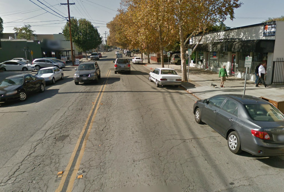
At the west end of the Park/San Fernando/San Antonio Primary Bikeway, the city's transportation planners hope to install standard and buffered bicycle lanes, new pedestrian curb ramps, and some signal modifications on Park Avenue to create "an enhanced bicycle-friendly corridor linking our downtown to the City of Santa Clara."
Standard bike lanes would be added where none exist now, and existing door-zone bike lanes would be upgraded to buffered bike lanes, removing 168 on-street parallel parking spaces in the process. Currently, drivers may park vehicles on both sides of Park Avenue. Some retail business owners along the four blocks of Park between Race and Sunol streets, just west of Diridon Station, have already expressed concerns about removing parking.
"That proposal will be very hurtful for the local business on the street," wrote King of Campus shirt printing shop owner Sulaiman Hyatt in a Facebook discussion thread. "I unload and load up boxes all day, so parking is a very important thing for me. Also for my clients parking is a very important thing."
Mr Hyatt suggested that super sharrows (green lane painted inside a travel lane) be installed between Race and Sunol streets, instead of removing 35 parallel parking spaces along the westbound side of Park Avenue. San Francisco and Palo Alto have installed green-backed sharrows on some of their designated bike routes.
"Taking the lane on a high-volume street with 35 mph traffic hardly qualifies as a bike route," countered bike blogger Janet Lafleur. "Some [drivers] will honk, pass close, or tailgate to harass and intimidate the bike riders to get out of the way. Even with green backing and a [dashed] yellow line, sharrows won't be enough to get anyone except the 3% of the population who are already hardened urban riders to start riding," said Lafleur.
A city-conducted parking study for Park Avenue found that peak demand for the 66 existing on-street parking spaces on that stretch of Park Avenue was 70 to 76 percent, with higher demand along the street's eastbound lane. 35 parking spaces would be removed along the westbound travel lane, which at peak demand would result in 18 drivers looking for somewhere else to park.
These drivers won't have to look far: the city's parking study concludes that "there is adequate remaining parking on Park Avenue in off-street commercial lots, residential properties, and on side streets within 200 feet of Park Avenue to satisfy the parking demand in the corridor." Private off-street parking lots along this section of Park Avenue can store 132 vehicles. A total of 92 spaces are available along side streets within 200 feet, namely Sunol, Cleaves, Morrison, Ranier, and Race streets, and "almost all of the residences within this segment of Park Avenue have the capacity to park at least one vehicle on their premises," according to the study.
The other bikeway projects proposed for the area west of downtown include a total of 3 miles of new bike lanes on Lincoln Avenue, Julian Avenue, and Stockton Street, and about 1.5 miles of sharrows on Scott Street and Auzerais Avenue.
Stay in touch
Sign up for our free newsletter