Subway Metadata Master Plan
Yesterday afternoon the Land Use and Transportation Committee of the San Francisco Board of Supervisors heard a presentation from transportation officials on efforts to design a "Subway Master Plan," a long-range blueprint for a subway network for San Francisco.
From a release on the meeting from Supervisor Scott Wiener's office:
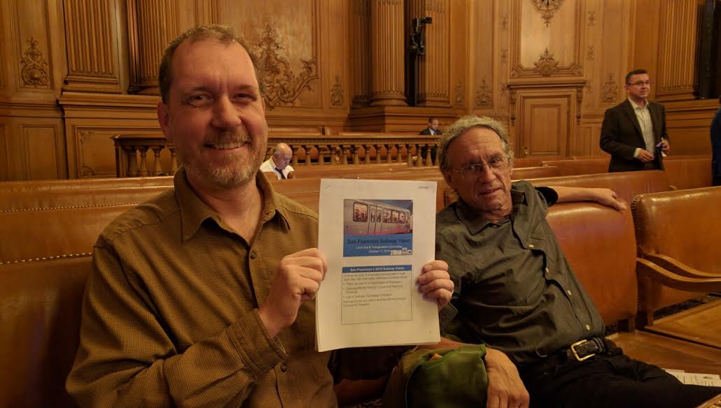
Today at the Land Use and Transportation Committee, City transportation agencies delivered a presentation on their work to create a Subway Master Plan. Supervisor Scott Wiener called for the development of the Subway Master Plan last year, and authored an ordinance requiring the policy be developed. At the hearing, the Municipal Transportation Agency (MTA) and the San Francisco County Transportation Authority (SFCTA) presented the initial findings – which they have called the Subway Vision -- that they have been developing over the last year.
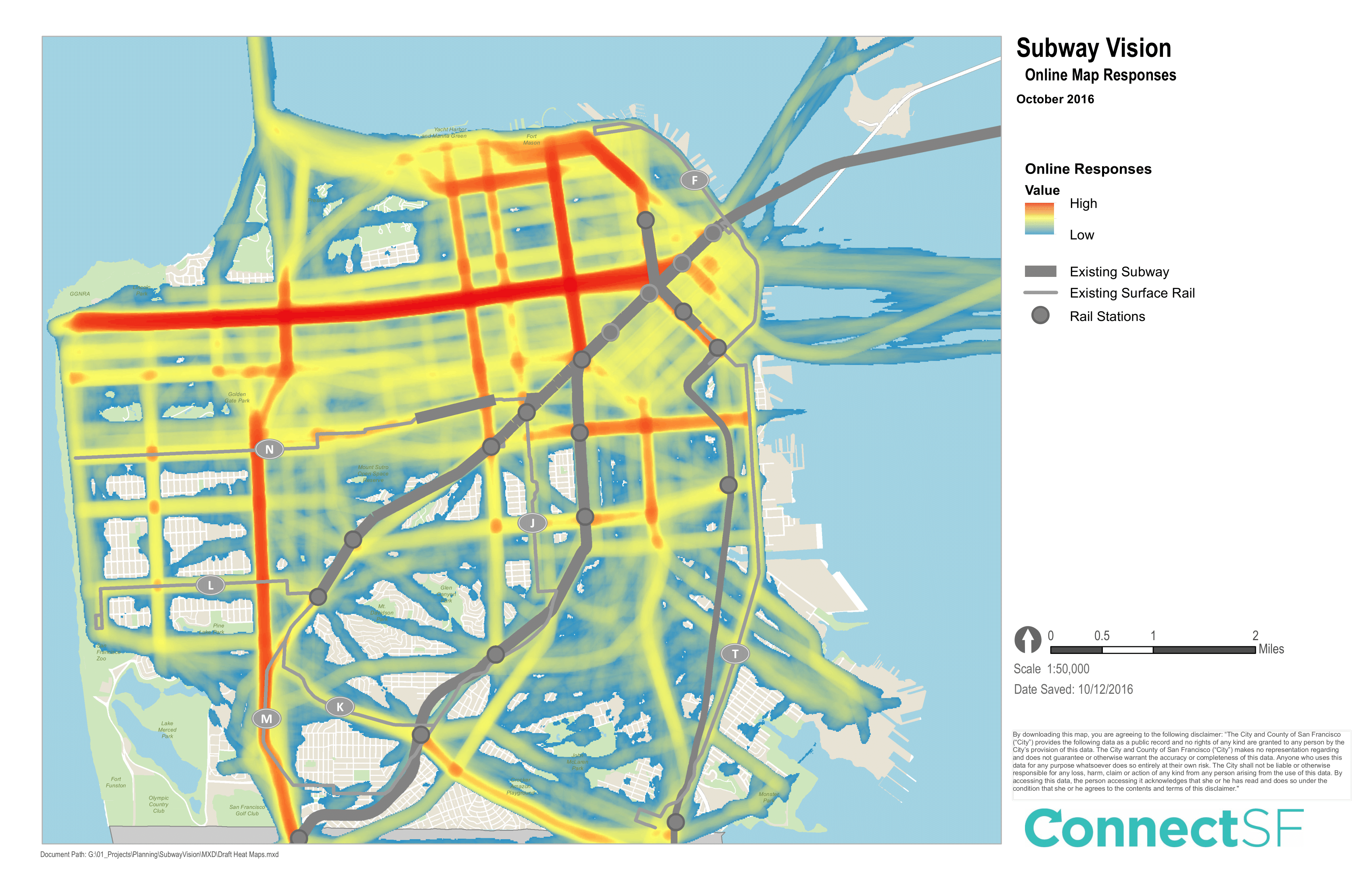
Streetsblog readers will recall that in August the SFMTA and other agencies launched a web page that invited people to draw subway lines and stations where they would most like to see them. The computers then combined the "over 2,600 unique submissions that ranged from a single line to a comprehensive system," explained Sarah Jones, SFMTA's Planning Director. "The most consistently drawn lines were in prior plans we reviewed, but also saw some other areas being opened up."
So, as readers can see from the above map of the results, a Geary subway remains high on the agenda for a whole lot of people--as reflected by the thick red line running east-west on the map. Also on people's minds is an extension of the Central Subway to the Marina, and some kind of line heading north-south on 19th Avenue.
Supervisor Wiener took notice of the demand on Geary; Jones and Wiener discussed that this probably reflects the overcrowding and plodding speed of the 38 bus. "People who rely on the 38 are very motivated," he said. But they both cautioned that subways have to be prioritized not only by where there's current demand, but where there will be demand in the future. "It's harder to think about where you’d want to go in 25 years, rather than thinking about traveling on the N or the 38 today, so the results here are expected," said Jones. "But that doesn’t stop us from thinking about what future needs will be."
"It does not appear the heat map is as strong down to the Bayview...we will be building an enormous amount of housing, but it’s not there yet," observed Wiener.
Peter Straus and Brian Stokle of the San Francisco Transit Riders came to address the committee, along with a handful of others from the public. "It’s exciting to see lines on a map," said Stokle, during the public comment period of the presentation. "But we have to finance it."
Stokle and Straus both suggested the effort was a little too San Francisco-centric. "The next priority has to be the Caltrain DTX connection. SF has other transit—Caltrain and BART, we have to make sure all three work together well. We’re not an island," added Stokle.
Wiener seemed to take slight umbrage. "San Francisco is committed to HSR and the DTX," he said. "I agree with the need for regional work. Unlike in the past we want San Francisco more engaged with our partners--BART and Caltrain matter to SF." That said, Wiener was pleased with the "metadata" the maps provided. It's worth noting the data also included real-world outreach at "pop-up" stations set up by the City, so the public didn't necessarily have to use the Internet portal to participate.
Digging into the data a little more, it's clear a second Bay crossing was on the mind of quite a few participants. Streetsblog counted over forty lines drawn by participants across the Oakland Bay. However, since there's no street grid to follow when indicating a desire for a second BART tube, the lines didn't concentrate and form a heavy line the way they did on Geary and 19th Avenue. Additionally, it would be nice to see the map zoomed out, so that participants can continue some of these subways into Alameda and the East Bay.
A couple of the speakers from the public brought up another salient point: if SF is going to go all out and spend billions on a far-flung subway system, it has to zone for the highest densities around the stations--and that's got to mean demolishing old, low density housing and surface parking around the stations. Otherwise, what's the point of building a subway that can carry hundreds of thousands of people to housing that's not dense enough to justify it?
And if San Francisco is going to go the all-subway route, it should look at trains that are compatible with BART or perhaps Caltrain's coming electrified trains--both have higher speeds and more capacity than Muni's light-rail fleet. Or, given the expense of subways, it may make more sense--at least in places--to improve surface rail routes, giving trains priority instead of having to stop at red lights for cross traffic, as they do now on so many lines.
Either way, Straus was pleased at the response to the ConnectSF outreach effort. "It's touched a nerve. San Francisco has gone from being skittish about high-capital-cost rail projects, to having a $30 to $40 billion appetite for projects," he said.
And that's a good place to be politically.
The agencies will now take more feedback and write a final report by the end of the year. Did you participate in the ConnectSF survey? If so, what do you think of the results? Comment below.
Read More:
Stay in touch
Sign up for our free newsletter