Cesar Chavez Street Redesign a Test Case For Better Agency Coordination
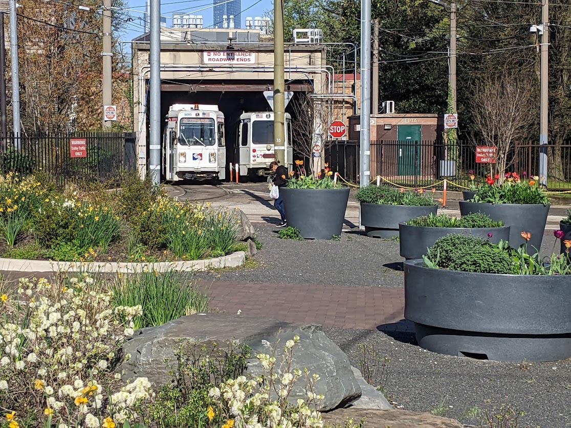
 Concept for Mission and Cesar Chavez intersection redesign. Image: Planning Department
It appears 2010 is the year the stewards of San Francisco's streets have marked to figure out how to cooperate with each other to design and build a better realm. While the much touted Better Streets Plan
synthesizes best practice principles and standards for street design,
the release of a new City Controller report (weeks early!) outlined
how the city family has historically failed to work together to better our streets [PDF], reminding us of the distance each agency has to
bridge before the public sees any concrete improvements.
The Controller's report recommended the city shoul "create and institute an efficient and thorough project design process to increase the consistency of proactive outreach by project managers to City experts and public stakeholders during the project concept phase." The report also recommends consolidating streetscape planning and delivery resources to inform developers and community partners.
Perhaps anticipating the Controller's study, project managers from the Planning Department, MTA, Department of Public Works (DPW) and Public Utilities Commission (PUC) yesterday gave a progress report at SPUR's weekly lunchtime forum on the redesign of Cesar Chavez Street
between Guerrero and Highway 101, arguing that the past two years of coordination on the project was the new standard for designing, funding, and building a world class street.
"Each agency has its charge and our projects get programmed that way,
they get planned that way with that mission in mind," said Kris
Opbroek, project manager for the DPW. "One of the things that's
shifting is all the agencies are thinking of the public right-of-way as a whole,
not just a sewer project, or just a transit project."
Staff reiterated that the process of reconstructing Cesar Chavez, the first phase of which begins later this year with drainage and sewer renovation under the street, had taught the city valuable lessons in cooperation between agencies that seldom look to each other for advice in project design. This coordination, according to the Planning Department's Andres Power, enabled the project to go after more grant funding that each individual agency would have been unable to secure on its own, including a recent $1.2 million grant from the EPA for innovative greenstreet treatments meant to capture runoff at the street level.
That the street is currently a disgrace is beyond question, particularly for pedestrians, cyclists, and transit riders. As the MTA's Mike Salaberry said, "If you like barren streetscapes only good at one thing, then you probably have no problem with Cesar Chavez."
The six-lane street moves between 30,000 and 50,000 cars daily and is designed to meet level-of-service capacity during the evening rush hour. Essentially, said Salaberry, Cesar Chavez is optimized for two hours of traffic each weekday, which is roughly 6 percent of a week. This privileging of peak-period traffic over all other users for the rest of the week is a relic of a different era, when traffic engineers expected to convert the street and neighboring Guerrero into freeway feeders.
For pedestrians, the primary issue is crossing Cesar Chavez in the north-south direction, given the width of the street. At Mission and Cesar Chavez, for instance, pedestrians have to cross seven lanes with numerous turning vehicles, many of which don't slow down to make the turn. The new plan for the intersection, paid for in part with developer fees from the 555 Bartlett condo building and Walgreens, will include pedestrian refuges in the new median island and bulbouts that will cut down the crossing distance. Similar treatments will run the length of the proposed reconstruction in an attempt to mitigate the barrier that the street is currently, dividing the neighborhoods on either side of it.
Another concern during the redesign is accommodation of day laborers, who routinely line Cesar Chavez sidewalks
waiting for work from passing vehicles exiting Highway 101. One option being considered by the city would move the Day Labor Program office from its current location just off Cesar Chavez to a new building on Bayshore Boulevard, near the Lowes. While the proposal could improve safety for both day laborers and drivers by preventing unsafe stops on the busy Chavez corridor, some neighbors say the new location is not ideal.
Fran Taylor of the community group CC Puede pointed out that the city's plan for the new site by the Lowes would require a shuttle bus from the Mission, where many of the day laborers live, in no small part because it is nearly impossible to walk through the Highway 101 and Cesar Chavez interchange nicknamed the "hairball."
While applauding the agency efforts for the street redesign, Taylor reminded the audience that she and her neighbors had been agitating for
changes to the street since 2005, well before the city came around to
the prospect of rethinking the street. Taylor noted that they had
collected more than 600 signatures in favor of traffic calming and
street improvements and that they had conducted numerous outreach
meetings to respond to concerns about lane reductions and cut-through
traffic on residential streets in the Mission and Precita.
Stay in touch
Sign up for our free newsletter
More from Streetsblog San Francisco
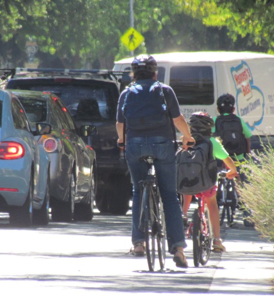
Streetsblog SF editor Roger Rudick offers constructive criticism of Chicago’s downtown bike network
"There were blocks that felt very safe and very secure," he said. "But then you're immediately – voom! – disgorged into three lanes of moving traffic with no protection."
Commentary: There is Zero Ambiguity to the West Portal Tragedy
What happened in West Portal was entirely predictable and preventable. The city must now close Ulloa to through traffic and make sure it can never happen again