Details on 2nd Street Protected Bike Lanes, Ped Upgrades Come Into Focus
The plan for raised, parking-protected bike lanes and pedestrian safety improvements on Second Street is shaping up after the Department of Public Works presented new details [PDF] last week.
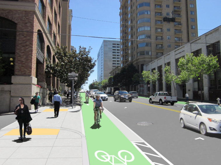
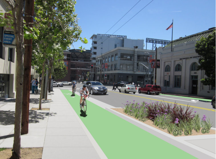
When completed in September 2016, the project is expected to transform Second into a far safer corridor with protected bike lanes, wider sidewalks, pedestrian bulb-outs, more visible crosswalks, and new greenery.
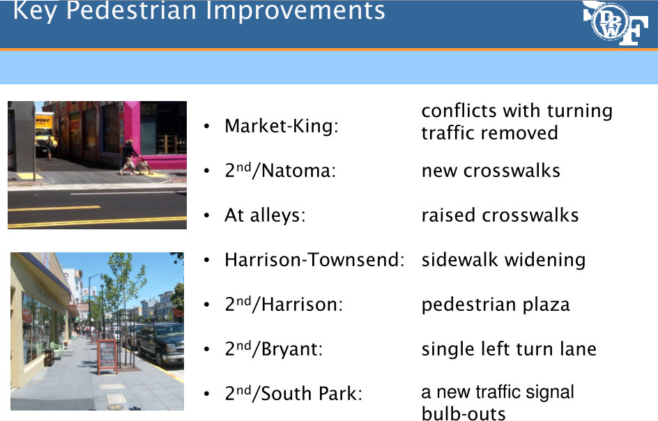
In response to calls for wider sidewalks, planners added a major improvement in the latest iteration of the plan. Originally, city staff said only one of the narrow sidewalks on the stretch of Second between Harrison and Townsend Streets could be widened due to budget constraints. But because of a push from residents who emphasized the importance of taking the opportunity to widen sidewalks on both sides to 15 feet, the project will now include that change, said Cristina Olea, DPW's project manager. Utility poles will remain in place until the city funds a separate project to move the overhead wires underground.
Despite surveys showing broad support for the proposed improvements, as well as praise for DPW's extensive community outreach from residents and city officials, discussion at the latest meeting was hijacked by a contingent of residents from a building at 355 Bryant Street who said they were recently caught off guard by the project.
Those residents mostly voiced fears about traffic congestion and problems with loading that they claimed would result from the project. When one man argued that the proposed safety improvements couldn't be made because car commuters need all four existing traffic lanes to get to and from the Bay Bridge, Olea said the improvements should discourage those drivers from using Second as an alternative to the main motor routes like First and Third Streets.
"Our overall vision is to de-emphasize Second Street as a route to the freeway," said Olea. "It's not an arterial."
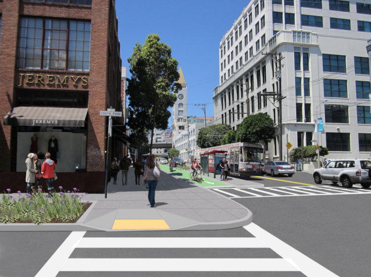
Another added provision is a new traffic signal at Second and South Park Street to make it easier for pedestrians to cross.
The green, parking-protected bike lanes will be raised a "half-step" toward curb height, similar to the design of bike lanes in Copenhagen. The bike lanes will also be separated by a sloped buffer zone to allow bike riders to exit the bike lane to avoid hazards. That will also allow drivers to stop in the bike lane as a "last resort" to load deliveries and to drop off paratransit passengers, planners said.
Car parking will be removed from one side of the street, meaning that parking on Second itself will be reduced by 60 percent, while the total parking supply within one block of Second will be reduced 10 percent. Planners said retaining loading zones in the remaining spaces will be a high priority, though most deliveries are done in alleys anyway.
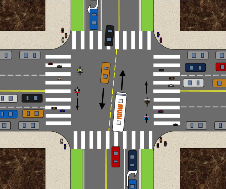
Crosswalks at alleyways will be raised to the sidewalk level, and all Muni stops will have 8-foot wide boarding islands, which will sit between the bike lanes and traffic lanes (think Duboce and Church). Left turns from Second will be banned at most intersections, and right-turning drivers will have a signal phase separate from pedestrian and bicycle crossing phases.
Planners expect the cost of the project, currently estimated at $13.5 million, to be mostly funded by the federal One Bay Area Grant. The project is expected to begin construction in September 2015 and be completed in September 2016.
Stay in touch
Sign up for our free newsletter
More from Streetsblog San Francisco
Commentary: There is Zero Ambiguity to the West Portal Tragedy
What happened in West Portal was entirely predictable and preventable. The city must now close Ulloa to through traffic and make sure it can never happen again

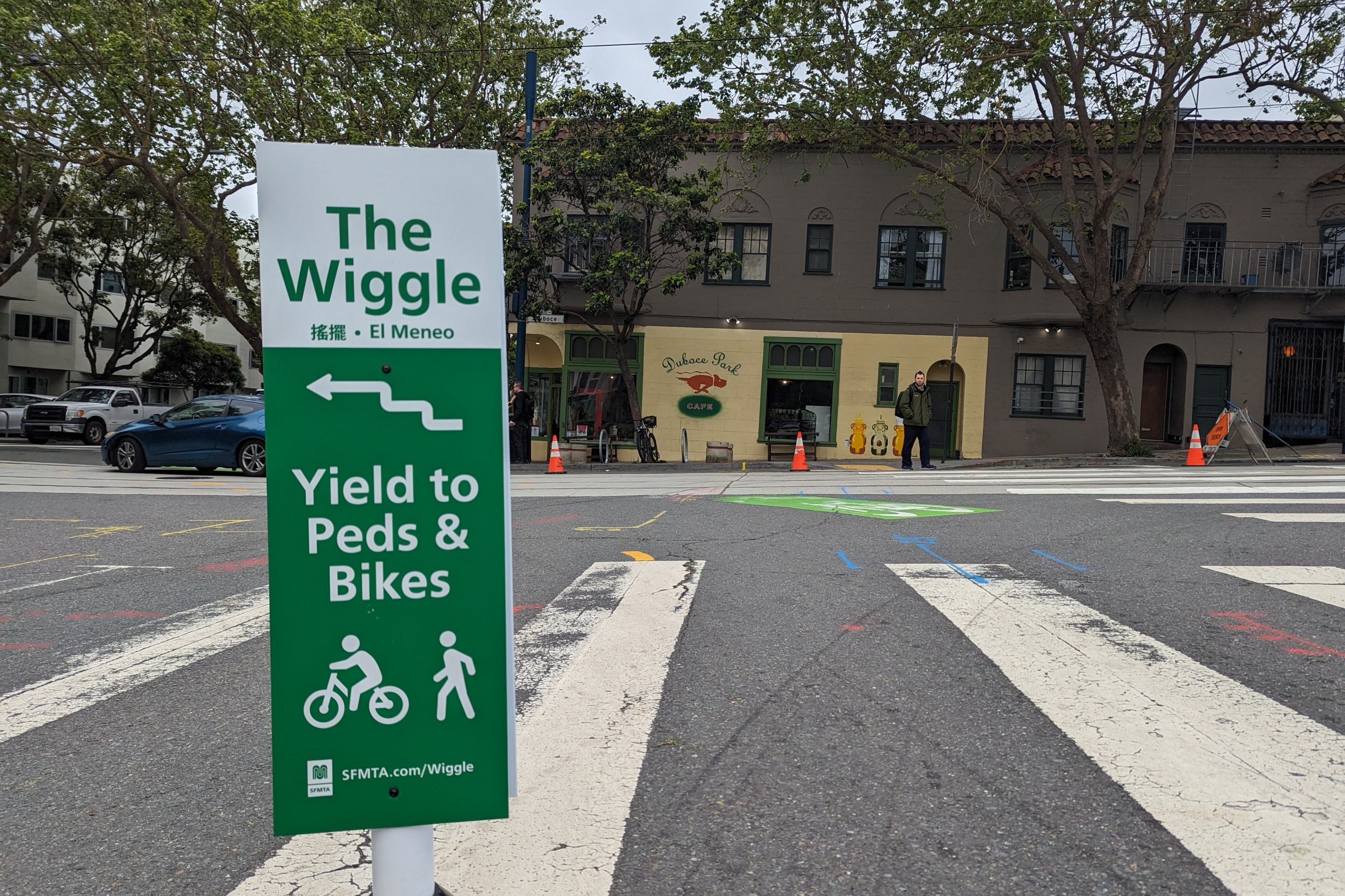
Independent Safety Advocates Beef up the Wiggle
Signs and soft-hit posts installed by advocates make the Wiggle bike route calmer and safer for cyclists and pedestrians