The Next Breakthrough for American Bike Lanes: Protected Intersections
As protected bike lanes become more widespread in the United States, creating physical separation from motor vehicle traffic that makes more people comfortable cycling on city streets, advocates are starting to push for even safer bikeway designs.
One area where the current generation of American protected bike lanes leaves something to be desired is intersections. How can streets be designed so cyclists can safely turn from the protected lane across oncoming traffic? And what’s the best way to reduce conflicts between cyclists continuing straight and drivers turning across the bikeway?
Dutch intersections solve this problem with a mix of physical protection and clever signal timing. Portland urban planner Nick Falbo has adapted those ideas for the above video and an accompanying website. Jonathan Maus at Bike Portland explains why this could be groundbreaking:
The problem with protected bike lane (a.k.a. cycle track) designs in America is that they disappear at intersections. The favorite treatment of U.S. planners has been to create “mixing zones” where people in cars and people on bikes share the lane just prior to the corner. This design creates a weak link in the bikeway right where it should be its strongest. In contrast, cycle tracks in Dutch (and other) cities have dedicated space for cycling all the way to the corner and then bike-specific signals to get riders through safely.
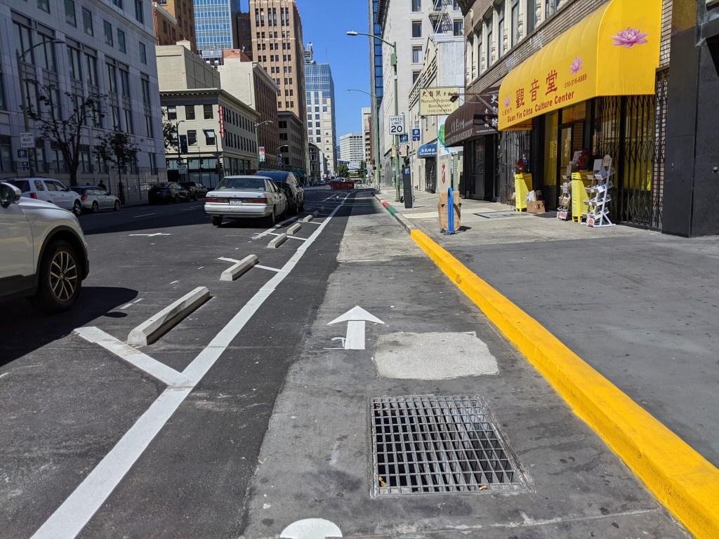
With his protected intersections for bicyclists, Falbo is trying to translate that Dutch design into an American context. As you can see in the image [above], there are four key elements to the design: a corner refuge island, bicycle-friendly signal phasing, a forward stop bar, and a setback bicycle crossing.
While he’s obviously enthused about the benefits of this design and committed to moving this idea forward, Falbo acknowledges there are some major challenges to overcome like large truck movements, auto capacity impacts, and how to make the design work well for people who walk and/or use a mobility device.
Falbo intends to tackle these challenges and post updates on his design to ProtectedIntersection.com, which he hopes will, “develop into a clearinghouse for exploration, examples, images, references related to the Protected Intersection design concept.”
Elsewhere on the Network today: Beyond DC explains why the Silver Spring transit center in suburban Maryland is a terrible place for a park. Cincy Map uses street configurations to create a heat map of the most connected places in the Cincinnati region. And as St. Louis explores bus rapid transit, Urban Review STL weighs in the the best places for the service in the region.

Read More:
Streetsblog has migrated to a new comment system. New commenters can register directly in the comments section of any article. Returning commenters: your previous comments and display name have been preserved, but you'll need to reclaim your account by clicking "Forgot your password?" on the sign-in form, entering your email, and following the verification link to set a new password — this is required because passwords could not be carried over during the migration. For questions, contact tips@streetsblog.org.