San Francisco Cuts Ribbon on Terry Francois Bikeway
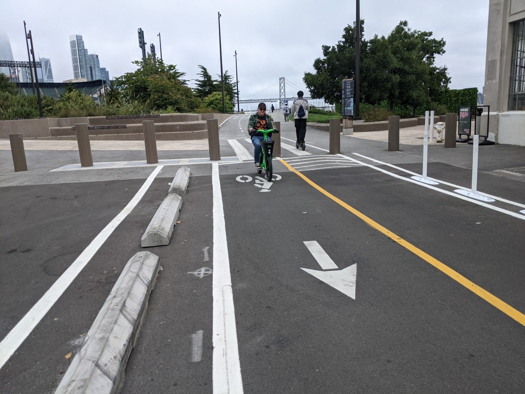
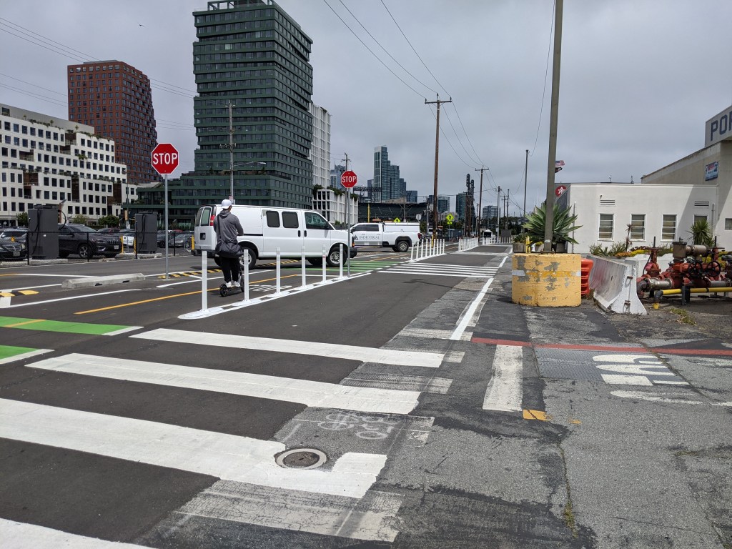
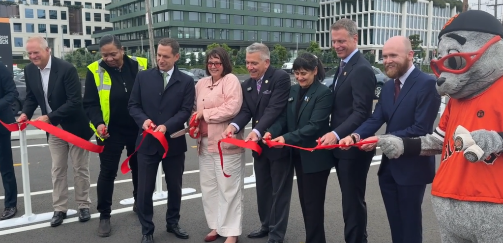
Mayor Daniel Lurie and officials cut the ribbon on the Terry Francois Boulevard Bike and Pedestrian Safety Project on Thursday, concluding work that started in 2019 to provide a safe route along the waterfront through Mission Bay. The newly paved segment that opened last week is part of a mile-long protected bike lane that runs from China Basin Park to Crane Cove Park and Mariposa Street.
“It’s the place to be. With so much activity, street safety has never been more important,” said District 6 Supervisor Matt Dorsey in a prepared statesamement. “These improvements go a long way to making the neighborhood’s streets safer for residents and visitors alike.”
More from the city:
Key improvements completed in the project include:
- New asphalt paving throughout the corridor
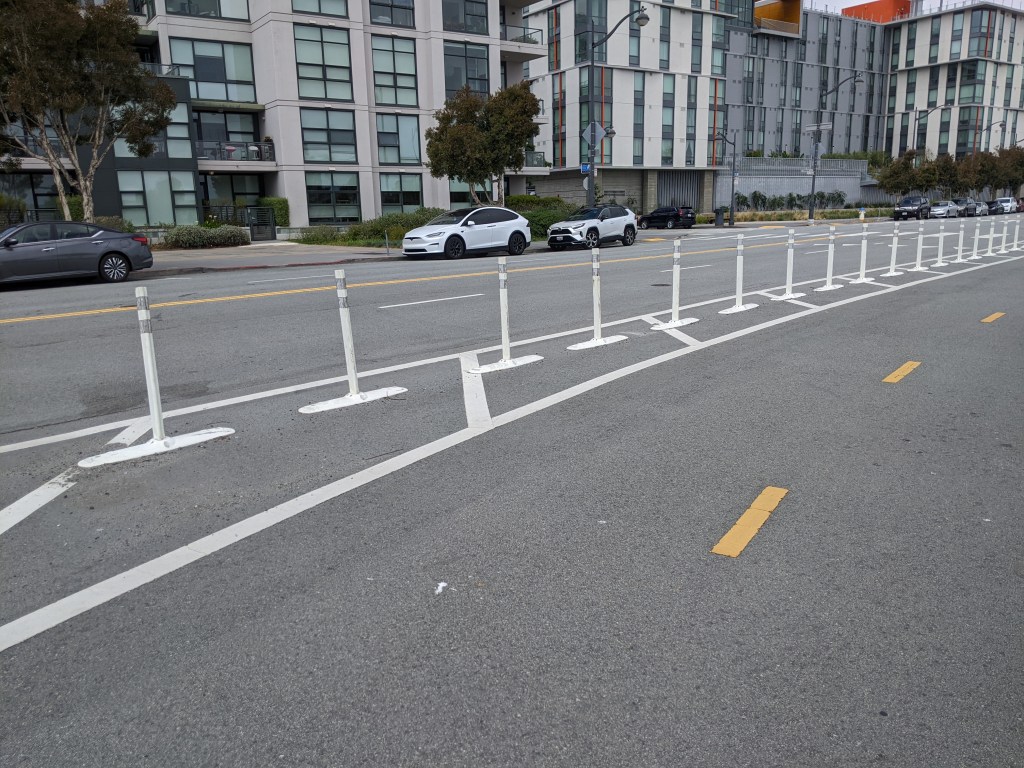
- Clearly defined roadway striping and signage for pedestrians, cyclists, and drivers
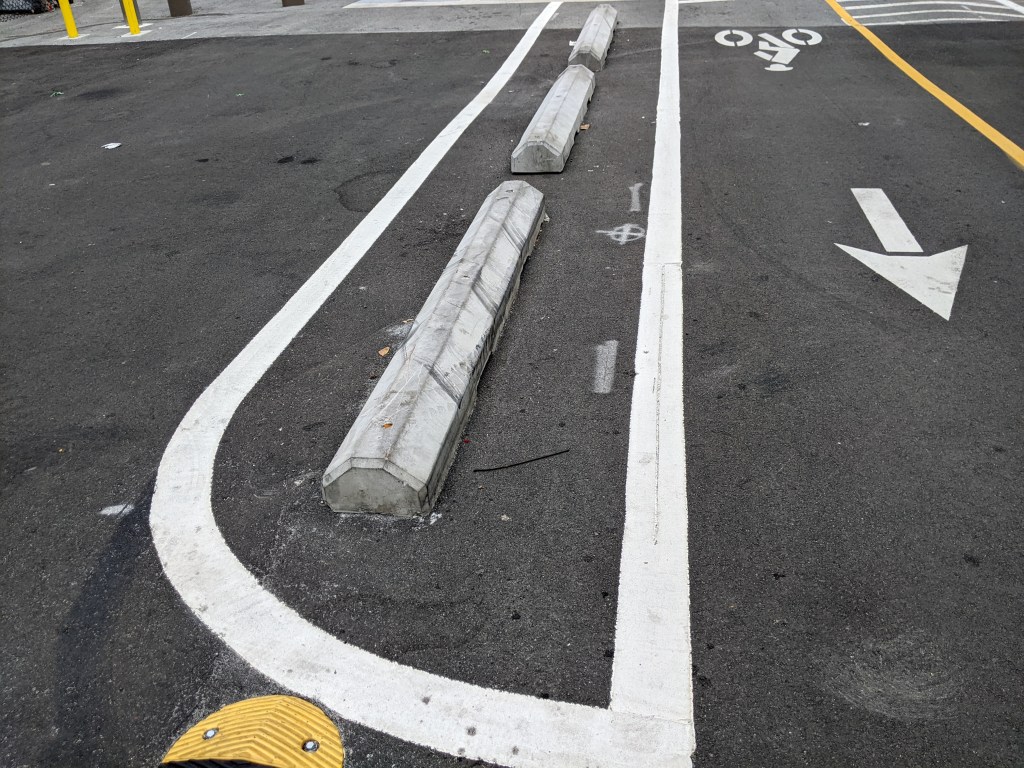
- Concrete barriers separating bike lanes from vehicle traffic to prevent encroachment
- Accessibility upgrades to support people with disabilities
- Narrowed driveway crossings to reduce conflicts between vehicles and active transportation users
- A newly painted plaza space fronting ATWater Tavern
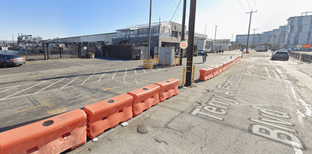
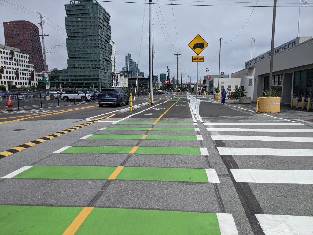
Streetsblog readers may recall that this project’s earlier phases opened seven years ago with a “quick-build,” mostly paint-and-plastic installation that also had a gap where it passed Pier 50 and the Port of San Francisco. Below is a Google Maps image showing what cyclists previously encountered near the Port Building in the gap:
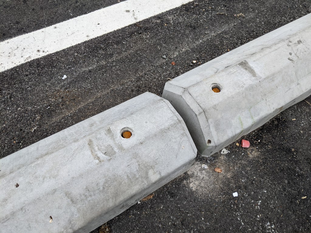
But now, with new pavement and concrete blocks, things are greatly improved.
That said, some of the route still depends on plastic, including a wide plastic speed bump to (one hopes) force turning motorists to reduce their speed as they enter the Port of San Francisco.
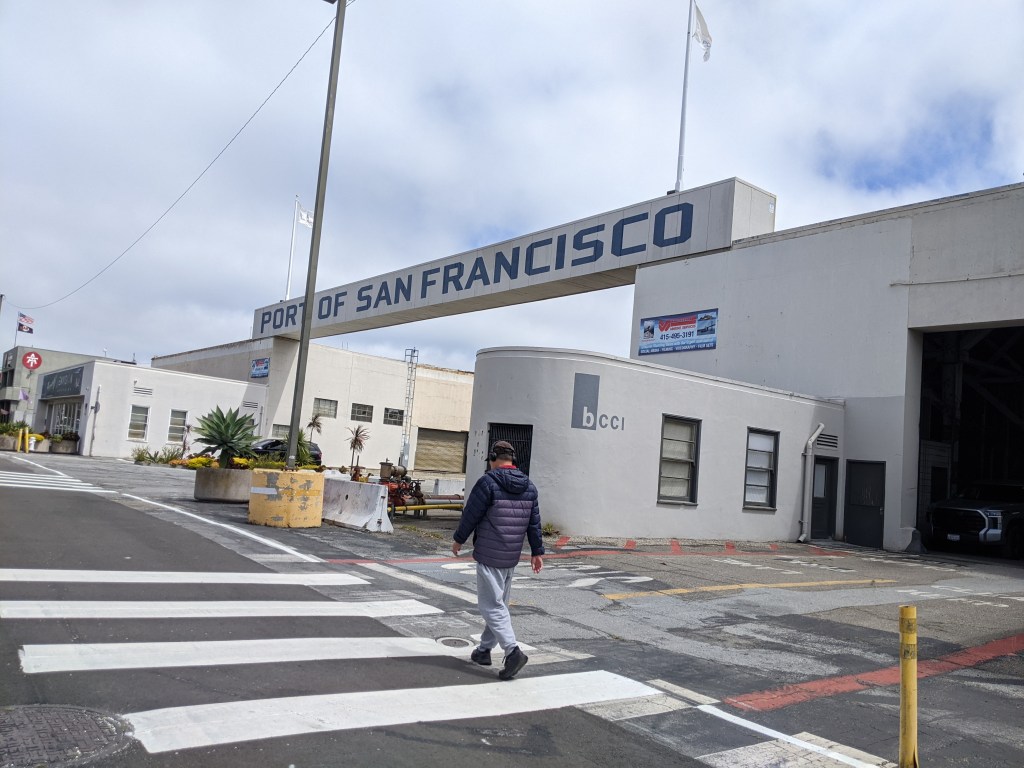
While these improvements are, of course, welcome, if Streetsblog were to nitpick, these plastic humps could be more severe to really force drivers to slow substantially. Also, there should probably be humps for cars exiting the driveways at Pier 50 too, lest an errant driver scoot into the path of a cyclist on their way out.
Also, as guest contributor Greg Rozmarynowycz pointed out in 2021, there’s a larger issue. The Mission Bay neighborhood was built with overly wide streets that still cater to drivers first, and everything else second. There’s also still an enormous amount of land dedicated to car storage. In San Francisco and nearly everywhere else, car infrastructure still gets priority, with cycling infrastructure the last consideration. One can only hope that someday, with future developments, planning, and construction will truly prioritize so-called “alternative” forms of transportation.
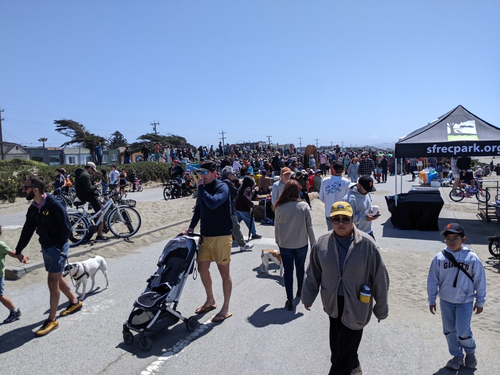
More photos below:

Streetsblog has migrated to a new comment system. New commenters can register directly in the comments section of any article. Returning commenters: your previous comments and display name have been preserved, but you'll need to reclaim your account by clicking "Forgot your password?" on the sign-in form, entering your email, and following the verification link to set a new password — this is required because passwords could not be carried over during the migration. For questions, contact tips@streetsblog.org.