SFMTA Tests Bike/Ped Wayfinding Signs During America’s Cup
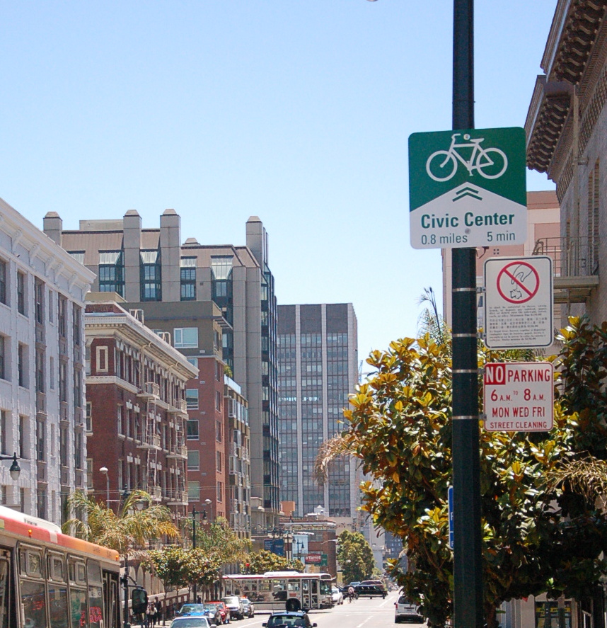
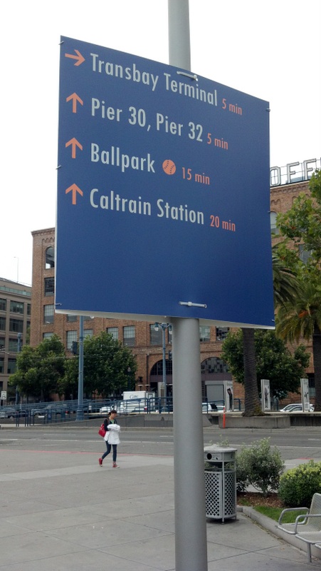
The SFMTA has installed 40 temporary wayfinding signs at 27 locations to guide people walking and biking to the America's Cup races starting next month, according to agency spokesperson Ben Jose. Though the SFMTA installed wayfinding signs for walking during the preliminary races last summer, this may be the first time the city has provided estimated travel times and distances for people on bikes.
The signs were installed as part of the People Plan, billed by Mayor Ed Lee as a transportation strategy to avoid inundating the waterfront with car congestion during America's Cup by encouraging visitors to come by foot, bike, and transit.
The temporary signage could also be a precursor to the wayfinding systems called for in the SFMTA Bicycle and Pedestrian Strategies. In New York City, the department of transportation unveiled its pedestrian wayfinding system yesterday.
Jose said planners are "testing out some concepts that will inform the SFMTA's development of more robust permanent wayfinding" systems.
"The signs were designed to be useful regardless of whether or not people are going to the America's Cup events or not," he said. "This reflects another one of the People Plan's core values -- that our transportation strategies should support San Franciscans in their regular travel around the race areas in addition to race visitors and participants."
Jose said "certain signs are race days-specific while others offer distance and time information for pedestrians and bicyclists." He said they will be taken down in September once the races finish.
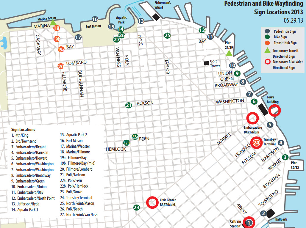
See a map of sign locations after the jump.
Stay in touch
Sign up for our free newsletter
More from Streetsblog San Francisco
SFMTA Starts West Portal Outreach
Agency presents plans to block traffic from crossing in front of the train station