Proving to Caltrans That El Camino Real Can Be a Safer Street
Despite pockets of new development, El Camino Real remains a dangerous, car-oriented urban highway along most of the San Francisco Peninsula. If it can ever transform into a great street, it will have to become safer for walking and biking. And while enhancing walkability is a key goal of the Grand Boulevard Initiative — the long-term planning effort to improve El Camino Real between San Francisco and San Jose — redesigning a state road to prioritize safety is always a tough lift, since Caltrans design standards create a thick barrier of red tape. In response, San Mateo County planners are working on four demonstration projects to show how a redesigned boulevard will function.
El Camino Real is the deadliest street in the San Francisco Bay Area for pedestrians, according to a review of traffic fatalities conducted by the Center for Investigative Reporting in April. Of the 59 people killed in traffic collisions on the street between 2002 and 2011, 37 — about two-thirds — were pedestrians. In comparison, only 22 percent of the 2,791 people killed in car crashes statewide in 2011 were pedestrians, according to Caltrans data.
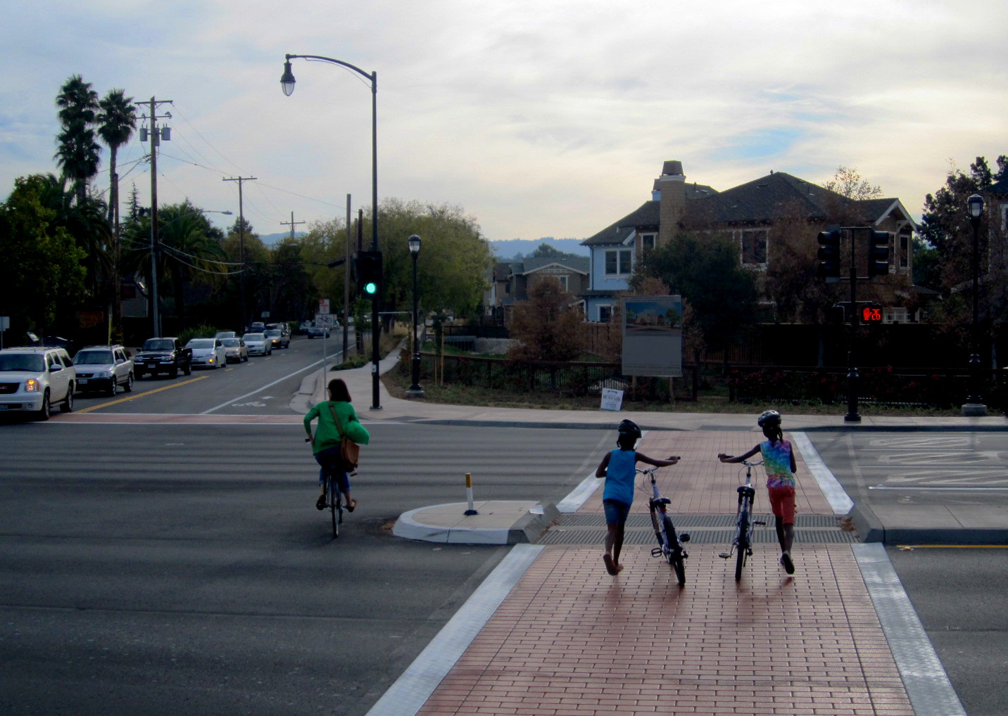
Car-oriented commercial retail centers currently dominate along El Camino Real, but residential and office development is gradually filling in the corridor. With more destinations clustered together, walking, bicycling, and transit become increasingly practical for residents and workers.
“Improved walkability and transit are critical to allow El Camino to become the kind of environment that can accept growth without generating additional traffic,” said Egon Terplan, regional planning director for SPUR.
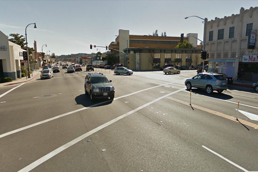
But as a state highway, the street is built primarily to accommodate large volumes of automobile traffic, using the same design standards that apply to freeways. The street’s current design gives little thought to the safety of people walking, bicycling, or accessing transit.
“How a street is designed has a very tangible effect on the number of injuries and deaths that occur,” said ST Mayer, director of health policy and planning for the San Mateo County Health System. “And El Camino has a high rate of bicycle and pedestrian injury.”
The most recent victim, 66-year-old San Mateo resident Shama Ayyad, was struck and killed by an SUV driver the morning of October 5 while walking across El Camino Real in a crosswalk at 25th Avenue in San Mateo. Police said they were investigating the timing of traffic signals to determine who had the right of way, and whether the driver’s speed played a role in Shama’s death.
“Vehicle speed has everything to do with whether or not pedestrians are killed in collisions,” said Mayer, citing research published by the National Highway Traffic Safety Administration showing that the chance of being seriously injured or killed increases exponentially with speed. “And vehicle speeds are primarily determined by how the street feels to drivers. On streets with fewer and narrower lanes, those with a tree canopy, or with a lot of pedestrian activity, drivers go slower.”
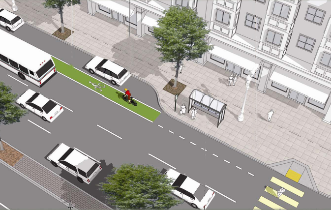
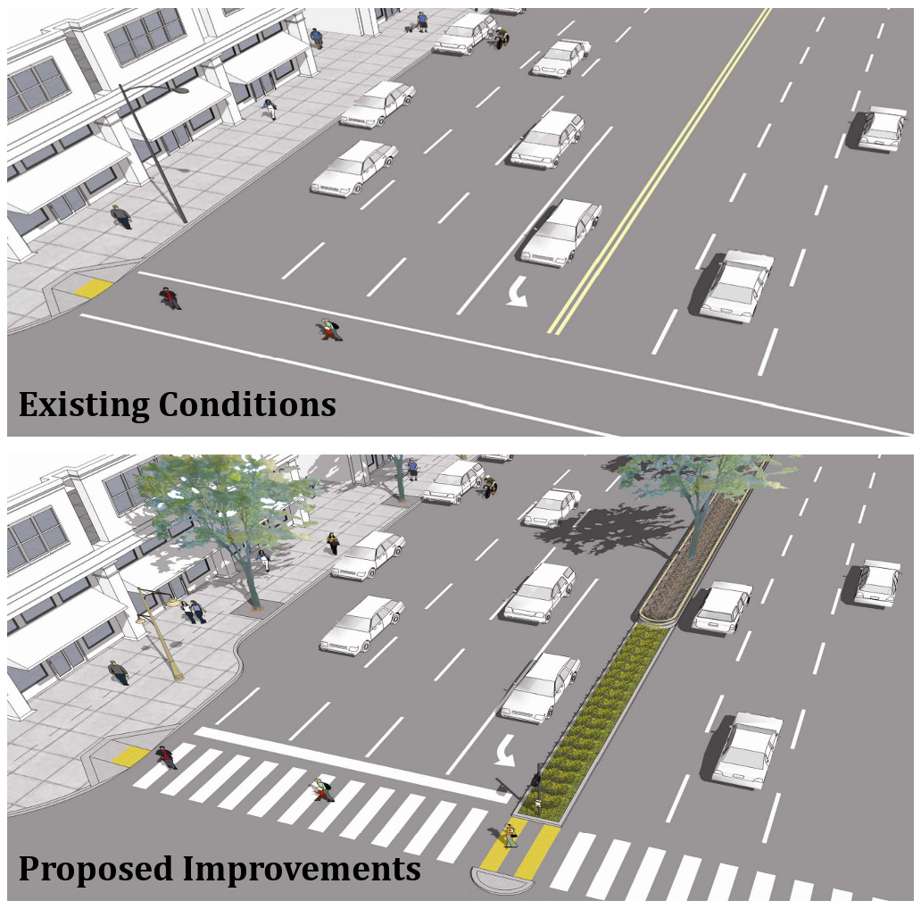
Because El Camino Real is a state highway, many design features known to improve safety, such as narrower travel lanes, tighter curb radii, and trees planted in the median near intersections, cannot be implemented because they don’t appear in the Caltrans Highway Design Manual. Gaining the necessary approvals from Caltrans adds cost and delay these projects, making funding more challenging to secure and reducing political support for such improvements.
Planners in San Mateo County hope to overcome this barrier with the Grand Boulevard Initiative’s Complete Streets Project, which will re-design four short segments of El Camino in Daly City, South San Francisco, San Bruno, and San Carlos. The segments range in length from a half mile to one mile and will complete the Caltrans design exception process needed to actually construct them. For the San Carlos segment, a total of six design exceptions are required. The project, which isn’t funded yet, currently doesn’t have a timeline.
“A lot of our work is about bringing predictability to the Caltrans process,” said Corinne Goodrich, strategic development manager for SamTrans. “These four segments in San Mateo County will serve as case studies for future modifications of El Camino and similar urban thoroughfares elsewhere.”
A typical intersection improvement will create space for pedestrian islands and bike lanes by narrowing travel lanes, and will include sidewalk curb extensions and bus bulbs. Street trees will also be planted in center medians and along widened sidewalks.
SamTrans Senior Planner Megan Wessel explained, “These projects are trying to push the envelope in terms of Complete Streets improvements for El Camino Real and similar urban highways.”
One design change known to have a significant impact on safety is not being considered by the Complete Streets Project, however: a lane reduction, or road diet. “The most effective way to slow traffic is to have fewer lanes,” said Mayer. “If we really want a Complete Street, we have to make a commitment to making it safe for everyone.” El Camino Real is currently six lanes wide for most of its length, but already narrows to four lanes through downtown Burlingame, Redwood City, Atherton, and Menlo Park.
“Our cities have been designed around automobiles,” said Chris Lepe, senior community planner for TransForm. “The legacy of auto-centric design is unsafe streets in which pedestrians and cyclists are more likely to suffer serious injuries or fatalities. We have a long way to go to create communities that are healthy and safe.”

Read More:
Streetsblog has migrated to a new comment system. New commenters can register directly in the comments section of any article. Returning commenters: your previous comments and display name have been preserved, but you'll need to reclaim your account by clicking "Forgot your password?" on the sign-in form, entering your email, and following the verification link to set a new password — this is required because passwords could not be carried over during the migration. For questions, contact tips@streetsblog.org.