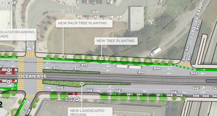
A proposed solution has surfaced for one of the most frightening gaps in the Ocean Avenue bike lane at Balboa Park Station, where the existing bike lane disappears and throws uphill bike commuters in front of a high-speed freeway off-ramp. City College of SF has proposed opening up the edge of its main campus property, currently occupied by a retaining wall and undeveloped land, to make room for the bike lane extension, sidewalk extensions, and landscaped medians.
With plans also in the works to remove the curved highway 280 off-ramp and replace it with a perpendicular, signalized ramp, that stretch of Ocean could become dramatically safer.
The fix was presented this week at the final open house meeting for planned streetscape improvements along Ocean and around Balboa Park Station. Livable City Executive Director Tom Radulovich, a member of the BART Board of Directors, said the plans for bike and pedestrian improvements are "so far, so good," and have been anticipated since the city began developing plans for the area in the late 90's.
"The community has been remarkably patient, and the devil will be in the details," he said. Still, the currently poor conditions for walking and biking to the station set "a low bar."
City planners had originally included no substantial improvements to make bicycling safer on Ocean between the Balboa Park BART/Muni Station and CCSF, insisting on retaining both westbound traffic lanes, which Muni buses use. City agencies are now "working with City College to design a terraced landscape to eliminate the blank retaining wall currently in place and create a more inviting entrance," according to Planning Department presentation materials [PDF].
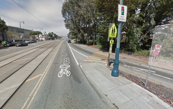
Widening Ocean east of Phelan Avenue will also make room to move the Muni rail boarding islands from their existing location near Phelan over to Howth Street, which planners say is a more central place to board the K-Ingleside, and allows for boarding island designs that comply with the Americans With Disabilities Act.
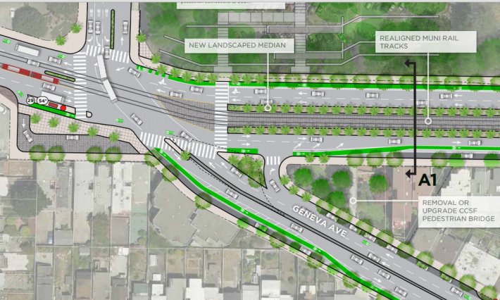
City planners also recommended removing car parking on two blocks of Geneva Avenue to create curbside bike lanes between the highway 280 overpass and Howth, where bike commuters could connect to the CCSF campus entrance via a lightly-trafficked block of Howth on a contra-flow bike lane. However, bike lanes in both directions of Geneva would not extend across the overpass to Balboa Park Station.
Similarly, Ocean's eastbound, downhill bike lane would disappear before its highway overpass, and riders would be squeezed into a single lane with drivers at a pinch point alongside a bus bulb-out. A car parking lane on the overpass would remain.
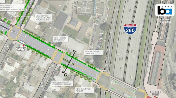
Geneva's southbound bike lane would also extend all the way back to the Ocean and Geneva intersection. One of Geneva's two southbound traffic lanes would be converted into a buffered bike lane (next to a parking lane) on the initial uphill climb for half a block, then become a curbside bike lane on the downhill stretch where the two traffic lanes will be retained.
The new Geneva configuration is a departure from a previous option proposed to downsize the massive Ocean and Geneva intersection. Under that proposal, the beginning of Geneva’s two southbound lanes, which are currently angled for drivers to shoot quickly through the intersection, would have been re-aligned at a 90-degree angle so drivers would have to stop before turning right. Land currently devoted to traffic lanes and a parking lot would be converted into a “plaza” with a “local access lane” running through it.
West of Phelan and CCSF, Ocean would get spruced up with planted bulb-outs and seating, but otherwise no roadway space on that stretch is set to be reallocated for biking, walking, or transit.
