A Vision for Marin’s Future Bike Network
A version of this post also appeared on the Marin County Bicycle Coalition’s blog and is published here with permission.
In 2025, the Marin County Bicycle Coalition (MCBC) celebrated its 25th anniversary. While preparing for that event, we asked, “what impact has MCBC had?” We found that the All Ages and Abilities (AAA) network in Marin had nearly doubled in size since MCBC’s founding, and that roughly $200M had been spent on biking across the county.
But we’re not finished. Though biking in Marin may be better than in most of California, we’re still a long way from every parent feeling like they could let their 10-year-old visit a friend in the next town over. Older riders and people traveling with children still have to brave busy streets or treacherous crossings that make many consider driving to be the better option.
The next three years will see another six miles of bikeways built for all ages and abilities in Marin, with another ~10 miles in the pipeline behind that (see our post about the MCBC Countywide Project Tracker here). But what will it take to actually complete Marin’s bike network?
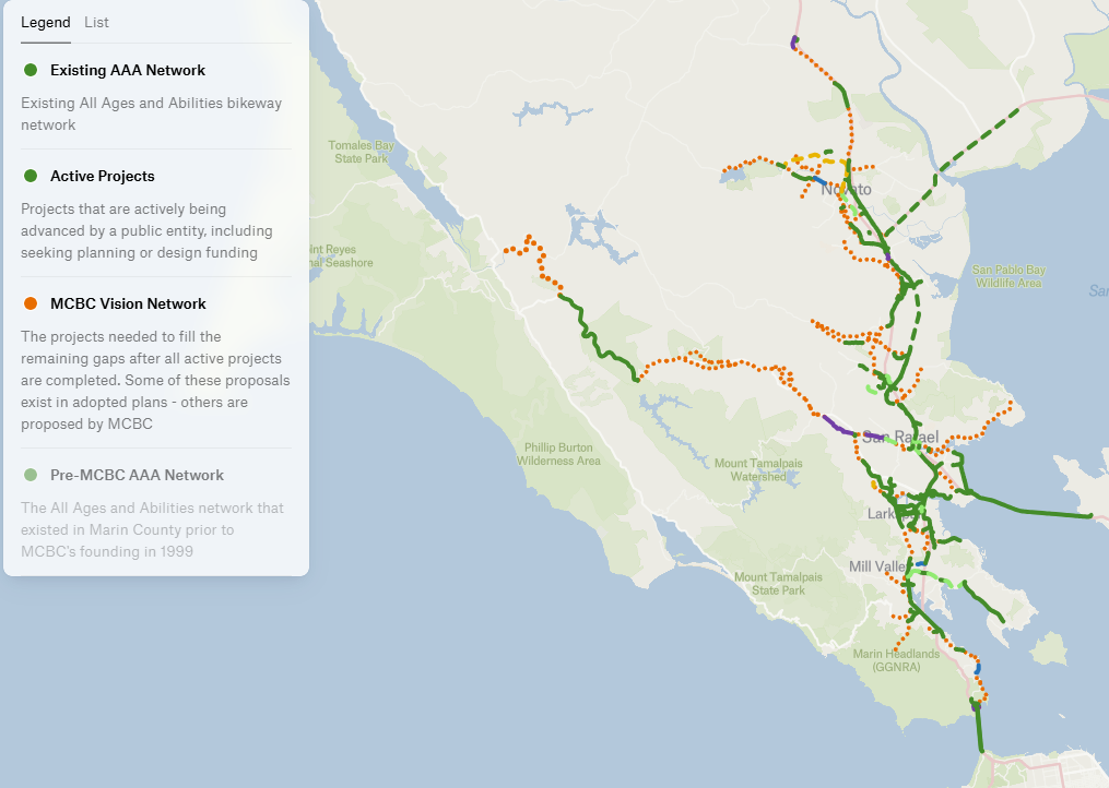
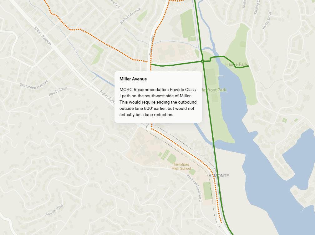
We’re glad you asked! We spent a year coming up with recommendations to fill all of the gaps that would remain after the projects currently in the pipeline are co/mplete. Embedded in the map below, in the layer titled “Marin 2050 Vision Network,” are the ~100 projects that we believe would allow almost anyone to get almost anywhere in Marin on a bike.
Designing the Network
In a perfect world, every single street in Marin would feel 100% safe to bike. The 2050 Vision Network focuses on an ambitious but achievable goal: creating a low-stress bike connection between every city and town in Marin, as well as much of unincorporated Marin County. In some cases that looks like a protected bikeway or path on a busy street, where parking would need to be removed. Other times we recommend routing bicycles onto a traffic-calmed neighborhood street.
Our goal was to create the safest network while still working within the bounds of realistic politics and budgetary constraints. Where a cheaper, quick-build project would suffice, we recommend that. Where only a multiuse path totally separate from the roadway would provide a low-stress route (such as through a freeway interchange), we advocate for the more expensive option.
Even with this map, challenges remain. For instance, there is no clear way to connect Stinson Beach or Tomales to the network, and the stretch of Sir Francis Drake Boulevard between Lagunitas and Inkwells will need real creativity. Those limitations aside, the proposed network would put the vast majority of Marin’s population within 1 mile (i.e. a 5-minute ride) of the countywide bike network.
Reading the Map
The solid and dashed lines on the map represent, respectively, the county’s current AAA network and projects in the pipeline that will add to it. Beyond that, the 2050 Vision Network is depicted in orange dotted lines, which represents what we believe is needed on top of that to complete Marin’s bike network.
Every 2050 Vision Network project can be clicked on for a brief description. If that project already exists in a plan, it is noted. Each project on the map can also be found in tabular form in this sheet, where you can find a link to any prior plans.
Take a look and tell us what you think! Would the projects described there help you get around? Is something missing?
How Would This Happen?
Marin’s existing AAA network consists of mostly shared use paths (40 miles) and a couple miles of separated bikeways. Our plan would see a 50% increase in shared use path mileage, but ten times as many protected bikeways along high-traffic corridors, such as Novato Boulevard, Smith Ranch Road, and Sir Francis Drake Boulevard in Fairfax. Much of the remaining improvements would happen through bike boulevard treatments, where neighborhood streets see traffic calming and traffic circles rather than dedicated lanes, in order to facilitate low-stress riding without limiting parking.
Will the County Plan This?
The timing of this is important, as the Transportation Authority of Marin (TAM) will soon be developing Marin’s first ever “countywide active transportation plan,” the purpose of which will be to build out a bikeway network spanning Marin. We have known for several years that they were planning this, and we built out our proposal for the network in preparation.
While we don’t expect TAM to simply accept our proposal as the countywide plan, they are more than welcome to do so!
What Would it Cost
Such an effort would be a heavy lift. But it is not an unimaginable one. Our very rough estimate of the cost of completing MCBC’s 2050 Vision Network is ~$250m. This sounds like a lot, but it is roughly the same amount spent to date on Marin’s AAA bikeway network (including completed and active projects), and less than 1/3rd the amount spent on widening US-101 between Petaluma and Novato.
To complete the Vision Network in the next 25 years would require, we believe, an investment of $10M/year across the county, or just $40 per person per year. That’s less than half the cost to fill up a Subaru Crosstrek, something many people do once every ten days. For a city like Mill Valley, that would be an investment of $600k/year, or slightly less than 1% of the city’s budget.
Historically, Marin has brought in a great deal of grant funding, and we are confident that regional, state, and federal dollars (taxes and tolls we have already paid) could be part of this total, particularly for the larger projects.
What’s Next
We would love to get your feedback on the map. Do you love it? Do you hate it? What do you think it gets right and what does it get wrong? Look out for a couple other posts highlighting the key projects. Make sure to bookmark it so you can keep track of what’s going on, and send it to your fellow Marin County bicyclists!
We have shared this with TAM, and when their countywide active transportation plan kicks off, we’ll be letting our members know!
See the 2050 Vision Network embedded below, or click the button in the upper right to go to full screen.
Streetsblog has migrated to a new comment system. New commenters can register directly in the comments section of any article. Returning commenters: your previous comments and display name have been preserved, but you'll need to reclaim your account by clicking "Forgot your password?" on the sign-in form, entering your email, and following the verification link to set a new password — this is required because passwords could not be carried over during the migration. For questions, contact tips@streetsblog.org.