Subway Station at SFSU? SFCTA Looks to Realign Muni’s M-Line on 19th Ave
With an influx of residents and students anticipated in the coming years, the city is looking at ways to improve rail service along the southern stretch of 19th Avenue by the Stonestown Mall and SF State University. A new study underway will consider putting Muni’s M-Ocean View on a trackway running above or below the highway to separate it from traffic crossings and route the line into Parkmerced.

Under approved redevelopment plans, Parkmerced’s population is expected to triple in the years ahead, and SFSU aspires to increase enrollment from 20,000 to 25,000 full-time students. To improve transit service in the neighborhood, the M-line will need to be re-aligned to the west side of 19th and separated from traffic crossings, said Liz Brisson, a planner at the SF County Transportation Authority, which is leading the year-long study.
“We know that those people who live there and go to school there are going to be making more trips, and we can think about whether we would want those trips to be by driving, by walking, biking, or transit,” said Brisson at a community outreach meeting at SFSU on Wednesday. “Knowing how congested 19th Avenue already is, we want to make sure those trips are accommodated sustainably.”
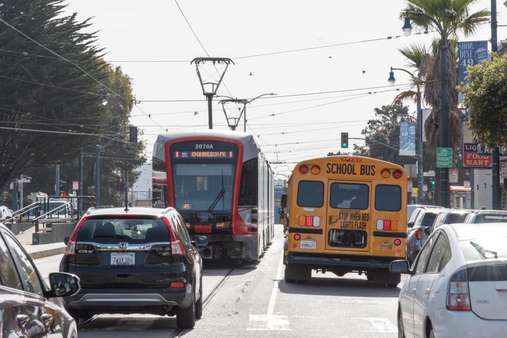
Bringing the M closer to Parkmerced residents would make it easier to access, though it would add some extra distance to the route and potentially increase travel times. But eliminating crossings with car traffic could make up for it by providing a sorely needed boost to the line’s speed and reliability. As the Bay Citizen reported last May, the line has the second-lowest on-time performance of Muni’s metro lines (leading only the L-Taraval). One major source of delay is at 19th and Eucalypus Drive, where drivers stopped at a light often illegally encroach on the intersection and block trains crossing in and out of the center-running tracks along 19th.
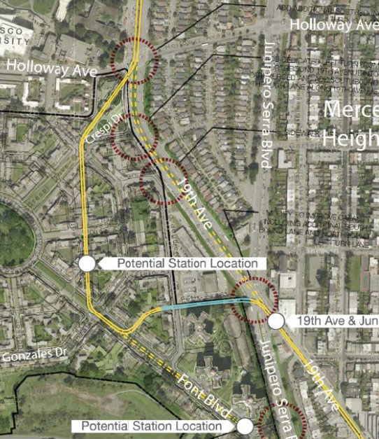
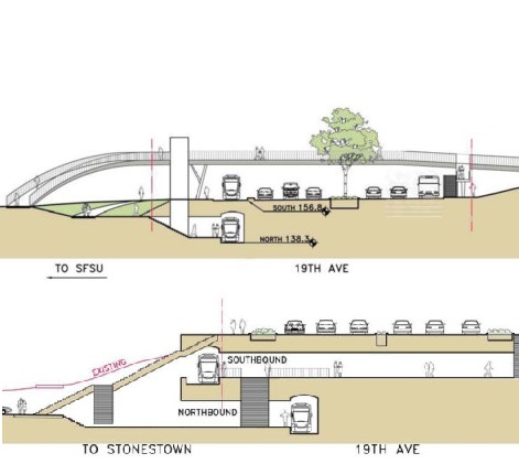
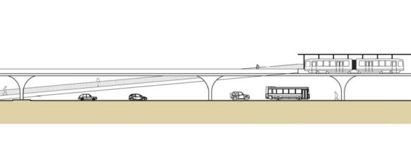
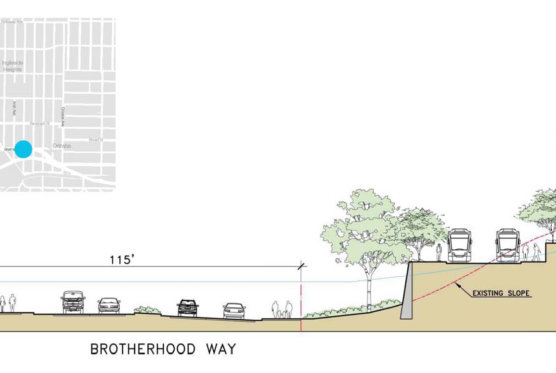
Under the preliminary concepts being studied [PDF], the M could run on a combination of underground, elevated, and street-level tracks, with the goal being to remove the trains from traffic crossings that cause delays at streets like 19th, Ocean Avenue, Eucalyptus, and Junipero Serra Boulevard. The SFCTA is also looking at consolidating and moving stops in the area, possibly in the form of elevated or underground subway stations with pedestrian bridges or tunnels. Brisson said the study will also explore ways to improve connections to the Daly City BART Station.
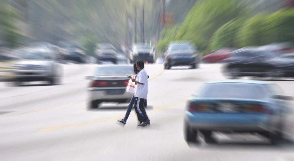
There are few pedestrian crossings on the southern stretch of 19th, and there’s a ton of work to be done to improve safety for people walking and biking on the six-lane state highway. It’s unclear whether safety improvements for 19th are on the table, but the SFCTA says the key goals of the study include “supporting strong and safe nonmotorized connectivity” and enhancing “the corridor’s sense of place.” Since state highways are controlled by Caltrans and its hidebound design requirements, pedestrian and bike improvements could be limited.
The station at 19th at Holloway Avenue, which serves SFSU, is the M line’s busiest street-level stop by far, with nearly 4,000 daily boardings, according to the SFCTA. Between 2005 and 2010, six pedestrians were injured at the intersection, including one woman who was severely injured, according to data from the Department of Public Health.
The intersection also sees bike traffic on Holloway, which serves as the bike route connecting the university to areas east. The most direct bicycling alternative to 19th from the north, meanwhile, is a confusing and sometimes dangerous route that runs through the Stonestown parking lot, dissuading many students from bike commuting.
The study is scheduled to be completed next winter, but there’s no timeline set for the project that would follow, nor has the cost been estimated. SFCTA staff said the study is being funded by grants from Caltrans, Stonestown, SFSU and other organizations.
The agency expects to hold a follow-up meeting later this year.
Below are some samples of the conceptual options. Check out the rest, including an overhead look at other potential alignments, in this PDF document.
Note: Streetsblog will be offline Monday for Presidents Day. See you back here Tuesday.

Streetsblog has migrated to a new comment system. New commenters can register directly in the comments section of any article. Returning commenters: your previous comments and display name have been preserved, but you'll need to reclaim your account by clicking "Forgot your password?" on the sign-in form, entering your email, and following the verification link to set a new password — this is required because passwords could not be carried over during the migration. For questions, contact tips@streetsblog.org.