The long-sought addition of bicycle and pedestrian access across the length of the San Francisco Bay Bridge is one step closer to fruition. Last night, engineers presented the first design proposals for a pathway for bicyclists, pedestrians and maintenance crews to the west span, but they say the funding and technical challenges that lie ahead mean the project is still in its infancy.
For more than 15 years, bicycle advocates in San Francisco and the East Bay have pushed for a west span path to connect bike commuters to the east span path expected to open between Oakland to Yerba Buena Island by 2014.
"We're very encouraged that Caltrans and the Metropolitan Transportation Commission (MTC) have come up with a design that works for the west span and the touchdown on either end," said Dave Campbell, the program director for the East Bay Bicycle Coalition.
"This new study not only affirms the feasibility and benefits of the pathway, it also puts this important project in line for funding," said San Francisco Bicycle Coalition Executive Director Leah Shahum. "Now, the city and the region are showing their commitment to connect not only the East Bay and San Francisco, but also San Francisco's own neighborhoods, which is critical as Treasure Island is developed. This is an exciting step for a much-needed bridge between communities."
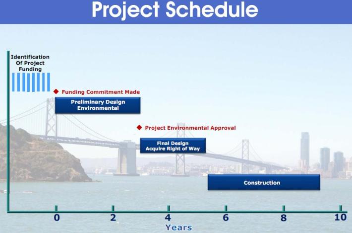
The project would still take up to ten years to plan and construct once the estimated $500 to $550 million in funding is secured, said John Goodwin, spokesperson for the MTC, which manages regional transportation funding. Last night's presentation of the project study report, funded by toll revenue, was just one step in developing the project initiation document, expected to be completed next summer, which will allow agencies to begin the funding search. After that, roughly five years of planning and five years of construction lie ahead.
The study report "shows that the project is possible, but not that it's affordable," said Goodwin.
While the cost has risen about $200 million from its original 2001 estimate, potential transbay bike commuter Tina Crawford pointed out to KTVU today that "we spend a lot more on transportation options for cars so I think it's about time we offer this alternative and have a showcase for bike commuting in the Bay Area."
Despite the lengthy project timeline, advocates praised MTC Executive Director Steve Heminger for helping to push reluctant engineers and staff to take on the daunting design and funding challenges.
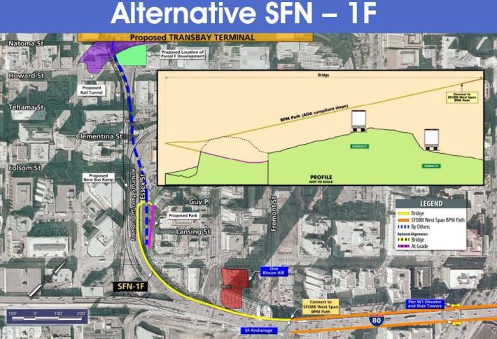
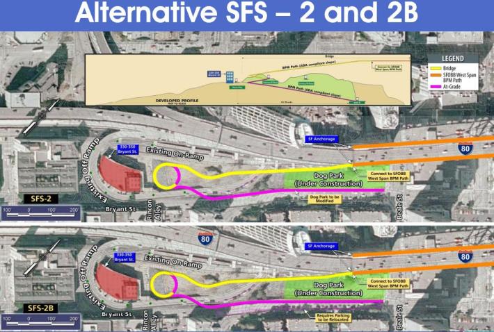
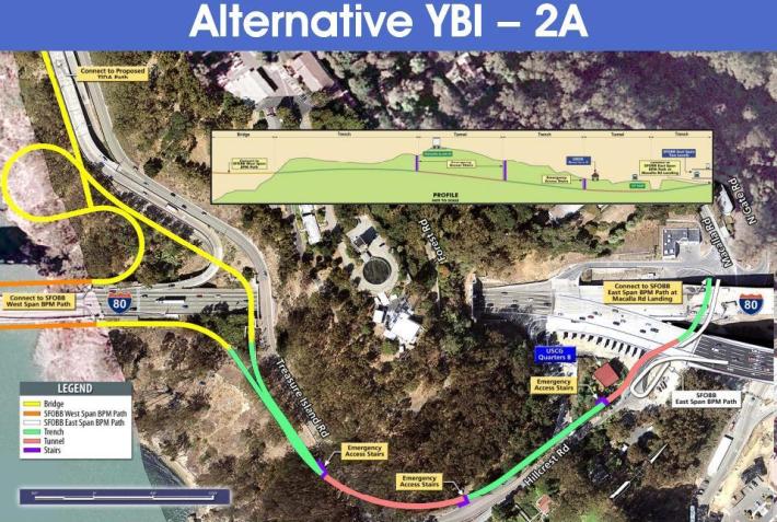
Engineers from Caltrans and the Bay Area Toll Authority last night presented a number of possible ways [PDF] to connect the path to downtown San Francisco and the bridge's east span across Yerba Buena Island. The impact of the additional weight would also have to be mitigated, possibly by counter-weights and shortening the suspension cables, they said.
In downtown San Francisco, the west end of the path would have to navigate around the existing off-ramp as well as buildings and other planned developments, but engineers presented several possible configurations. The ramp could land bike riders and pedestrians in parks planned for the areas near the highway offramp, or on the short and narrow Lansing Street. One proposal would even connect to the roof of the planned Transbay Terminal, where stairs and elevators would provide the only way down. In any case, ADA requirements would mean the path would have to avoid including steep slopes and narrow passages.
On Yerba Buena, planners must also determine the best way to connect the east and west spans of the bridges by navigating the island's terrain. Nine alternatives had already been considered and put aside, including a path suspended through the bridge tunnel above motor traffic, due to reasons including the lack of right-of-way, poor user experience, and interference with Coast Guard operations.
Advocates and officials said they plan to begin searching for funding after the project initiation document is completed and a preferred alternative is chosen next summer.


