The Wiggle could be transformed into a greener, more bicycle- and pedestrian-friendly route in the coming years thanks to a new planning effort launched by the SFMTA and the SF Public Utilities Commission.
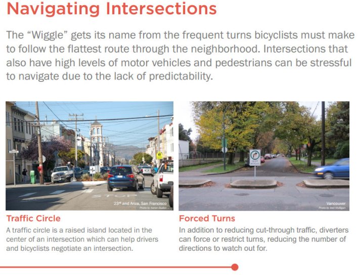
At an open house community meeting yesterday, planners shopped potential treatments like traffic diverters, traffic circles, bulb-outs, and raised crosswalks that could be used to calm motor traffic while adding plants and surfacing treatments to absorb more storm runoff.
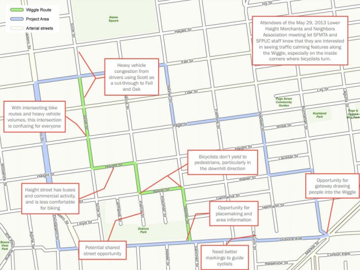
"We want to think about how we can make the streets for people," said Luis Montoya, a planner at the SFMTA's Livable Streets Subdivision. "We've been hearing for several years about several issues going on on the Wiggle, whether it be cut-through traffic, bikes and cars speeding and not yielding to pedestrians, and people wanting to see more green on their streets."
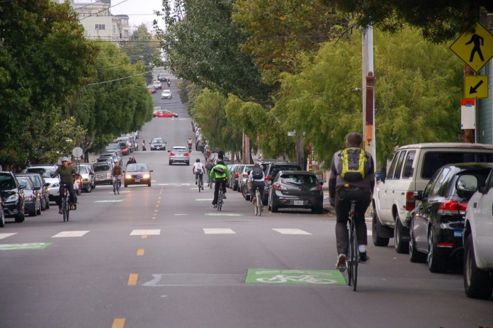
Bicycle traffic has grown dramatically in recent years on the Wiggle, the flattest central route connecting the eastern and western neighborhoods by zig-zagging through the Lower Haight. During that time, the SFMTA has added green-backed sharrows and more visible crosswalks, and the agency plans to remove parking spaces at corners (a.k.a. daylighting) this summer to improve visibility at intersections.
Connections to the Wiggle have also seen major improvements recently, with the installation of the Fell and Oak protected bike lanes on the west end, and an overhaul of Duboce Avenue on the east end that included a new green bike channel.
The SFMTA is now able to embark on more intensive changes to the Wiggle's streetscape thanks to a partnership with the PUC, which is looking to replace the sewers and add water-absorbing treatments (similar to the project under construction on western Cesar Chavez Street), planners said.
The PUC is providing $4.2 million in addition to $800,000 from the Prop B street improvement bond. By combining projects and funds, both agencies can save time and money, planners said. The project is currently scheduled to be completed in mid-2016.
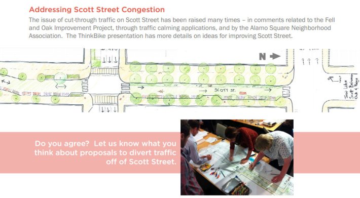
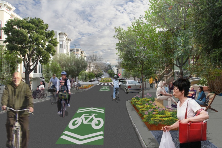
Ambitious visions for the Wiggle have been sketched out by city planners and livable streets advocates. In 2011, bicycle planners from the SFMTA joined planners from the Netherlands in a workshop called ThinkBike, where they set out to re-design major SF bicycle routes for walking and biking first. The conceptual plans that came out of the workshop depicted on-street greenways with chicanes and traffic lane closures, as well as green-backed sharrows and bike channels like the ones which were later implemented. Last year the SF Bicycle Coalition created more detailed renderings of a Wiggle greenway based on those visions.
Montoya said the newly-launched project is "definitely an opportunity to have a public dialogue about" the ThinkBike concepts.
"We don't want to jump a step and say we're going to be implementing those things, but I think certainly there were a lot of good ideas that came out of that, and it's built momentum for this project," he said. "It really opened people's minds to what was possible... it got people to say, 'Wow, the streets could be very different from the way they are today.'"
Bike commuters are far from the first travelers to rely on the Wiggle for relief from San Francisco's notorious hills. Before the valley was developed, it was used for thousands of years as a walking route by the native Ohlone people, and subsequently the Spaniards, as San Francisco natural historian Joel Pomerantz explained to Bay Nature. It also partially served as a waterway, which figures into the giant mural along the Duboce bikeway. (Pomerantz, who led the mural project, noted that the imagined vision of a streambed is "only partially correct.")
"All of this has been paved over by 90-degree angles, and bicyclists are now experiencing this at a kinetic level," said Lawrence Li, a board member of the Lower Haight Merchants and Neighbors Association.
Li said he's "delighted" to see city agencies approach sustainability on the Wiggle from both a traffic and ecological standpoint. "Slowing things down, and getting them to a more human pace, is beneficial to the neighborhood, but also improves the overall functioning of transportation throughout the city."
Planners will be looking at potential locations for street safety tools like traffic diverters, which discourage drivers from using the streets but allow bike traffic to filter through, said Montoya. "People have said this has worked great in Berkeley, Palo Alto, and other cities, so it seems like this would be a neighborhood to think really closely about doing it. Where, exactly -- that's what tonight's meeting is about."
Calming the Wiggle, he noted, is a key part of the larger vision for a next-gen route that runs continuously from the bay to the beach.
"It's this route that we've been able to start connecting the pieces on," said Montoya. "Because of improvements to Market Street, Oak and Fell, the Panhandle to JFK, we can really build out the network in order to allow people to get around town on facilities that are safe enough for people with a variety of abilities."
.jpg&w=633&zc=1)
