New Renderings, Details on Car-Free Areas From “Better Market Street”
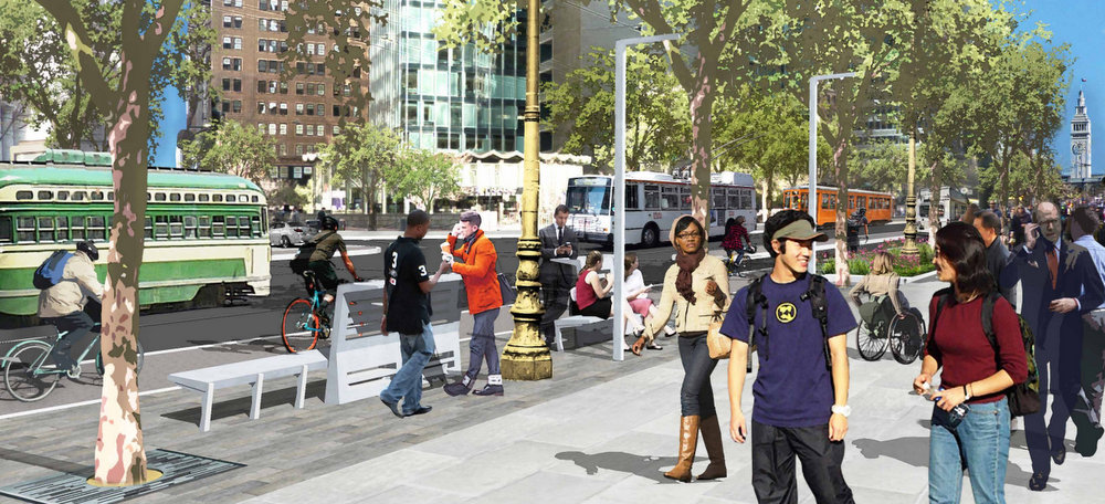
The vision for Market Street (and potentially Mission) is becoming clearer with the release of new renderings of streets and plazas at public workshops for the “Better Market Street” project this week.
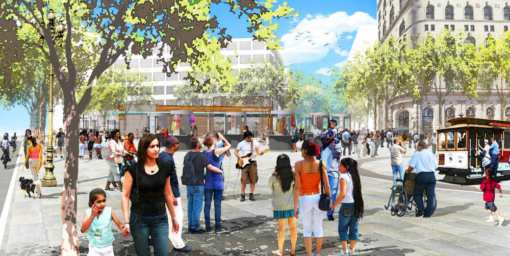
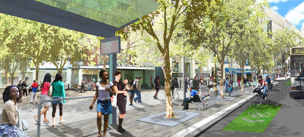
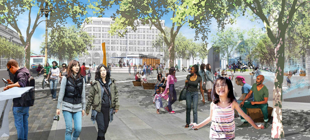
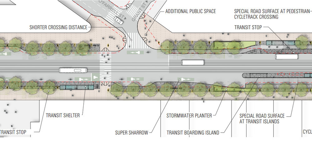
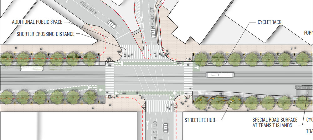
Planners presented renderings of specific stretches of Market, including redesigns for both UN and Hallidie Plaza (where the Powell Station entrance would be raised), as well as proposed changes to Muni stop spacing. Ellis Street would also be closed to car traffic to create a new plaza.
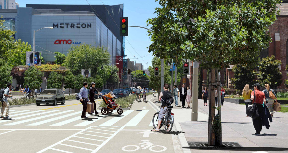
The presentation also shed more light on the three bikeway options — putting protected bike lanes on Market, on Mission, or neither. New street plans show how those ideas would pan out, including the spots where planners say there just isn’t enough width to maintain a continuous bikeway on Market.
For each of the three options [PDF], details on potential car-free areas have also been released.
- Option 1, with protected bike lanes on neither Market nor Mission, would ban cars between Fremont and Eighth Streets.
- Option 2, with protected bike lanes on Market, would prohibit cars only between Fremont and Fifth Streets. The idea is that where protected bike lanes exist, car bans aren’t as neceessary, planners said. But since there’s not enough width to provide a protected bike lane between Grant and Fifth Streets, they say, that stretch will at least be car-free, to provide more comfort for bicyclists and keep transit moving.
- Option 3, with protected bike lanes on Mission (but not Market), would include the longest car-free stretch on Market, from Van Ness Avenue to the Embarcadero. One reason for that is to help speed up buses that would be re-routed from Mission on to Market, according to the presentation materials.
All of the proposed car bans would apply only between 7 a.m. and 7 p.m.
Planners will present the proposals for feedback again on Saturday at the SF Main Library from 10 a.m. to 12:30 p.m. You can also submit comments online.
See more images after the jump.

Read More:
Streetsblog has migrated to a new comment system. New commenters can register directly in the comments section of any article. Returning commenters: your previous comments and display name have been preserved, but you'll need to reclaim your account by clicking "Forgot your password?" on the sign-in form, entering your email, and following the verification link to set a new password — this is required because passwords could not be carried over during the migration. For questions, contact tips@streetsblog.org.