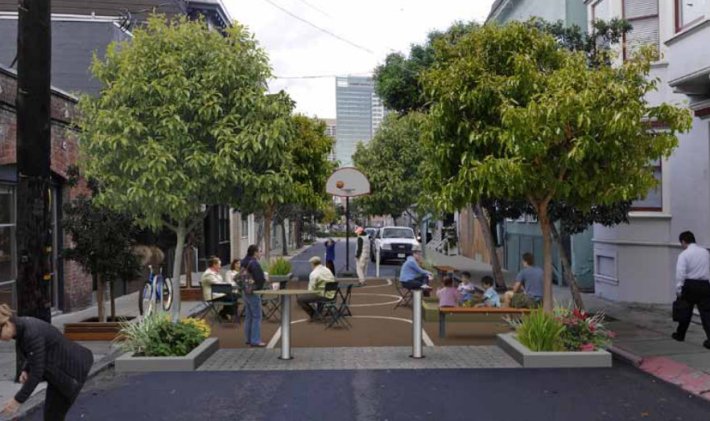
The SF Planning Department released a design guide this week for "living alleys" [PDF], providing a template to transform SF's narrow, low-traffic streets into places to gather and play.
Inspired by the Dutch "woonerf" concept, the "Living Alleys Toolkit" lays out proven design measures that make smaller streets more inviting to stay and play on, giving street life priority over drivers moving through. The guide states:
A living alley is a street designed as a place for people. It can be considered an “Urban Living Room”. Its design can reconfigure the geometry and surfacing of the street, or simply add low cost amenities for residents while maintaining the traditional curbed right-of-way. Whatever approach, living alleys prioritize the entire public right-of-way for pedestrians and bicyclists with alternative but clear physical boundaries. A living alley also has areas of exclusive pedestrian use and areas where vehicles are allowed to share space with pedestrians and bicyclists.
While the concept has been implemented more widely in northern Europe, the guide notes, similar ideas have been applied in Los Angeles, Austin, Chicago, Seattle, and Portland, Oregon. In SF, a section of Linden Street was redesigned as a living alley in 2010, and plaza projects have been implemented in SoMA on Annie Alley and Mint Plaza. In Oakland, two alleys in the Temescal neighborhood were converted into pedestrianized retail streets that delivery vehicles can enter.
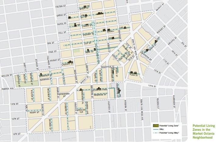
The new guide, which started development in mid-2013, focuses on the potential for living alleys in Hayes Valley and just south of Market Street near Octavia Boulevard, since it was conceived in the Market-Octavia Area Plan with the removal of the Central Freeway. But in the future, as those initial alley transformations are implemented, the city will look at expanding them citywide, said the Planning Department's David Winslow.
The guide includes prototype street designs. One is a plan to convert Ivy Street, between Gough and Franklin Streets, to a shared-space zone where cars are still allowed to pass through, as seen on nearby Linden.
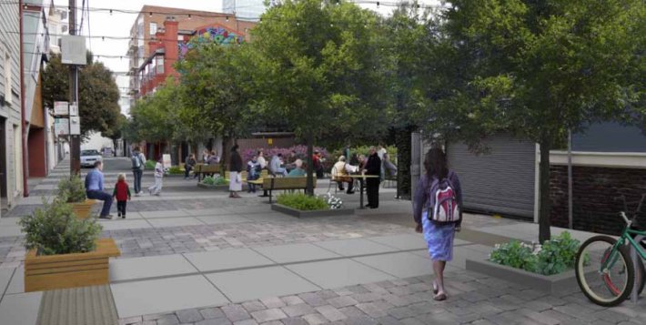
The other prototype is for a "living zone," which can easily be closed to through car traffic by "spontaneously furnishing the street with tables and chairs, planters, play structures, basketball hoops, sandboxes, etc." The plan identifies nearly two dozen potential sites for living zones in the plan area, but doesn't name a specific one to implement first.
The "Living Alleys Toolkit" was written for laypeople more than city planners. The guide "is designed to enable local residents, business owners, and other community members to actively lead in building the network in close collaboration with the city." Winslow said the first alley projects could be implemented within a few years, assuming grants from a variety of sources can be secured.
As with any changes to public streets, making living alleys a reality "requires changing expectations," the guide says. "Trade-offs are inevitable. Alleys cannot maintain their current amount of parking, traffic, and back-of-house service functions, and simultaneously provide usable open space and a comfortable pedestrian realm. A living alley is a holistic transformation of the use and function of the alley."
