Bay Bridge Bike Path Set to Open to Yerba Buena, Close Weekdays
Update: Caltrans officially announced the opening of the island end of the path will happen at noon on Sunday [PDF]. The press release includes a map of the shuttle route, which will run every 30 minutes between 7 a.m. and 6 p.m. on weekends and holidays. And here’s an explanatory video they made.
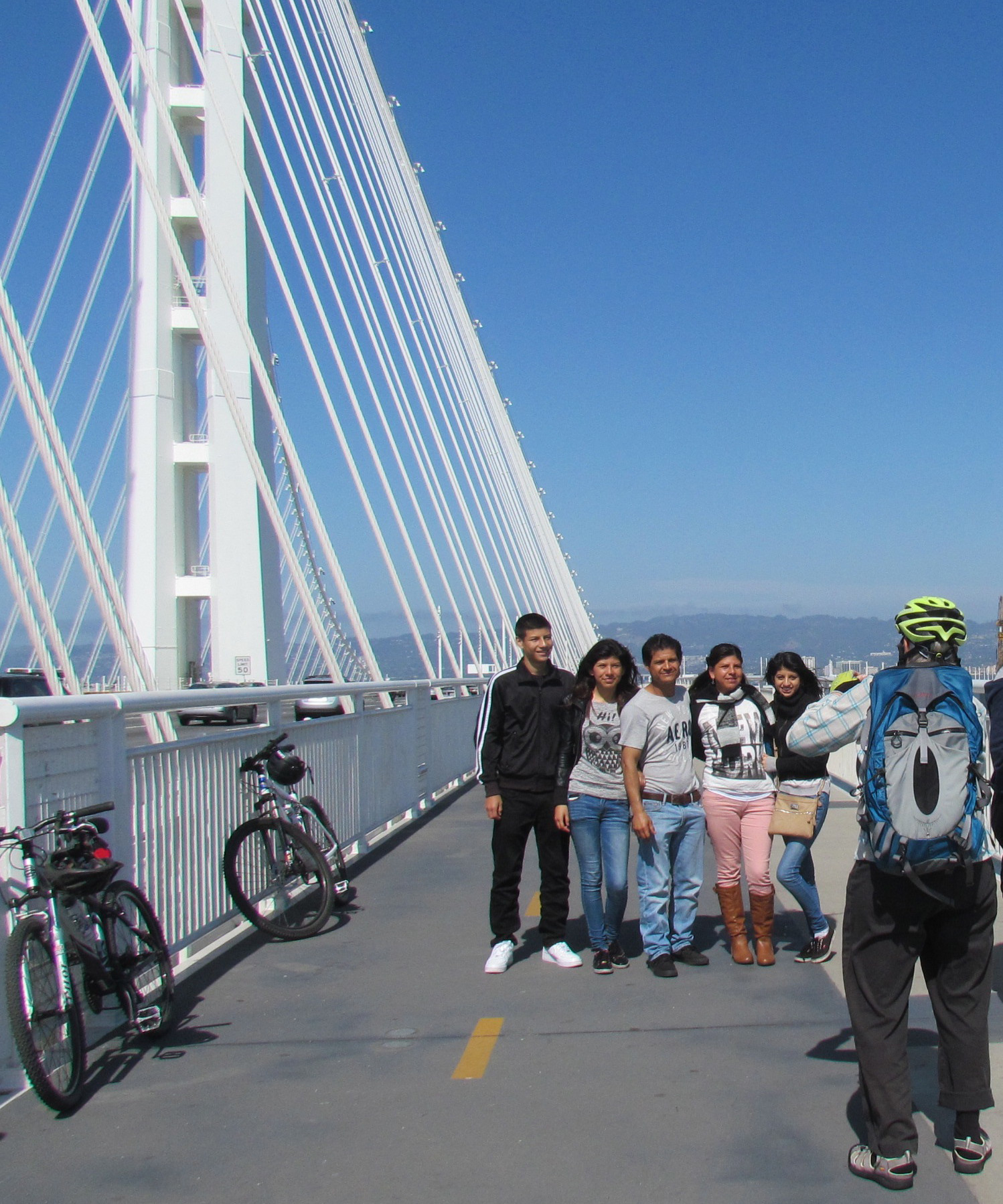
At long last, the Alex Zuckermann Bike Path on the Oakland Bay Bridge will reach Yerba Buena Island.
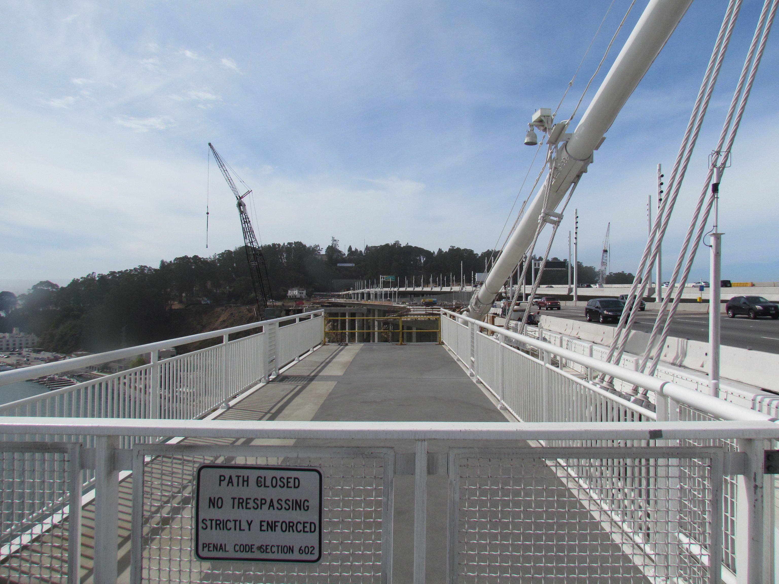
Although officials are holding off on making an announcement, the path from Oakland /Emeryville will soon touch down on Yerba Buena Island just near the east end of the freeway tunnel.
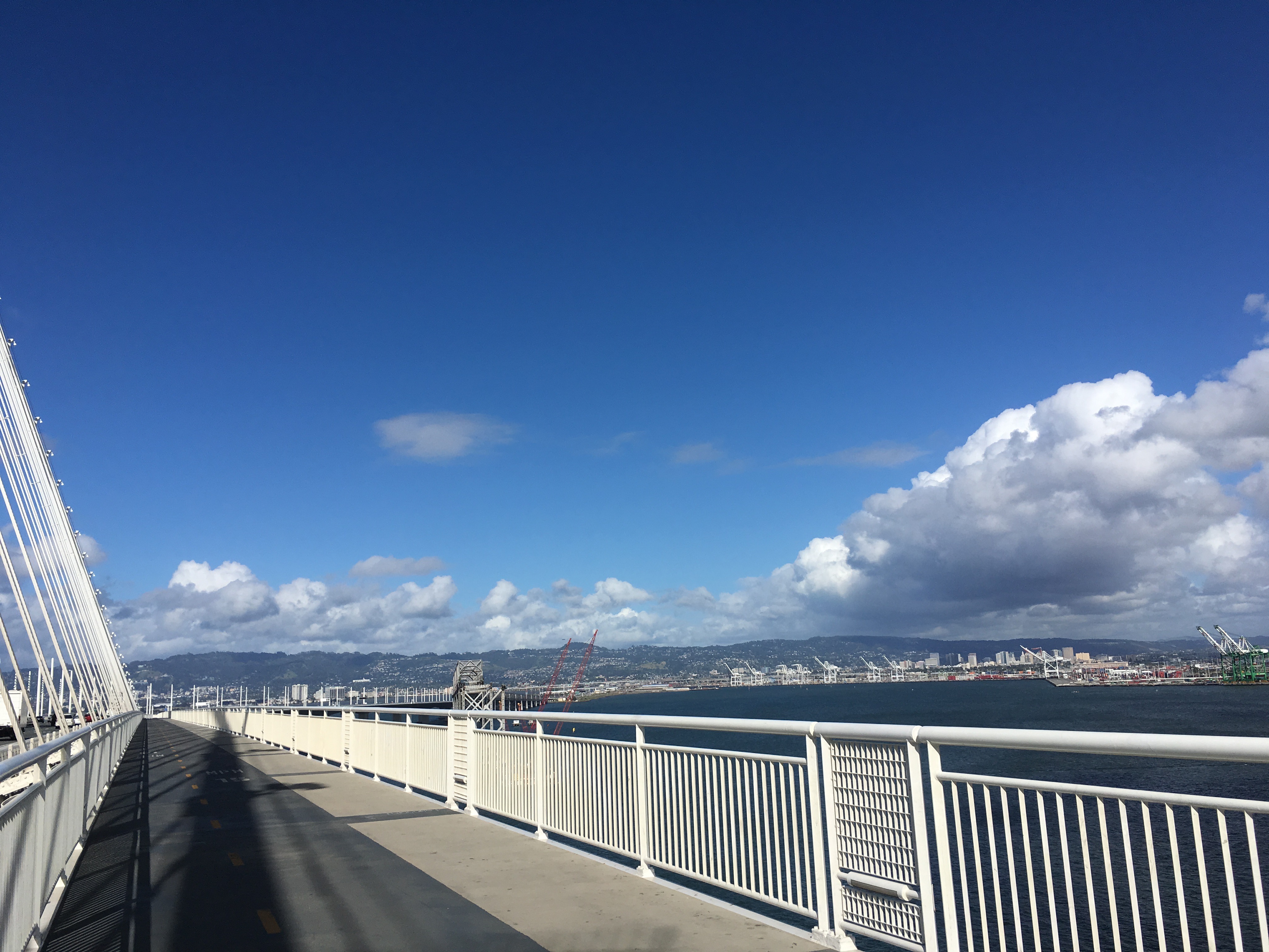
That is probably going to happen on Sunday, although there will be no official ribbon cutting or any celebration. At the touchdown, a vista point will offer a spot to rest and take in views that few people have the opportunity to enjoy, seeing as how most pass by there at fifty miles an hour or more. But San Francisco won’t be visible from that eastern edge of Yerba Buena Island and it won’t be simple to get down to Treasure Island.
After Sunday, the bridge path will be closed completely until November 5, because of the planned demolition of the old bridge’s piers. And thereafter, the entire path along the eastern span will only be open on weekends and holidays, “because of demolition activities on the old bridge,” according to Bob Haus, Caltrans spokesperson. “The bridge is just too close to the path.”
The weekday closures will continue until the old bridge is completely demolished, which could take a year or so.
Even though it’s been dubbed a “path to nowhere,” plenty of people find it worth riding and walking the path, and most days you can find people hanging out at the end of the path and taking selfies with the bridge behind them.
The connection to the island has been finished for several weeks, tantalizing people who reached the gate with a clear view of it heading west. That final bit was not open because the three agencies involved in planning for it—the Metropolitan Transportation Commission, Caltrans, and the San Francisco County Transportation Authority—had not yet ironed out the details of getting people from the touchdown further on to the two islands.
It’s a tricky issue for a number of reasons. Road access around Yerba Buena Island to Treasure Island is via a narrow, steep, and winding road without space for bike lanes or sidewalks. As of Saturday, the off-ramp from the bridge will switch from the south side—a sharp left-hand turn off the freeway—to the north side. That will reduce some potential conflicts at the bike path’s touchdown point, and somewhat reduce traffic on the south side of the island. But the island route currently available to bikes will still be carrying traffic headed toward the on-ramp. Because there is no sidewalk or room to add one, those hardy souls who walk all the way to the end of the bridge won’t be able to go around the hill to get a view of the city.
But the agencies have devised a few temporary solutions until construction on the freeway ramps is completed. To begin with, they will run a shuttle to carry walkers and bikers from the viewpoint to Treasure Island.
If you’re in shape and used to riding a bike in traffic, you can ride your bike the whole way, but Randy Rentschler, Public Affairs Director for the MTC, warns that the route is not for everyone. “A family can go on an adventure on the bridge and get as far as the vista point overlook—that would be the destination,” he said. “If you’re a very experienced cyclist, going to Treasure Island is within your skill set, but there’s traffic to deal with, including a lot of tourist bus traffic.”
“You could easily get from the eastern span to Treasure Island,” he said, “but you’re not going to take your family, or a stroller.”
Note that there is no parking at the viewpoint, which has a tight turning radius for the shuttles. If you want to come from San Francisco to enjoy the bridge path, you’ll have to get yourself to Treasure Island—best on Muni Line 25, on which you can bring your bike. Then you can take the shuttle up to the landing point, or be prepared to ride up a fairly steep hill in traffic.
When the old bridge is finally and completely dismantled, the bridge path will be open 24 hours, seven days a week. That may happen within a year. Future plans—at least two years away—will widen Macalla Road on the north side of Yerba Buena Island and add a bike lane to it. Eventually, after construction on the freeway on- and off-ramps is complete, the plan is to make Macalla Road one way for vehicles, with a class 1 bike path and room for pedestrians.
And even further in the future, a connection across the island to a future bike lane on the remaining bridge span all the way to San Francisco is contemplated. But that will take a lot more planning and a whole lot more money.

Read More:
Streetsblog has migrated to a new comment system. New commenters can register directly in the comments section of any article. Returning commenters: your previous comments and display name have been preserved, but you'll need to reclaim your account by clicking "Forgot your password?" on the sign-in form, entering your email, and following the verification link to set a new password — this is required because passwords could not be carried over during the migration. For questions, contact tips@streetsblog.org.