South San Francisco will rebuild a one-mile segment of El Camino Real this Spring with wider sidewalks, safer crosswalks, curb extensions, pedestrian refuges, bike lanes, and new street trees planted in both the medians and sidewalks. However, the bike lanes won't be continuous--to preserve curbside parking, in places they will disappear. And some intersections will remain dangerous to cross.
Stretching from McClellan Boulevard to Chestnut Avenue, the $4 million streetscape upgrade is the most extensive to date of a series of Grand Boulevard Initiative Complete Streets projects spearheaded by SamTrans and the cities located along that hazardous, auto-oriented arterial street. The city will reduce the speed limit along its entire 2.5-mile segment of El Camino Real from 40 to 35 miles per hour. New speed limit signs are to be installed in mid-December, whether permitting.
But even when the project is finished, hazardous conditions will remain. South San Francisco designs still prioritize auto traffic and parking over safety, despite a clear vision established by the regional Grand Boulevard Initiative ten years ago for people of all ages and abilities to use the street via any mode of transportation.
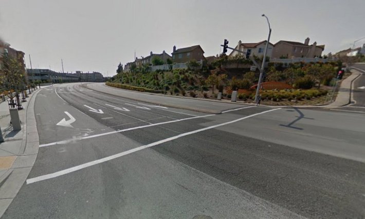
For example, the huge intersection at El Camino Real and McClellan Drive will remain virtually unchanged, except for the crosswalk restriped as a high-visibility "continential" crosswalk and a six-foot wide pedestrian refuge built into the median. But pedestrians will continue to face a total crossing distance of 110 feet over eight traffic lanes and the intersection's large curb radii allow drivers to speed around the corners. There’s no crosswalk at all on the intersection’s west side, where pedestrians are banned from crossing.
And El Camino Real and Chestnut Avenue, at the southern end of the one-mile segment, will see the same minimal improvements: one new high-visibility crosswalk with a six-foot wide pedestrian refuge.
In addition, the bike lanes in South San Francisco’s design are both narrow (five feet) and discontinuous, disappearing in several places for parallel parking. This creates a hazardous situation for bicyclists, who have to merge left into the right-most traffic lane and avoid the door zone of the parked cars. Five-foot wide discontinuous bike lanes that require merging into and out of 35 mph traffic lanes isn't a Complete Street suitable for people of all ages and abilities.
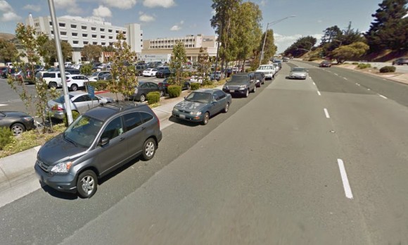
In one spot in the city's design, the bike lane on northbound El Camino Real disappears to squeeze in four parking spaces, just before reaching the entrance to the South San Francisco BART Station (BART Way). Bike lanes also suddenly drop to preserve parallel parking on El Camino Real next to the Kaiser Permanent South San Francisco Medical Center, where hundreds of spaces are available in a surface parking lot and a five-story parking structure.
City officials say such a design was chosen as a middle ground to compromise between competing goals of the project and that most parallel parking areas along the one-mile segment will be removed for wider sidewalks. In addition, the smaller intersections at BART Way and at Kaiser Way will see major pedestrian improvements. New high-visibility crosswalks will be installed on the east sides of both intersections where today there are no crosswalks at all. Pedestrian refuges will be built into the medians on both sides of the intersections. Sidewalk curb extensions will shorten the total crossing distance (across El Camino Real) to 93 feet.
But on the whole, project "compromises" prioritize motorist convenience over safety.
Construction is expected from Spring 2017 to Summer 2018 in two phases, first from Arroyo Drive to Chestnut Avenue and then from McClellan Drive to Kaiser Way. The one-quarter mile segment in between Kaiser Way and Arroyo Drive will remain as today until the city secures another grant to fund its reconstruction.
