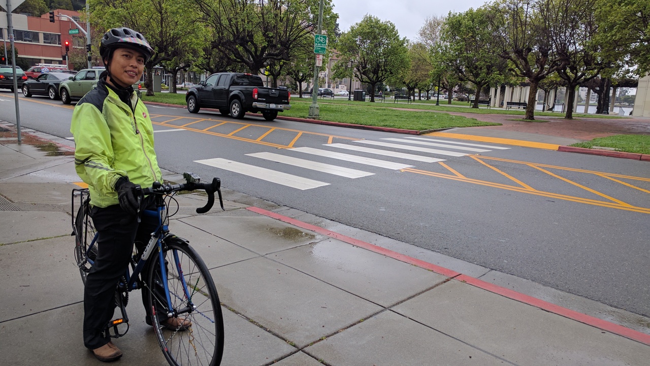
Streetsblog did a survey tour of Oakland bike infrastructure last Friday with Walk Oakland Bike Oakland (WOBO) president Chris Hwang. The group's mission statement, from its web page, is a familiar one for safe-streets advocates: "We want every person who lives, plays, and works in Oakland to feel safe and comfortable walking and bicycling, and that they know how to make their neighborhood a better place to walk and bike."
Oakland is poised to make some real strides in that direction. With the passage of Measure KK last November, the city now has $600 million to spend on street improvements, including for bicycle and pedestrian safety. Oakland is also well along with the creation of its new Department of Transportation, under the guidance of NelsonNygaard 's Jeff Tumlin.
Oakland has gotten on the protected bike lane bandwagon, as part of its complete streets project on Telegraph. That project, by almost any measure, has been a success and is a sign of things to come. But that's still going to depend on the activism of groups including WOBO and Bike East Bay.
"We're encouraging people to look at their lifestyles and ask how much do we depend on motor vehicles," Hwang said to Streetsblog. "We can't reach climate action goals if we don't change. But to change, we need better amenities."
So how is Oakland shaping up at street level?
Hwang started the survey tour at the bike corrals on Oak Street in front of the Oakland Museum of California. Going north from there, Streetsblog and Hwang encountered a familiar issue--cars driving on the bike lane.
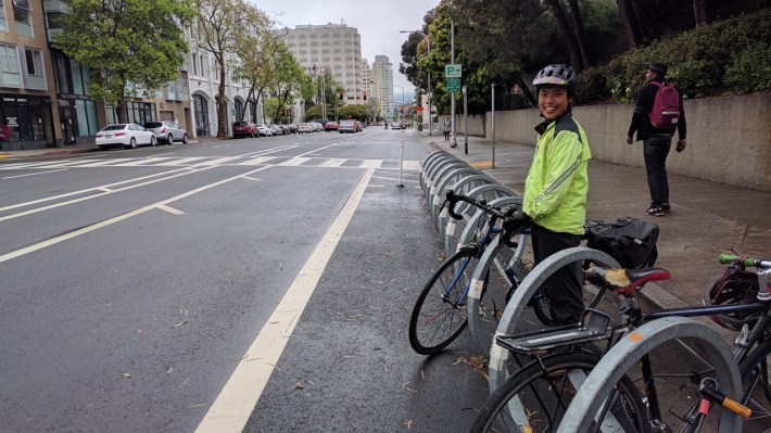
So why is Oakland still painting unprotected bike lanes? It's a bit unclear, but Hwang has found one of the biggest problems is, once again, resistance from those concerned about giving up street parking.
But that doesn't explain the treatments, seen in the photos below, on nearby Lake Merritt Boulevard, where there's a curbside lane and no parking anyway.
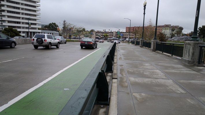
Hwang was pleased with the green, kermit paint that's been added to the lane in places, which she said helps cue motorists to stay off it. That's good, but Streetsblog found it imponderable that the city put in fences to keep cars off the sidewalks and off the landscaping, but placed it on the wrong side - right of the bike lane. For the same amount of money, they could have put protection on the left side of the bike lane, creating a fully-protected space for cyclists. Another option is to put the barrier on the sidewalk, a few feet to the right of the curb, to create a raised bike lane--it's a wide enough sidewalk to carve out some space for bikes. But putting it to the right of an on-street bike lane makes no sense and makes for some very uncomfortable cycling.
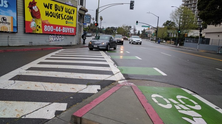
Streetsblog continued the tour, coming across this turnout at Lake Merritt and International. Cars made right turns, sweeping across the bike lane at high speeds. Hwang said the city insisted on keeping it wide so buses could make the turn. Oakland needs to go back here and add some kind of physical protection for cyclists, and perhaps phased signals, so cars are forced to slow and cross the bike lane at a sharper, safer angle.
Hwang then stopped by a senior living facility on Lakeshore, where paratransit needs to pick up elderly patrons. The population of Oakland is aging, she explained. The need to pick up and drop off elderly passengers can cause pushback against curbside bike lanes and parking removal. But this problem only exists because Oakland spent so many years building far-flung shopping centers so it's now almost impossible for the elderly to walk to things. "Markets are far away," said Hwang. But this is part of what WOBO is lobbying to fix. "We want communities that are more livable."
Hwang then stopped at El Embarcadero, at the northern end of Lake Merritt. This stretch of road was recently put on a diet; instead of having two separate sets of motor-vehicle lanes, the lakeside lanes were transformed into an inviting, red-brick pedestrian path. The other two lanes were changed from one way to bi-directional traffic, as seen in the lead photo.
But this highlighted another issue. Some cyclists want to use the red-brick path, but the divided median of Lakeshore Avenue inadvertently cuts it off and makes it difficult to use it to go anywhere. "Street medians are great," said Hwang, "But it's better to do some temporary pilot first." Because that median was done in concrete, it would be a big project now to create an opening so cyclists can use the brick path to get between Lakeshore and Grand. Hwang wants to see temporary infrastructure--planters, safe-hit posts, etc--used first and concrete second, so designs can be tweaked and perfected as failings and unintended consequences are discovered.
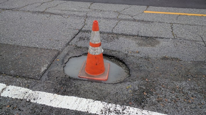
From there, Streetsblog and Hwang continued up Grand. A road diet and lane reduction has made Upper Grand more comfortable for cycling. "Counts and speed measurements show it caused no delays," she said. In fact, that was a theme on many of Oakland's streets--they are generally excessively wide for the traffic volume, the good news being there's no strong argument for not reducing speeds by adding good safety infrastructure and calming traffic. Unfortunately, the recent storms have made much of the road surface pockmarked, as seen in the above photo. Streetsblog hopes city services will get this fixed quickly.
Streetsblog and Hwang then turned onto Piedmont towards 40th, and from there onto the infamous green "super sharrows," which make cyclists share an excessively fast car lane on a busy road. More on that in a previous post.
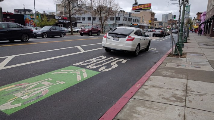
From there, Hwang led Streetsblog onto Telegraph's parking-protected bike lanes. Telegraph is a great first step and a template for what can be done on downtown streets everywhere. But Oakland made some of the same mistakes other cities have made--expecting cyclists and buses to jostle for position at bus stops in a "mixing zone" not made for comfortable cycling. The mixing zone also invites incursions from motorists, as in the above photo. "Bus-boarding islands are in the plans," said Hwang. "In about two years."
More photos of Telegraph below.
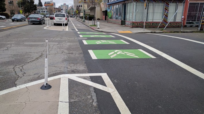
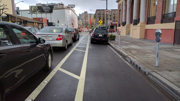
Of course, even a protected bike lane breaks down if motorists park on it. Streetsblog came across this car (seen above) doing just that. As with SFMTA's short chunk of protected bike lane on Valencia, Oakland put the parking meters on the right side of the lane, so drivers are sometimes confused and continue to park against the curb. Streetsblog hopes SFMTA will be kind enough to send over some of the laminated flyers it attached to the Valencia parking meters to help motorists get with the program. Either way, Telegraph follows Hwang's recommendation that temporary measures precede concrete so the treatments can be tweaked.
Hwang, meanwhile, stressed the importance of an active community in getting safer streets. "We try to encourage people to be proactive," she said. That means people who care about livable streets have to get out there. "WOBO's mission is all about sustainability and livability, but we're hamstrung if we can't get people involved."
