Turning the Remnants of the Old Bay Bridge into a Beautiful Park
Kaboom!
That was to be the end of all the footings of the dismantled eastern span of the Oakland Bay Bridge. Most have been blown up already and the debris carried away. But a few advocates within and outside of some key government agencies figured out a way to put the ones nearest the shoreline to a new use–as a boardwalk that will eventually be part of a huge public park.
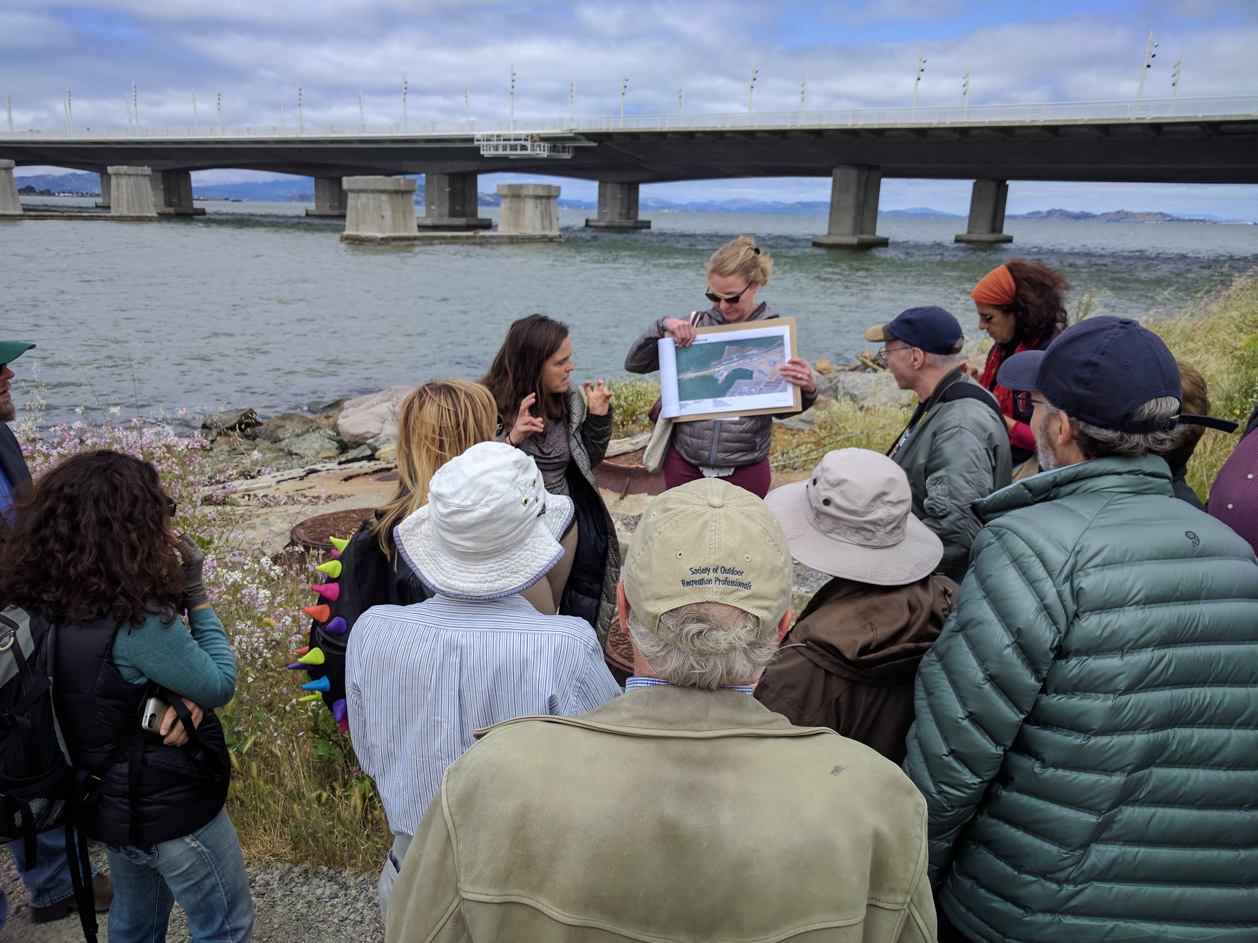
Earlier this week they gave a tour of the land around the footings and explained what they have in mind.
“Where the old Bay Bridge touched down is where the new park will be,” explained Will Travis, an advocate and the now-retired executive director of the Bay Conservation and Development Commission. “We will try to make this a place.”
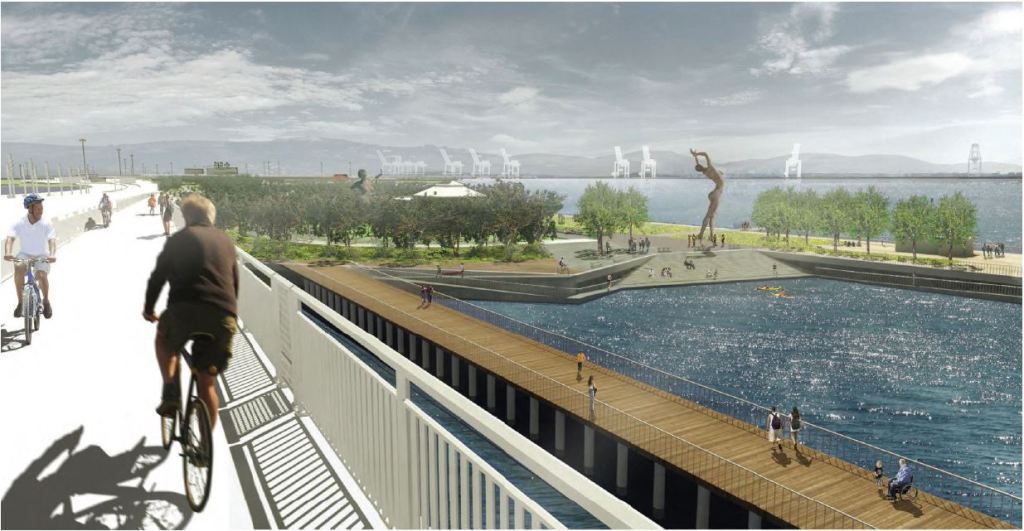
That place will be called “Gateway Park” (at least that’s the working title).
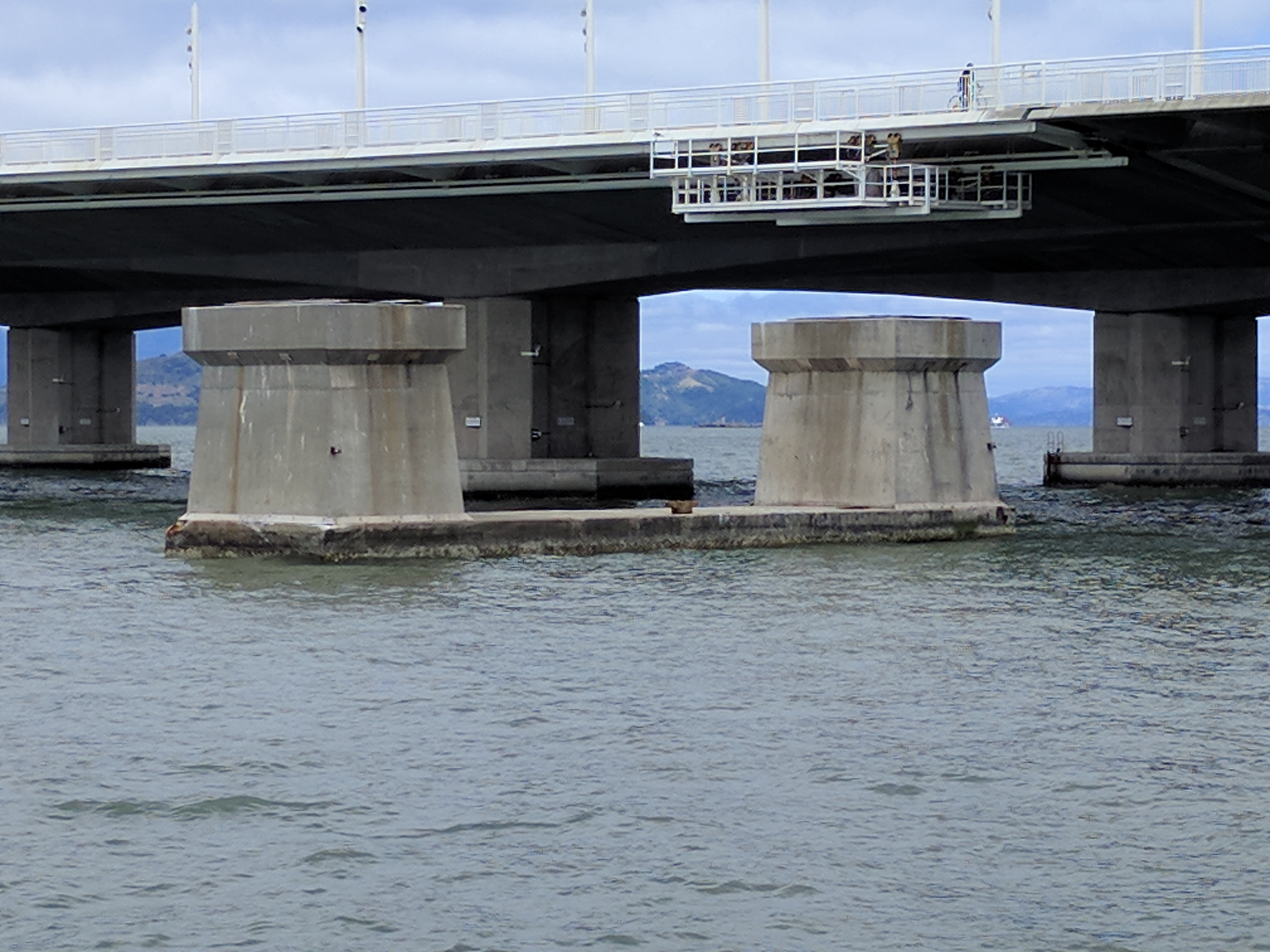
$52 million dollars was approved for the first step of the project back in January, and involves building a viewing platform on one of the footings on the Yerba Buena Island side, and a longer pier, as seen the lead image, on the Oakland side. KQED did a great breakdown of what’s involved.
But converting the footings into recreational and viewing space is just a step in a larger vision to turn the whole area around the Oakland touchdown of the bridge into a huge recreation facility, as seen in the map below:
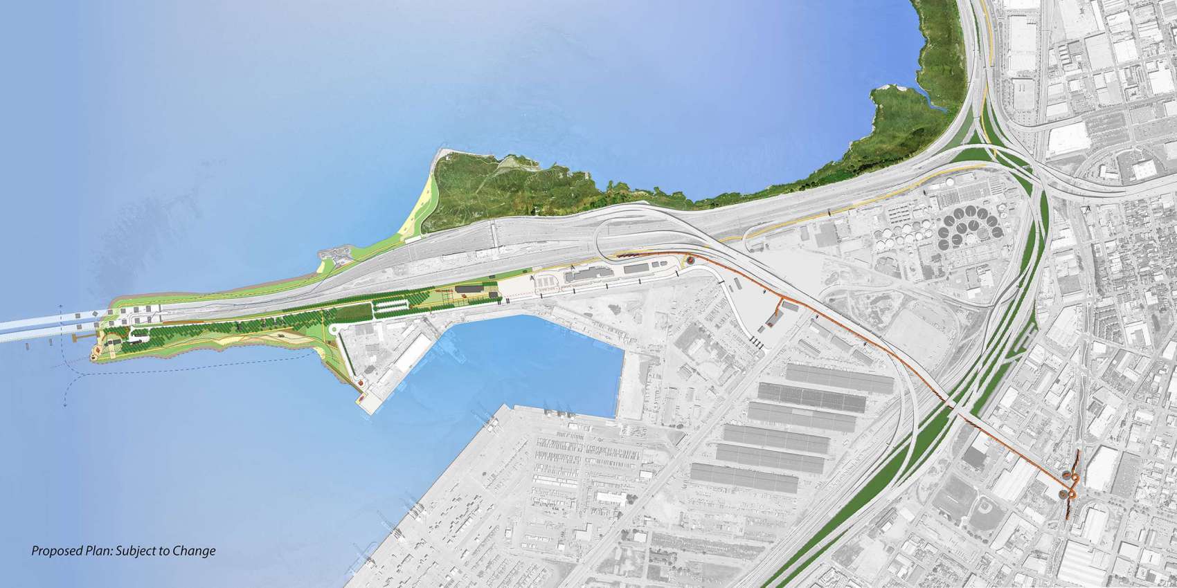
“This will be a place to celebrate the economic engine of the Bay Area,” said Sarah Kuehl, a design architect who worked on the concept plan for Gateway Park. She explained that the great cranes of the Port of Oakland set the industrial backdrop for the park. The idea, explained Karin Betts with the Metropolitan Transportation Commission, is to give Oakland its own Central Park.
But there’s the access issue–unlike New York’s Central Park, this is not exactly an easy spot to get to.
There’s a very-hard-to-find exit off the bridge to get to it by car. It’s also possible to take an AC Transit bus to the toll plaza and walk or bike a half-mile from there. Unfortunately, the bus stops there in the eastbound direction only. Bike access is better, thanks to the dedicated bike path from Emeryville to the start of the bike and pedestrian path on the Eastern Span of the Bay bridge. Part of the plan is to eventually have a second dedicated bike path from West Oakland along Grand Avenue to the bridge and park. And, of course, when the bike path on the western span of the Bay Bridge is completed, this park could become another destination from San Francisco–maybe rivaling the popular tourist ride across the Golden Gate Bridge to Sausalito? Either way, “We want this to celebrate non-motorized park access,” said Brian Holt of the East Bay Regional Park District.
What’s the time frame for all this? Well, that’s the rub.
The good news is the contract to remove the bridge footings or leave them in some usable form has to be fulfilled by the end of this year, so the pier part of the vision will soon be realized.
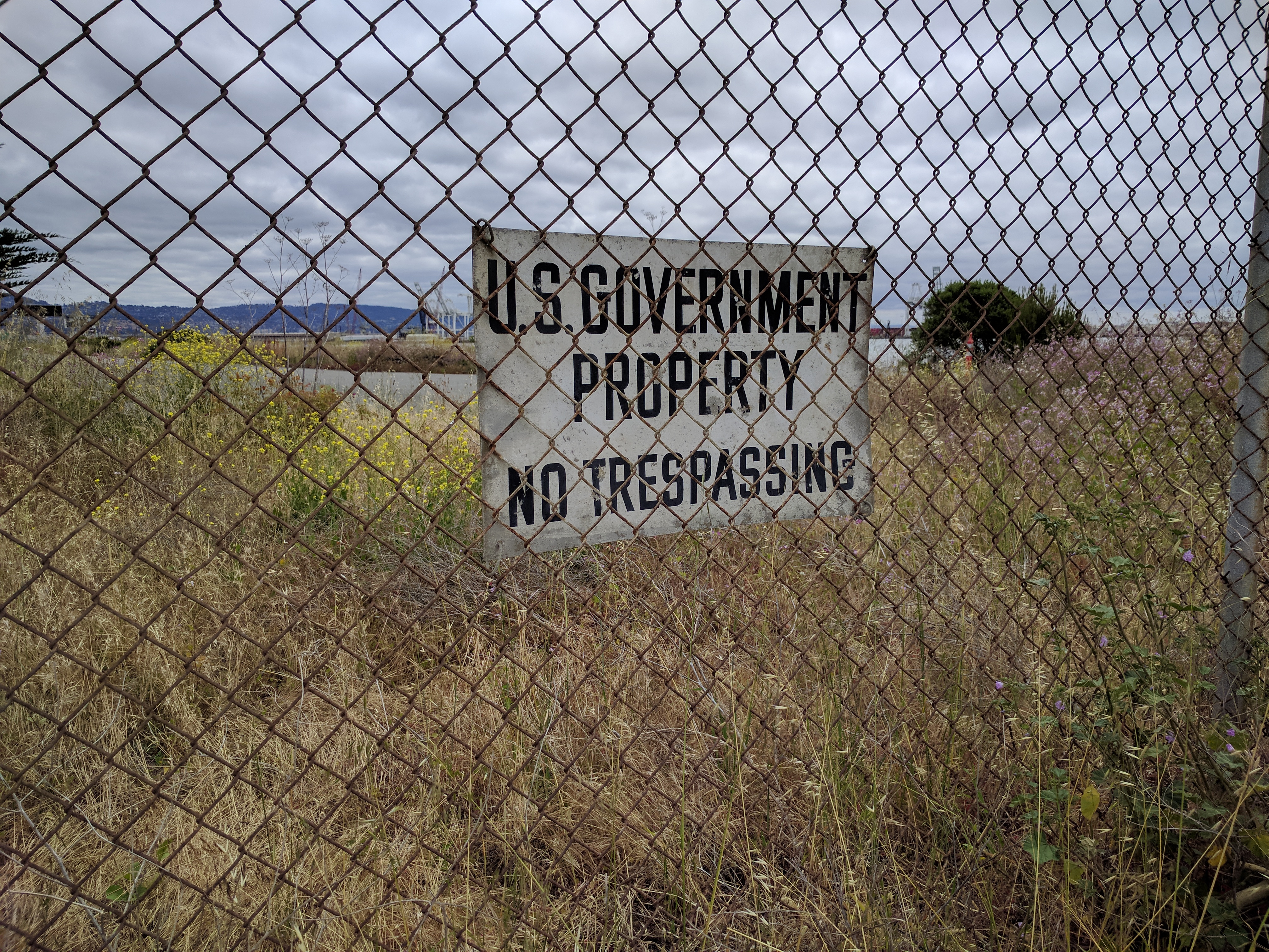
The rest of it is going to take a bit longer. According to the East Bay Regional Parks District, the final environmental review should be completed in about a year. After that, things will be built in phases. An indoor/outdoor auditorium is due in about three years. A kayak launch, playgrounds, etc. and the rest of the finishing touches could take more than ten years. There also still some potential unknowns. The army owns much of the land (see last photo) and negotiations to acquire it are ongoing. There’s also soil contamination that has to be dealt with. And we know how well that sometimes goes.
For now, they are trying to build one bit at a time in what one official at MTC called a “campus approach.” And with the Bay Bridge bike and ped path already attracting 1,700 people every month, and the pier lookout getting constructed, this greater park vision is bound to get more attention–as more and more people start to enjoy the views from the area, political momentum should build for getting the park done and making it easier to access.

Streetsblog has migrated to a new comment system. New commenters can register directly in the comments section of any article. Returning commenters: your previous comments and display name have been preserved, but you'll need to reclaim your account by clicking "Forgot your password?" on the sign-in form, entering your email, and following the verification link to set a new password — this is required because passwords could not be carried over during the migration. For questions, contact tips@streetsblog.org.