Note: GJEL Accident Attorneys regularly sponsors coverage on Streetsblog San Francisco and Streetsblog California. Unless noted in the story, GJEL Accident Attorneys is not consulted for the content or editorial direction of the sponsored content,
California cities with populations over 25,000 are invited to apply for the Complete Streets Assessment program from UC Berkeley's Safe Transportation and Research Center, or SafeTREC, by Tuesday, March 31. The program, which is free to cities, provides professional consultation to assess high-injury areas and come up with potential solutions to make them safer.
The application is short, basically a series of questions about the need for safety assessments. Priority will be given to cities that haven't had a study done by SafeTREC for a while, although right now there are still open slots so that may be moot.
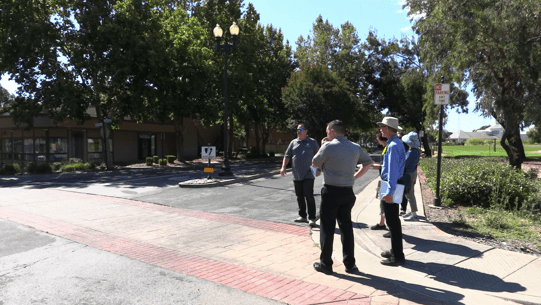
The program offers a safety assessment by professional planners and engineers for the areas the city wants to focus on--which could be a corridor, an intersection, or a section of town. Many cities have used these assessments to help them plan for safety improvements around schools, for example. After examining data and maps, and discussing the area context, SafeTREC planners meet with city personnel--which could be people from Public Works, planning departments, police, etc.--and conduct a field audit to discuss safety problems and suggest potential solutions.
The program is somewhat similar to SafeTREC's Community Pedestrian and Bicycle Safety Assessment Program, which also does analyses and public walk audits. However, the community workshops, which are conducted in conjunction with CalWalks, focus on gathering input and recommendations from community members, and engaging them in helping plan safety solutions. The Complete Streets Safety Assessments are more technical, and are intended for city planners. The aim is to provide tools and ideas that planners can use to formulate plans, plan projects, and apply for funding to complete those projects.
The walk audits involve taking a group of people out to a place that has been identified as a trouble spot--a high-injury corridor or intersection, say, or a high-traffic spot near a school--and observing travel behavior, speeds, and other issues that arise.
"The people who do the assessments," said Jill Cooper, SafeTREC's co-director, "are strong on bike and pedestrian safety. They are looking at safety in a different way" from a car-driver windshield perspective, and as outsiders they can raise questions and point out issues that city planners may not think of. The city representatives' experience brings another perspective to the conversations that ensue.
Suggestions are made, elicited, and discussed, and could include or any of a number of solutions from policy changes to traffic signal timing adjustments, new pedestrian or bicycle facilities, pavement markings, or roadway geometry changes. "There's a lot of discussion in the field," said Cooper.
In the end the city receives a summary report of the data analysis, discussions, and recommendations. The suggestions are customized to the community, the specific needs of the area, and the city itself. These reports can be used to inform bike and pedestrian plans, specific projects, or even applications for Active Transportation Program grants.
SafeTREC has an example report on its website from Suisun City, which completed a Complete Streets Safety Assessment last year.
The program is funded through the California Office of Traffic Safety, which also funds the Community Pedestrian and Bicycle Safety Assessment Program. Both are free to cities. Right now, the program is aimed at cities with 25,000 residents or more, but smaller cities may be able to apply in a future program.


