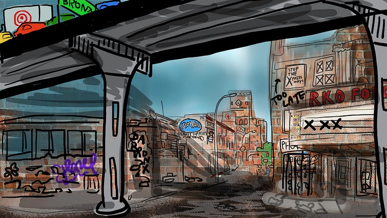
How Highways Wrecked America’s Cities
It is well-documented that America’s urban places have been designed and built for cars since the late 1920s. This planning orthodoxy came at a great cost: ecological destruction, social alienation, traffic-related disease, injury, and death, economic harm, unwelcoming urban environments. Cities from Los Angeles to Buffalo were once walkable, with streetcar lines that took citizens where they needed to go. But at the behest of lobbyists for the automobile, oil, and chemical industries, all but a few cities tore out their streetcar lines and replaced them with bus systems in the mid-twentieth century (coinciding with a national wave of first-time car ownership); by 1950, General Motors alone had bought up more than 100 municipal streetcar lines and replaced them with GM manufactured buses.¹
In America’s largest public works project ever, between the 1950s and the 1990s, federal and state transportation agencies planned for and built 41,000 miles of freeways, with the federal government fronting a whopping 90 percent of the $138.9 billion price tag (approximately $425 billion in 2006 dollars). These massive roads usually ran directly through cities and were often constructed directly on top of established neighborhoods of color. Nearly every city in the country can point to a major highway and in the same breath point to a neighborhood of color that was bisected or destroyed by the road’s placement: I-75 and Black Bottom in Detroit, I-580 in West Oakland, the Cross-Bronx Expressway in New York, the Claiborne Expressway in New Orleans, and I-35 in East Austin, to name just a few.
The new highways enabled suburban development, and then white flight from cities, since many new, single-family suburbs were restricted to white home ownership through regulations including racial covenants and redlining practices that withheld federal mortgages from people who sought to buy homes in integrated or colored neighborhoods. Between 1950 and 1970, America’s suburban population nearly doubled to 74 million, with 83 percent of all population growth occurring in suburban places, in a boom of development that converted wild and agricultural lands into low-density tract homes and shopping malls. In the cities, streets where children had once played were no longer safe due to high speeds and car traffic. The percentage of American families who owned cars increased from 54% in 1948 to 74% in 1959, and by 2016, 95 percent of Americans owned cars.
Citizens have been fighting against the automobile’s predominance for a long time. National highway protests took place all over the country in the 1960s and 70s, leading to the passage of the National Environmental Protection Act (NEPA) in 1970, which among other things required federal transportation planners to conduct community outreach when designing a new highway.² The 1970s also saw the oil embargo, which renewed interest in public transit infrastructure, as well as the Clean Air Act, which set pollution standards to curb traffic smog. Since the 1990s and 2000s, many city streets have been redesigned to be safer for all users, including pedestrians and cyclists, though these changes have been piecemeal and inequitably distributed — as of 2020, just 42 percent of sidewalks met accessibility requirements for people with disabilities. This is a marked difference from the status quo of just a few decades ago, when the primacy of car culture was so unquestioned that even the introduction of safety measures as modest as seatbelt bills sparked widespread hysteria over perceived impediments to freedom of mobility.
Still, the automobile’s continued stranglehold on the nation is profound: In 2017, about 80 percent of all trips in this country are made by car or light truck. In 2019, car and light truck trips were responsible for 23.2 percent of the United States’ national greenhouse gas emission inventory.³ In the face of dire climate projections, the transportation sector is an obvious sector for reform and redesign; already it is undergoing radical transformation, with auto-companies rolling out increasingly ambitious targets for electric and autonomous vehicles. President Biden’s infamous Infrastructure Bill, meanwhile, aims to allocate more federal investment towards rail and public transit than has been earmarked in decades.
Now, toss in COVID. In the year and a half of devastating tragedy that the pandemic has wrought, one positive thing to emerge has been that many Americans have been given the opportunity to experience what a more human-centric design approach, wherein cars are not given priority on public streets, can look and feel like. In the early months of the pandemic, slow/shared/car-free street programs, which gave pedestrians and cyclists prime access and permission to use the full right of way on certain roads, were rolled out in cities across the nation to give urban-dwellers more space to publicly distance while recreating, or an outdoor route for traveling to work. Norms about what is possible and desired for our public land are changing; there is popular support for transportation policy that prioritizes peoples’ safety and vibrant public places over a “right to drive.” The average citizen’s understanding of the impacts of infrastructure is more nuanced than it was fifty years ago. What is unique about this moment, Kyle Shelton, Director of the University of Minnesota’s Center for Transportation Studies, believes, is that “a broader coalition of folks — neighbors concerned with continued negative impacts from a highway or people who are interested in different forms of mobility — are asking questions about the kind of transportation choices we are making at a city and national level.”

Yet here we are in September 2021. Many of the Infrastructure Bill’s earlier environmental programs have been watered down by a polarized legislature. The version that passed the Senate contains enormous funding packages for new highways, supported by both Democrats including Raphael Warnock of Georgia, and Republicans such as the Texan Trump ally, Ted Cruz.
Meanwhile, two intriguing local battles are currently being waged over transportation infrastructure and may serve as a bellwether for transportation policy in years to come. Activists in Houston are begging the federal government to halt a highway expansion that would bulldoze low-income neighborhoods, and citizens in San Francisco are struggling to convince the local government that a slow street called the Great Highway, whose closure to traffic has incontrovertible public support, should be kept car-free. What is going on in Houston and San Francisco provides two useful case studies for this strange moment in transportation policy. The outcomes of both cities’ battles, like the content of the Infrastructure Bill, are still up in the air. There is a real possibility that we could see cutting-edge urban design and historic victories for community activists emerge out of these projects. Just as easily, however, we could see a preservation of the status quo.
What is happening in Houston
Houston is a city known for and defined by its highways. Highway construction spurred the development of the Bayou City’s monstrous metropolis, and highways are as much a feature of the city’s urban form as any architecture or natural feature, which is unsurprising because there are more than 1,200 miles of freeway within Houston and Harris County. Houston’s highways are federal and state roads, so they are planned and constructed by the Texas Department of Transportation (TxDOT), an agency that is defiantly pro-highway. However, the City of Houston’s local transportation policies are relatively multimodal: Houston is building bike lanes, prioritizing rapid transit and light rail, and seeking to ensure pedestrian safety.
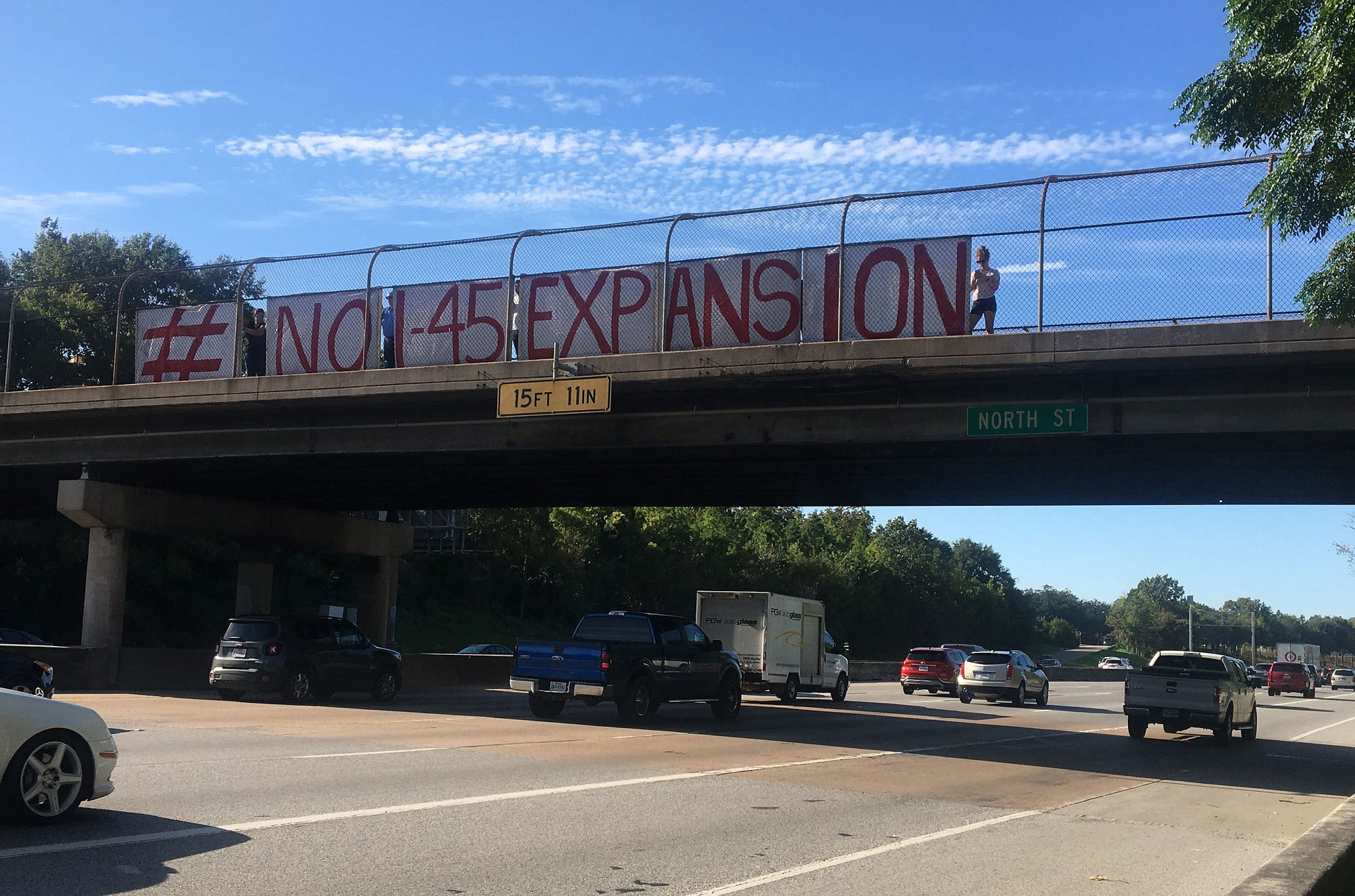
Today, activists in Houston and allies around the country are fighting against a proposed highway expansion project that would displace 1,079 housing units, 341 businesses, five churches, and two schools in majority neighborhoods of color; increase community exposure to particulate matter and toxic air contaminants from traffic exhaust that are known to cause cancer and Alzheimer’s disease; and lock another generation of taxpayers into footing the bill for car-centric infrastructure despite public outcry for more transit options.
I-45, an interstate highway that spans Texas north to south, was the first freeway ever built in Houston (and Texas). When it was constructed in the late 1940s, I-45 displaced hundreds of homes and structures. The highway is nationally known for its terrible traffic, a defining feature since the 1980s. There has been talk about improvements to ease I-45’s congestion since a catastrophic evacuation of Hurricane Rita in 2005, when thousands of cars sat stalled, trying to get out of the city at the same time. The solution TxDOT is proposing is called the “North Houston Highway Improvement Project” (NHHIP), which would extend I-45 by four to 13 lanes where it spans Houston. It would be built out in three segments of construction, and the estimated cost is $7 billion of taxpayer funding. Whitepapers on the project’s website declare that the project would be “transformational” and identify benefits as better drainage and reduced flooding in adjacent neighborhoods, better noise mitigation than exists today, improved access and safety for pedestrians and bicyclists, better air quality, improved congestion through added capacity, and expanded transit and carpool opportunities.
In a 2019 Houston Chronicle editorial, urban planner and academic, Jeff Speck, wrote that the NHHIP “can be described as having significant costs and significant benefits. The costs are best understood as tremendous, and the benefits are best understood as false.”
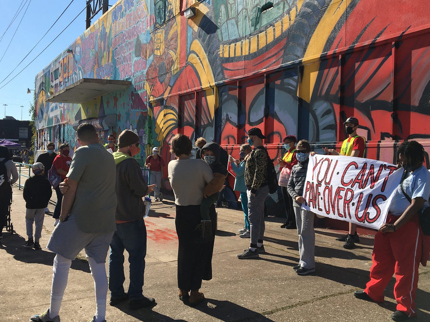
Environmental justice groups have been working to stop the proposed NHHIP for the last three years. These organizations state that a lot of things are wrong about the NHHIP — the displacement, the pollution, the massive price tag, fear that the design will make flooding worse (an issue top of mind post-Hurricane Harvey), the destruction of parts of Texas’ first independent Black incorporated city, Independence Heights (which TxDOT notably did not list as a historic resource in their environmental analysis) — but their arguments also make clear that at the crux of the struggle is a question of local control.
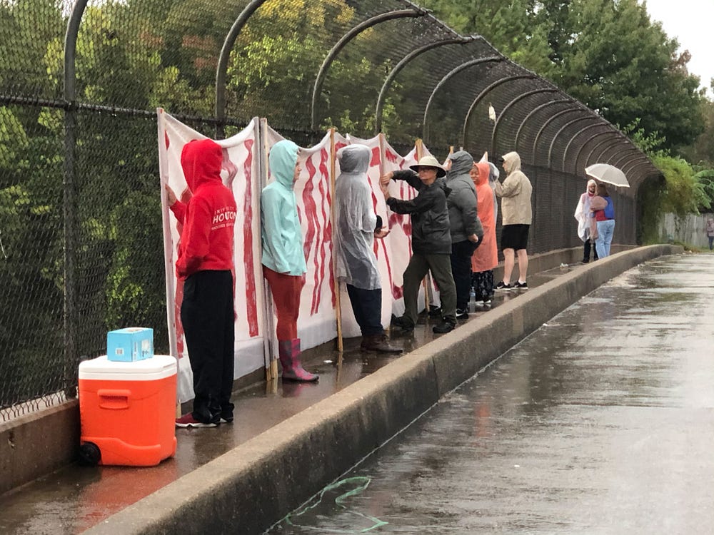
The most prominent of the anti-highway groups is a coalition called Stop TxDOT I-45 (Stop TxDOT), comprised of directly impacted community members, many of whom have been affected by multiple rounds of highway widenings; allies in public health; and Houstonians who are rightly seeing the connection between where the highway will be located and who is being impacted. The group also includes partner organizations that highlight the myriad themes of why the NHHIP is so undesirable to so many people: affordable housing advocates, transit advocacy groups, and environmental justice groups. Further, there are the members of the broader coalition that Kyle Shelton describes: people who just want to bike to work or live in a walkable neighborhood “have joined the broader call to reduce impacts of infrastructure on neighborhoods and evaluate highways of this size and type.”
What is also unique is that activists have pushed the City of Houston into what Shelton, who has written extensively about the political history of highway development in Houston, considers “the most concerted effort by Harris County and the City to reshape a project of this scale that I know of.” When activists and residents complained that TxDOT’s engagement process was obtuse, insufficient, and did not give residents any mechanisms to provide feedback or hold TxDOT accountable for listening to their comments, the City hired a planning firm to conduct a more transparent engagement process. Over the course of several months, public participation led to the development of a set of guiding principles and parameters for the project that is more in line with the community’s wishes.
“Those were really great public engagement meetings,” says Harrison Humphreys, a transportation policy advocate at Air Alliance Houston, a regional nonprofit, who has worked on advocacy around the NHHIP since 2018. “There were lots of options, and they started from the basics of ‘what do you value in a transportation project,’ instead of ‘look at these options, which community do you want to knock out next?”
However, TxDOT has refused to incorporate or acknowledge the designs that came out of public engagement, which call for a project that would not displace or endanger residents and includes transit.
“They’re just saying ‘we recognize that you did [public outreach] but we’re not interested in incorporating it in any way, any real way,’” Humphreys says. “Even though at every step they’ve said, ‘we’re not going to do something the City doesn’t want us to do.’”
In December 2020, Houston’s Mayor, Sylvester Turner, publicly commented on TxDOT’s draft Environmental Impact Statement — a legally required document required by the National Environmental Protection Act (NEPA) for projects involving federal funding before they can begin construction (the law emerged as a direct result of anti-highway protests in the late 1960s) — that the City had serious reservations about the project as proposed, and wanted to see TxDOT incorporate the substantial public input that had been collected, requesting further review and study for several key issues, most notably, reducing the footprint of the project to avoid displacement of residents.
In February 2021, however, TxDOT issued its “Record of Decision,” the final stage of the NEPA process, indicating that they had completed their environmental review, incorporated comments, and were ready to begin construction. Organizers erupted in outcry that the updated design for the NHHIP had not meaningfully addressed community comments, displacement and air quality impacts, or incorporated transit.
In March 2021, Harris County filed a lawsuit against TxDOT, asking that the court revoke the Record of Decision, and for TxDOT to halt activity around the NHHIP immediately. In the press conference in which County Judge, Lena Hidalgo, announced the lawsuit, she spoke of the County’s desire to see transportation policies that prioritize people over cars, and warned of the Katy Freeway Expansion, another Houston TxDOT project in recent memory which resulted in morning commutes that were 30 percent longer, and afternoon commutes that were 55 percent longer, just four years after the project’s buildout. The expansion’s catastrophic failure to relieve congestion is a planning textbook example of “induced demand,” wherein adding lanes to highways incentivizes more people to drive and traffic gets worse as a result.
TxDOT issued a statement that they were disappointed the lawsuit would prevent them from working with Harris County and continued to solicit contractors. Then, something extraordinary occurred: shortly after Harris County’s lawsuit was filed, the Federal Highway Administration (FHWA) formally requested that TxDOT pause the NHHIP project while they reviewed allegations of Title VI civil rights violations. The allegations had been brought to the administration’s attention by a letter from Air Alliance Houston which argued that communities of color would be disproportionately impacted by the expansion’s harmful burdens. The FHWA carries enough clout to make TxDOT listen, and the project has been on hold since the FHWA stepped in.
What does it mean that neither the City of Houston nor Harris County have the jurisdiction to alter or stop a project whose impacts will be entirely within their boundaries? To Molly Cook, one of the lead organizers in Stop TxDOT, it’s symbolic of a broken system.
“Stop TxDOT I-45 set a goal as an organization early on to try and take this to the State level, because our mission is to create a more equitable transportation in the state, and also because we are so limited,” she said. “Houston and Harris County will try to do all sorts of things, like hold people accountable to air quality standards, and the State will block it at every turn. The County may want to make a place walkable and the State will block that. There’s only so much we can accomplish in our own home without advocating at a state level.”
In April 2021, a group of 21 Stop TxDOT members and allies went to Austin to testify to the Texas Legislature’s Transportation Committee on behalf of three bills:
- HJR 109 would have loosened restrictions on state transportation funds, which currently require up to 97 percent of funding to be spent on highways.
- HB 4520 would have changed the makeup of the Texas Transportation Commission (TxDOT’s governing body) to more accurately reflect the demographics of the state, including seating transit riders.
- HB 4515 came directly out of the TxDOT/Houston dual outreach processes and would have required TxDOT to consider alternative project designs if those designs have been approved by the local governing body.
Neither of the three bills made it out of committee, though HB 4515 was the most well-received. Nevertheless, both Cook and Humphreys, who has prior experience working in the Texas Legislature, considered the experience a success.
“No one really pays attention to transportation issues, and the fact that these bills had 20–25 witnesses, that they all had well-reasoned arguments coming from different perspectives — a lot of times when groups show up it’s just one script. The committee was not used to seeing such a dynamic organization present those kinds of arguments, and that was a success. Even if the bills didn’t make it very far, the group definitely made a splash. The conventional wisdom in the legislature is that it takes three to four sessions to pass something. The first one, you get it on paper, get it into committee, and let people know about it and it develops from there. If this was the first step, then it was a great first step,” Humphreys said.

In the same period that the Texas legislature chose not to move Stop TxDOT’s sponsored bills forward, they did advance a bill that would ban drive-through voting, a practice which was utilized by Harris County during the 2020 election. In Texas, you can drive but you can’t do it while voting. In most parts of Houston, you can’t walk to go vote either. Harris County is extravagantly gerrymandered, as are the counties containing Austin, San Antonio, and Dallas. The result is that left-leaning cities are not able to exert much influence on the state roads that run through them. (Perhaps this is because most of the representatives in the legislature are reliant on the support of suburban communities who would benefit from eased freeway congestion into and out of cities, despite TxDOT’s spotty track record of delivering on that promise.)
The struggle in Houston highlights an urgent need for environmental regulations that are stronger than exist now, and which can rise to meet the challenge of ensuring all communities really do have access to clean air, water, and soil; that protect communities — especially historically marginalized ones — from projects whose outcomes are blatantly unjust. But simply strengthening NEPA might not be the best way to achieve these outcomes. The State of California has its own environmental protection act, the California Environmental Quality Act (CEQA), which is essentially a beefed-up NEPA that almost all projects in the state are subject to. Whereas NEPA only requires an agency to report potential environmental impacts, CEQA mandates that agencies identify the environmentally superior alternative to any project and propose mitigation measures for any harmful impacts.⁴
The policy intent is honorable, but since the law’s passage in 1970, its implementation has been exploited and perverted by interest groups to block a wide range of projects, including ones that are obviously pro-environment in their design such as solar farms, transit, bike lanes, and housing near employment centers. Some critics argue that this is because CEQA put the onus for environmental regulation on private citizens to hold the government accountable by suing projects that they believe will degrade environmental quality (this is the same way that ADA compliance is enforced in buildings and public spaces). In practice, this means that the law is mostly administered by citizens who choose to show up and engage. History has shown us that those who participate most are not usually representative of the broader population, particularly people who would benefit from projects that are meant to, say, uplift the poor, or integrate segregated communities. In California there are countless cases of wealthy neighborhood associations suing cities under CEQA frameworks for trying to build housing or transit in their neighborhoods; this hijacking of environmental review is one of the leading reasons why construction costs are so high in the state, and thus a key facet of the affordability crisis.
CEQA/NEPA reform is an option, but a better one is for the country to adopt a system more like those in European countries, wherein public agencies do environmental review based on standards that representative departments like the EPA set, listen to and work with communities in the planning process, and have the authority and discretion to move forward with a project that demonstrably utilitarian.
Until then, we are stuck with situations like what is going on with the Great Highway in San Francisco.

What is going on in San Francisco
San Francisco has a proud anti-highway history. In 1959, it was the first city in the country to outright ban freeway construction in its urban core. In 1973, as nationwide gas prices skyrocketed during the OPEC oil embargo, San Francisco’s Mayor, Joseph Alioto, testified before Congress asking them to allow the City to use its allotment of federal highway funding for a mass transit system. He was successful, and the Federal Highway Act was amended, leading to the construction of the Bay Area Rapid Transit (BART) system, as well as Washington D.C. and Atlanta’s subway systems (in this same era, Houstonians voted “no” on HART). Many of the goals in the current San Francisco General Plan’s transportation element pertain to increasing transit access, improving pedestrian safety, and phasing out reliance on single-passenger vehicles.
Today the City is home to a famously onerous and inefficient bureaucracy, fierce political infighting, massive wealth inequality, and a politically active population that is vitriolically opposed to change. San Francisco didn’t displace people with highways, but it pushed out BIPOC and low-income people during the tech bubble’s real estate boom and gentrification tidal wave (exacerbated by the aforementioned politically-active contingent, which fights any new housing construction to the death). The idea that a new road, much less 14 lanes of highway, could be built in the city today is laughable; it’s taken 16 years and counting for the City’s transit authority (SFMTA) to implement a single rapid bus lane project.
When COVID happened, the City implemented a quick-build program called “Slow Streets.” The slow streets would prohibit through-traffic on residential streets, maintaining access for local users, but otherwise transforming select corridors into a shared space for foot and bicycle traffic. The rationale was that transit service had been reduced and people needed more room to maintain social distancing on many of the city’s sidewalks, paths, and bikeways. Overnight, sandbags, traffic cones, and signs indicating street’s closure to through traffic appeared on corridors throughout the city.

Notably, slow streets were implemented without any public process, which is unheard of in San Francisco. There were drawbacks to this approach: access was not evenly distributed (it took months and a lot of activist lobbying before the dense Tenderloin neighborhood, home to the city’s highest concentration of unhoused individuals who had unique and desperate need for space to socially distance, received a slow street), drivers found themselves unable to or unsure of how to drive on the streets where they lived, and people worried about policing, or lack thereof, and BIPOC community members’ safety in these shared spaces. Mostly, though, the program was a huge hit. Neighborhoods decorated their barricades with public art, and it wasn’t an uncommon sight to see folks gathered around in lawn chairs playing instruments on the median, almost like a block party. Lots of happy families, puppies, skateboarders, cyclists, seniors, and walking groups to be found out strolling. In the last year, there has been an abundance of articles about bicycle shortages sweeping the city, as all age groups, especially children, take up a newfound interest in riding.
Most of the slow streets are on residential roads, but the City also implemented something that is better described as a “no-street:” they prohibited all car traffic on two major corridors in and near Golden Gate Park. JFK Drive is the main street that traverses three and a half meandering miles through the heart of the park, and the Upper Great Highway is a two-mile stretch of a four-lane roadway that runs parallel to the Golden Gate National Seashore, beginning at the southwestern edge of Golden Gate Park and terminating at the southwestern edge of the foggy Sunset neighborhood (San Francisco’s largest residential neighborhood). Since both roads closed to cars, they have taken up the titles of San Francisco’s number one and number two most-used open spaces. Unsurprising, because they are vibrant linear parks in stunning settings, where cars do not threaten the safety or rhythm of human play.
The Great Highway was actually conceived of as an oceanside promenade for pedestrians, bicyclists, and horses when it was built in the early 1900s. Unique in that it is a single access road that does not connect to the surrounding street grid, the Great Highway was paved in the 1920s and became a popular drag racing destination in the 1970s and ’80s. Today, its existence is threatened by sea level rise and coastal erosion. Prior to 2020, the road would close for up to 30 percent of the year due to high winds blowing sand across the lanes. In 2021, the Great Highway, though not an official interstate, made the cut for the Congress for the New Urbanism’s Freeways Without Futures report of the fifteen most dilapidated, problematic, highways in the country that are “prime for a transformation.” Per San Francisco Recreation & Parks’ adopted Ocean Beach Master Plan, the long-term future of the Great Highway is a managed retreat that gradually reduces lanes and dismantles the pavement to put in a boardwalk-like pedestrian pathway that allows for the restoration of native dunes. The first phase of the project will be built out in 2023, when the southern portion of the Great Highway — which is actively eroding into the sea — will be permanently closed and turned into a pedestrian path. At that point, the no-street segment of the Great Highway will connect and lead to nowhere.


2020 offered a preview of the Great Highway’s long-term future. Picture: a parade of human traffic, plus fishermen, homemade go-karts, kites, surfers, and seabirds (not human, but stakeholders all the same). The Great Walkway, as supporters have renamed it, has garnered immense community support. It’s offered San Francisco’s largest neighborhood a new park space; a flat, car-free, paved stretch of road where children have learned to bike; it has drastically expanded ocean access to people in wheelchairs; and it served as a venue for several marches for racial justice, one of which was organized by the district’s supervisor. In November 2020, San Francisco’s state representatives, State Senator Scott Weiner and Assemblymember Phil Ting co-authored a letter to the SFMTA and the City’s Director of Transportation urging the department to keep the Great Walkway closed to cars.
Initially, the Sunset’s district supervisor, Gordon Mar, described the future of the Great Highway in a similarly aspirational context. At the first community meeting regarding the road’s future, held in November 2020, he opened the conversation by describing how San Franciscans made a choice after the 1989 Loma Prieta earthquake to not rebuild the Embarcadero Freeway. Instead, the City invested in a waterfront promenade that is now an iconic destination. Mar was open about climate change and how urban design benefits can outweigh traffic convenience. But as the months went on, his tune began to shift to reflect growing backlash from a loud group of constituents.
As San Francisco began to ease its way out of the pandemic (variants notwithstanding), slow street supporters and advocacy groups such as Great Highway Park, Kid Safe SF, the Bicycle Coalition, and Urban Environmentalists rallied the City to make slow streets permanent. Given that the City has already adopted policies such as “where consistent with transportation needs, transform streets and alleys into neighborhood-serving open spaces” and “close certain streets not required as traffic carriers for pedestrian use,” such a transition would seem a natural step. In July 2021, several residential slow streets were selected for permanent reallocations. However, there has been enormous citywide controversy over proposals to keep the no-streets closed permanently.
After the 1989 Loma Prieta earthquake, San Francisco chose to not rebuild the Embarcadero Freeway, and instead invested in a waterfront promenade that is now an iconic destination. Many community members want to see a similar path forward for the Great Highway.
In early summer 2021, SFMTA and the parks department put forward their recommendation for the Great Highway to several local decision-making bodies, including the fire department and the board of supervisors: a two-year pilot study to test a permanent closure to car traffic. The public was given the opportunity to comment on this study at two initial “listening session” meetings between SFMTA, the parks department, and the board of supervisors. Hundreds of people called in to give their bit about the Great Highway’s future.
The opening salvo came from a leader of Kid Safe SF, one of the main groups organizing to keep the Highway car-free: he called for a permanent closure to preserve a climate-friendly, beloved community space where children and people of all mobilities can safely experience the ocean. The second caller was a Sunset resident whose points included “the Bicycle Coalition is a cult that has too much power,” and “the SFMTA has rigged public input to make people say they want to keep the highway closed.” It wasn’t difficult to imagine that if given more than the allotted 60 seconds, the caller may have begun chanting “make the highway great again.” Fans of the Great Walkway provided well-reasoned arguments about reducing the leading cause of childhood mortality in the city (traffic death), reducing greenhouse gas emissions, increasing park access, traffic safety, and equitable coastal access. The other side identified itself almost entirely as drivers of single-occupant vehicles, and nearly every argument cited the same reason for the road to be reopened: the caller had been inconvenienced by traffic, and they wanted to drive their cars again.

Public support for preserving the Great Highway as a no-street park is overwhelming (about 73 percent of people surveyed citywide are in favor of a permanent closure). Further, both the State of California and San Francisco have committed to stringent greenhouse gas emission reduction targets, with a goal of statewide carbon neutrality by 2045. Plugging two miles and four lanes into UC Davis’ National Center for Sustainable Transportation’s induced travel calculator indicates that reopening the Great Highway would result in 21 million more vehicle miles traveled each year, or roughly 8,000 tons of CO2e, a figure that directly counters climate action goals. Yet the summer’s initial meetings have spooked advocates that San Francisco’s supervisors who oversee the districts closest to the road — elected with much slimmer margins of support than the Great Walkway currently enjoys — will cave to the political pressure from the driver contingent.
On Monday, August 16, the road reopened to weekday traffic. It remains closed to cars on the weekends, beginning at 12PM on Fridays and ending at 6AM on Mondays. Mar’s office calls this a compromise. It’s certainly something, and it’s a better program than what existed before. But when one considers that there are currently 48 avenues that run north/south on the west side of the city where cars can drive but only a single bike path, and that now the bike path is only open for weekend access; or that 30 percent of San Franciscans don’t own cars, and therefore can’t access the space during the weekdays, it doesn’t feel like much of a victory. The official status of the pilot project is still in limbo, and the Board of Supervisors will vote on a direction forward in late 2021.
Conclusion
When looking at highway and transportation history in this country, one of the main themes that emerges is the disparity between pro-highway rhetoric and the disruptive reality of their construction. America’s Black and brown urban neighborhoods have suffered cruelly as a result of highway construction and related land use patterns. If this country has learned anything from its highway construction to date, it’s that we absolutely should not build new roads that displace and disproportionately burden people of color. The other takeaway is that cars have been universally prioritized in nearly all funding decisions to date, and are the dominant and often only mode on the majority of city streets. It’s worth remembering that not everyone can afford or legally drive a car, and pedestrians and cyclists face a much higher risk of mortality on roads than drivers do. When transportation advocates call for bike lanes and the rededication of street space to pedestrians, they are asking to see a restoration of balance among modes, to increase peoples’ choices in how they get around.
We live on a rapidly warming planet. We know what kind of infrastructure projects are going to help, and which are going to hurt our chances of survival. These are not just roads, but questions of collective action. Most people want access to safe places to walk and bike where they live. Most people say they would like to reduce greenhouse gas emissions. However, the infrastructure that will allow us to do this requires tradeoffs, such as losing a traffic lane to put in a bike lane, or muscling through a few months of construction near neighborhoods in order to build a new transit stop.
Highways and highway removals will be a salient political issue for cities across the country in the coming years, especially with new federal funding for just that in the works. With the NHHIP, the Great Highway, and every transportation project that shapes how we move through and experience cities, we must ask policymakers again and again: Who is the greater good that benefits from a “utilitarian infrastructure project”? If the answer doesn’t prioritize the planet, public health and safety for everyone — including people who cannot or do not drive — or the vitality of our precious public spaces, then we must fight for an alternative that does.
Breaking free of the status quo will require creativity and a commitment on the part of high-ranking transportation officials. It will require a clear mandate from voting citizens that they want to see funding go towards green spaces, bus service, and fixing inadequate sidewalk facilities, with less towards asphalt and road widening. It will require elected officials to show political courage and boldness, and implement the will of a representative democracy — not just the squeakiest wheels with the largest campaign donations.
We’ve got a way to go, but momentum is on the urbanist’s side. Though this work is slow and arduous, what is happening in Houston serves as a bitter example of what happens when communities are not given a voice in planning their cities. While attending planning meetings and calling representatives can be a frustrating tax on personal time, it’s important that we keep at it and advocate for the kind of transportation system we want to see. After all, once a piece of infrastructure is in the ground, it takes a great deal of effort to remove it.
***
Hazel O’Neil is an illustrator, graphic designer, and assistant planner who lives in San Francisco, CA. She is the creator of the short documentary, My Way is the Highway, an animated history of the US Interstate Highway system.
[1] Jackson, Kenneth T. 1985. Crabgrass frontier: the suburbanization of the United States. New York: Oxford University Press.
[2] The National Environmental Policy Act (NEPA) of 1970 is a procedural document that requires projects receiving federal funding to write environmental impact statements. All parties must come to an agreement about the project and sign on in order to reach a final environmental impact statement (FEIS), which allows the project to move forward provided that it conforms with the project description in the FEIS. NEPA does not pertain to the environmental impacts, only that the project must fully disclose all known environmental effects.
[3] NHWA, 2017. US EPA, 2021.
[4] The California Environmental Quality Act (CEQA) of 1970 requires all projects receiving federal, state, or local approval, permit oversight, or funding, and/or which require discretionary review to reach a final environmental impact report (FEIR). Under CEQA, projects have to analyze a range of environmental impacts, consider alternatives to the project, including a “no project” alternative, and move forward with the project that has the least negative impacts. CEQA analysis can put forward mitigating measures to reduce the negative impact of a project.
In 2017, CEQA was amended to analyze transportation impacts based on a metric called “vehicle miles traveled,” which is exactly what it sounds like, replacing the old standard of “level of service,” which refers to the speed and convenience of a driving commute (LOS A is a speedy trip, F is gridlocked congestion) (Pub. Resources Code, § 21099, subd. (b)(3)). Broadly, this change indicates that the State of California considers reducing how much vehicles are driving important for ensuring the quality of our environment.
Streetsblog has migrated to a new comment system. New commenters can register directly in the comments section of any article. Returning commenters: your previous comments and display name have been preserved, but you'll need to reclaim your account by clicking "Forgot your password?" on the sign-in form, entering your email, and following the verification link to set a new password — this is required because passwords could not be carried over during the migration. For questions, contact tips@streetsblog.org.