Mayor Michelle Wu’s press schedule for Tuesday includes “a press conference on Boston’s bike network and street safety at the Tobin Community Center” in Roxbury, according to the Mayor’s press office.
The announcement is scheduled for 10 a.m.
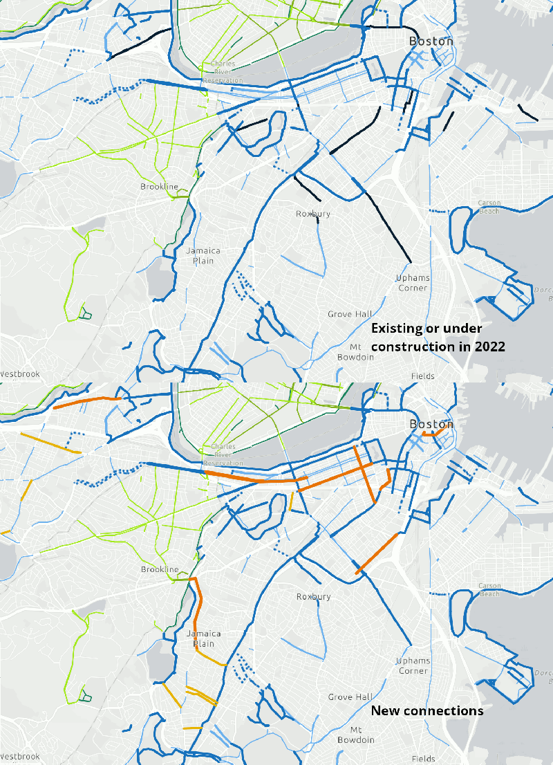
Mayor Wu’s predecessor, Marty Walsh, adopted an ambitious citywide transportation plan, Go Boston 2030, which called for a connected network of separated bike lanes throughout the city center (mapped above).
However, implementation of the GoBoston 2030 plan has been uneven, and progress on the proposed bike network has been particularly slow. Even where protected bike lanes exist, many of them remain disconnected from one another.
The 2017 Go Boston 2030 plan identified over 31 miles of “priority” bikeway projects and an additional 62 miles of 15-year projects to be implemented by 2030. In early 2020, a LivableStreets progress report found that a little over 9 miles of protected bike lanes had actually been built.
There are currently a number of protected bike lane projects that are actively under construction, including a 0.8-mile traffic calming project that includes separated bike lanes on Tremont Street in the South End and a two-way separated cycletrack on Massachusetts Avenue between Melnea Cass Boulevard and Columbia Road in Dorchester.
This story will be updated.


