Note: GJEL Accident Attorneys regularly sponsors coverage on Streetsblog San Francisco and Streetsblog California. Unless noted in the story, GJEL Accident Attorneys is not consulted for the content or editorial direction of the sponsored content.
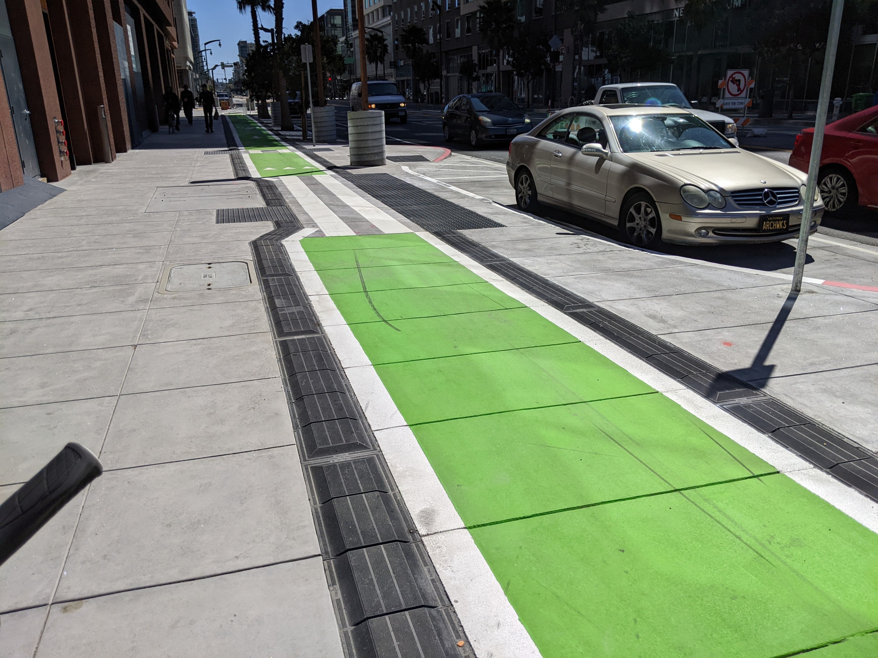
San Francisco just put the finishing touches on its first sidewalk-level bike lane. It runs north-bound only on Third Street in Mission Rock between Toni Stone Xing and the Bay Trail where it meets the Lefty O'Doul Bridge.
"The sidewalk-level cycle track is the first of its kind in San Francisco and designed in a collaborative effort with San Francisco Public Works. It replaces what was initially proposed by the Mission Rock Development to be a painted bike lane between the passenger loading zone and the travel lanes on Third Street," explained SFMTA's Michael Roccaforte in an email to Streetsblog. "We chose the sidewalk-level design because of the limited width available and the need to accommodate pedestrians, including those with disabilities and wheelchair users, who had to use the bikeway between the loading zone and sidewalk."

The bike space is separated from the rest of the sidewalk by a short, easily mountable rubber curb. "This delineator design was developed and tested during the Better Market Street effort as a means of finding a narrow but detectable design that allowed wheelchair users to use the bikeway and be easier to locate for people with sight challenges," explained Roccaforte.
San Francisco joins Alameda, Oakland, Fremont, and Redwood City in getting a sidewalk-level bike lane. It treats cyclists as what they are—fragile humans on wheels, not a smaller type of car (see note at end).
Does this mean sidewalk-level bikeways could become the new normal? "Sidewalk-level bikeways are a tool the city will use as appropriate. But given the civil engineering design requirements associated with them, which can be the equivalent of widening a sidewalk and require new catch basins for drainage, reshaping a roadway and relocating utilities, they can be cost-prohibitive compared to other designs," wrote Roccaforte. "Given the sidewalk was being rebuilt here as part of the Mission Rock Development, this was an opportune time for the sidewalk level design."
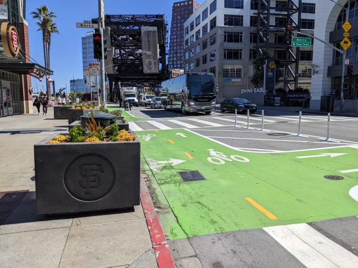
Sadly, there is plenty of new construction in the Bay Area where developers do not take the opportunity to build sidewalk-level lanes. Alas, even this new sidewalk-level lane is a bare minimum. It doesn't even run the length of the block. Roccaforte said that this is to accommodate paratransit. "There have been new posts installed, and the bikeway was painted green in late March," he said. However, it's still unclear why the bike lane couldn't have continued at sidewalk level. SFMTA's solution, having it go prematurely to street level and dividing the loading zone with plastic posts, seems an invitation to conflict (See pic below).
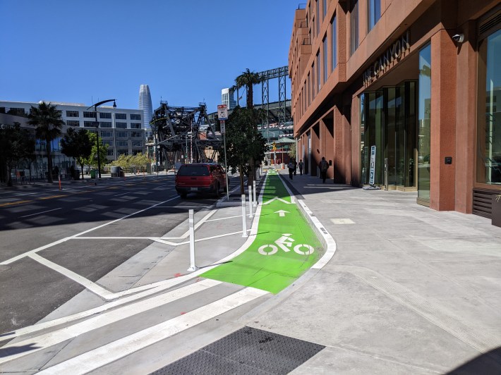
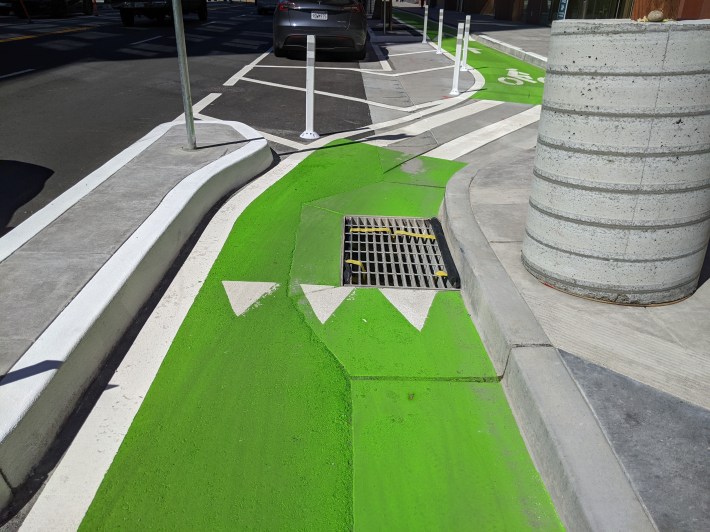
Around the corner, it connects with Toni Stone (which has a standard painted lane) with a sharp turn behind a protective curb as seen below:
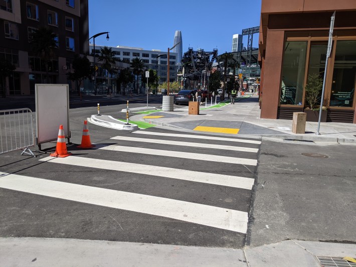
Unfortunately, there's no clear entrance for cyclists to get to the sidewalk-level lane from 3rd; many cyclists coming down 3rd blew right by it.
On the northern end, the sidewalk-level bike lane connects with the new two-way crossing of the Lefty O'Doul Bridge. This new unprotected lane (delineated by plastic posts—although part of it is parking-protected) is already showing its faults. See photo below of a Fedex truck blocking sight-lines by parking on top of the flex posts.
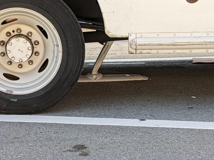
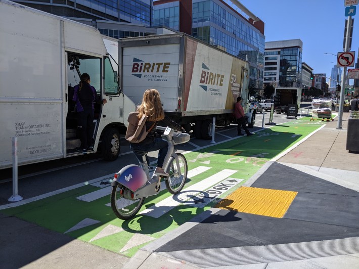
A driver also parked in the area where the sidewalk-level lane transitions to a two-way just south of the bridge. That short section is protected by a curb, but it also has a big opening in it. It's noteworthy that there are giant bollards in the foreground of the photo below, and along the stadium, used to keep drivers (and presumably terrorists?) away from people. But somehow these obvious solutions are ignored by planners for protecting cyclists.
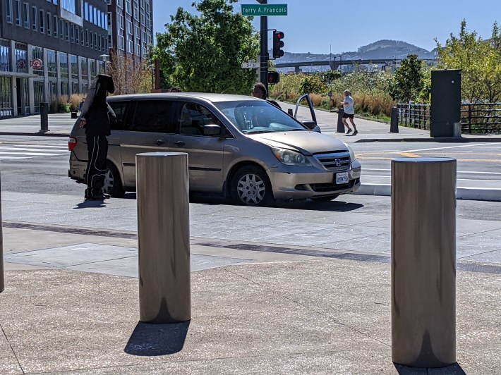
Perhaps the biggest fault, however, is that the two-way, which connects to the Bay Trail to the east, also shoots cyclists heading southbound into the new one-way northbound sidewalk-level bike lane. This resulted in quite a few cyclists heading the wrong way on the sidewalk-level portion, as seen below:
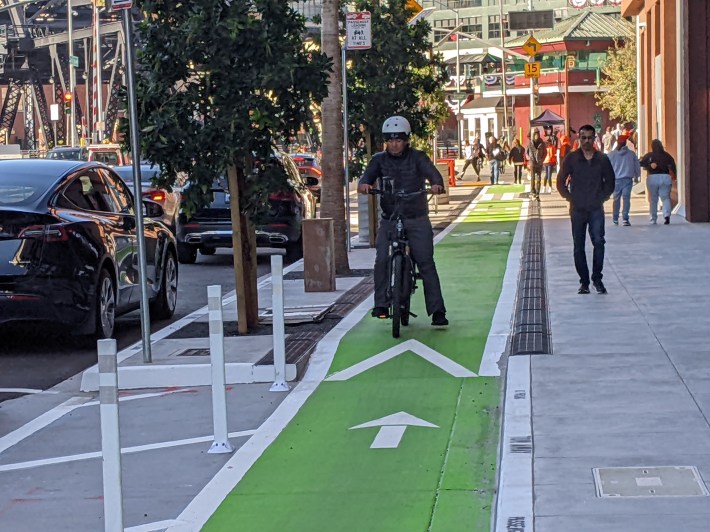
If the description of the layout seems confusing, it's probably because the layout itself is counterintuitive. Roccaforte told Streeetsblog that more paint and signals are planned to help clarify where cyclists are supposed to go. If you've ridden it, please let Streetsblog know your thoughts.
All in all, it's great to have a short section of sidewalk-level lane in San Francisco. It should be the default with all new development. But let's hope future designs are more coherent.
More pictures below.
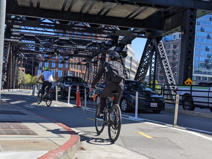
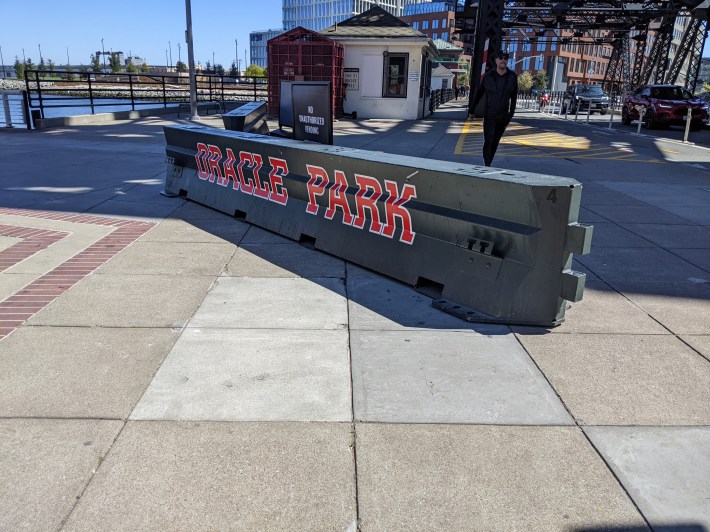
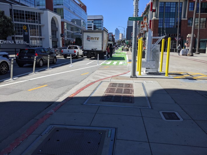
***
Note: Streetsblog welcomes the mildly perturbed email from the city planner of [fill-in-the-blank-city] about the sidewalk-level bike lane we forgot about.
Update, April 9: And sure enough, Bike East Bay's Robert Prinz reminded Streetsblog via email that there are also "sidewalk-level bikeways in the East Bay in Emeryville (Christie Ave), Albany (San Pablo Ave), and Livermore (First St)."
