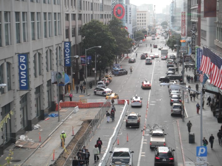
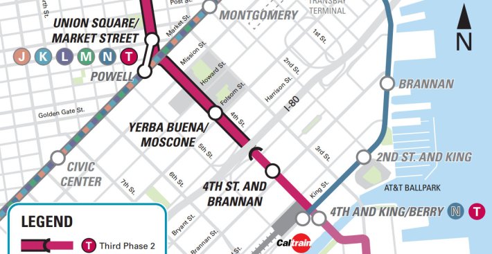
The Central Subway is coming, like it or not, and that means Fourth Street will get Muni Metro service starting in 2019. With that in mind, the SF Planning Department recently released the draft Central SoMa Plan (formerly known as the Central SoMa Plan), which sets the stage for upzoned transit-oriented development near new stations and street improvements to accommodate a growing population in a rapidly changing section of SoMa.
"The idea is to support development here because it's a transit-rich area," said Amnon Ben-Pazi of the Planning Department's City Design Group. "Between BART, Caltrain, and the new light-rail, you have as much city and regional transit as you can get."
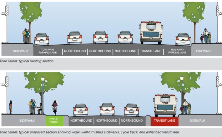
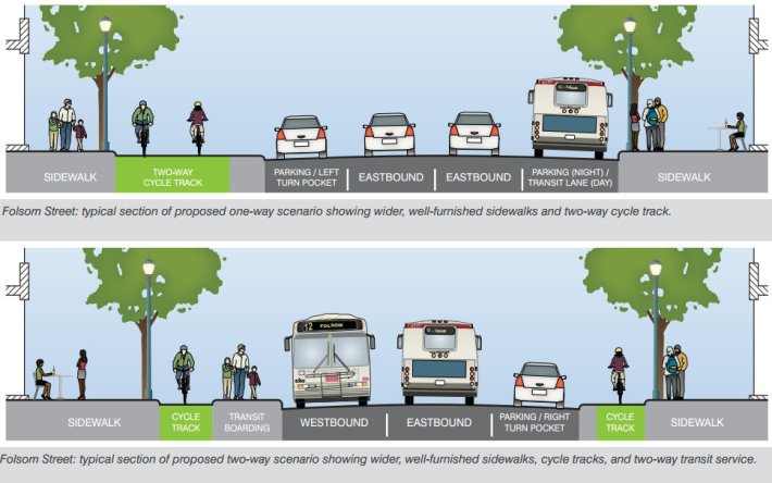
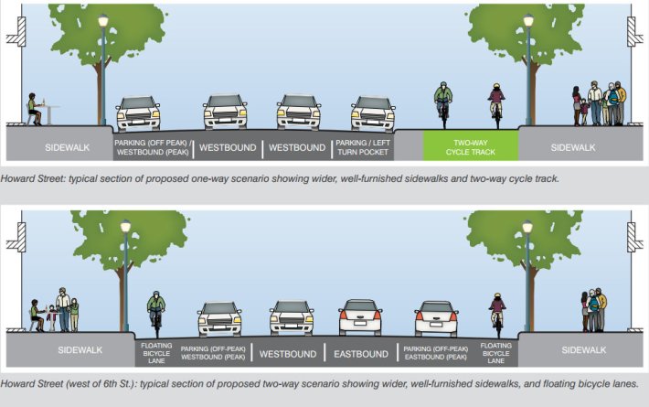
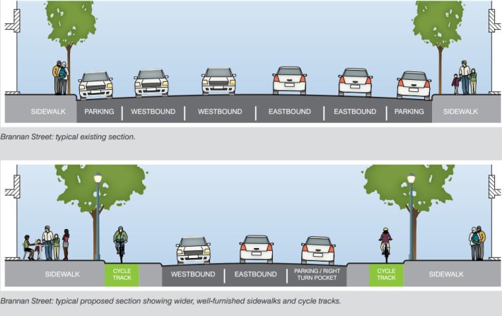
The Central SoMa Plan, which encompasses one section of the broader Eastern Neighborhoods Plan, is aimed at creating a more people-friendly SoMa -- a district which was primarily industrial until recent years. Streets that have served as car traffic funnels since the mid-20th century would be overhauled with improvements like protected bike lanes, new crosswalks, wider sidewalks, transit-only lanes, and two-way traffic conversions.
SoMa's streets "were designed in a really specific way to accommodate large volumes of very fast traffic and trucks," said Ben-Pazi. "While that may have been appropriate when this was an industrial area, it's certainly not appropriate now with what we know about pedestrian safety and how the design of streets really affects the behavior of drivers."
"If we're going to go in the direction of having more people live and work here," he added, "relying on the streets for their everyday circulation, we really need to address what these streets are designed as."
Livable City Executive Director Tom Radulovich said the plan seems to be mostly on the right track, though it should include greater restrictions on new car parking that are more in line with the plan for the adjacent Transbay District adopted last year. "With as much development as is planned, and with a desire to reclaim SoMa's mean, traffic-sewer streets for people and sustainable transportation, the plan has to be truly transit-oriented," he said.
The plan calls for reducing traffic lanes and on-street car parking to make room for improvements to transit, biking, and walking. Ben-Pazi said the environmental review process for all of those projects would be completed as part of the plan, which is currently set to be adopted in late 2014.
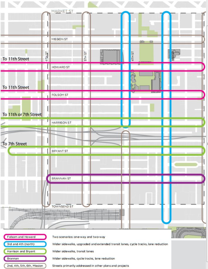
Planners propose installing raised, protected bike lanes on Howard, Folsom, Brannan, Third and Fourth Streets. Howard and Folsom could also be converted to two-way traffic flow, but in that case, Howard would receive part-time, un-protected curbside bike lanes instead. The Fourth Street protected bike lanes, however, would only run between Market and Harrison Streets, Ben-Pazi said, since south of Harrison, the Central Subway would run above ground, with fewer traffic lanes and calmer conditions. The plan says other nearby streets are to be addressed in other projects like the Muni Transit Effectiveness Project and the SF Bike Plan.
"It is good to see plans for pedestrian, cycling, and transit-friendly Folsom and Howard," said Radulovich. "Fixing these streets have been talked about for over a decade, but none of the prior efforts generated an actual project, or completed environmental review."
Transit-only lanes would also be added, extended or "upgraded" on Harrison, Bryant, Third, and Fourth. Third and Fourth would each get a colored transit lane separated from car traffic by a raised barrier on the road.
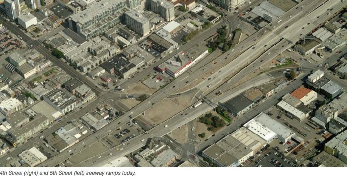
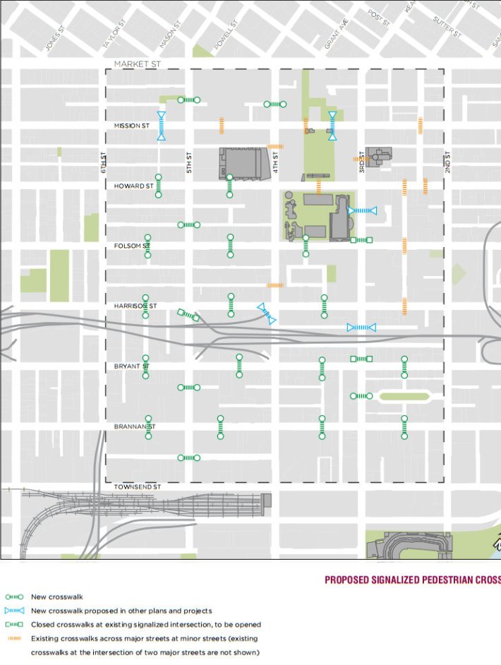
All of the streets named above would get sidewalk widenings under the plan, as well as numerous new mid-block crossings with traffic signals throughout the area. Three closed crosswalks would be re-opened at Third and Byant, Third and Folsom, and at a freeway offramp at Fifth and Harrison.
The ramps that touch down along highway 80, Ben-Pazi noted, make for "horrible intersections," and appear "much more frequently" than today's Caltrans guidelines would allow.
"They're not something that would be built today," he said. "We've learned a lot since."
Though the prospect of removing SoMa freeway ramps is beyond the Central SoMa Plan's scope, Ben-Pazi said it calls on the city to study the issue further.
The Central SoMa Plan also calls for turning several alleyways into pedestrianized public spaces, creating new parks, as well as adding more alleyways required as part of new development.
Ben-Pazi said the Planning Department expects the impact fees from increased development to fund most of the street improvements called for in the plan.
In a blog post, Sarah Karlinsky, deputy director of SPUR, praised the plan overall, but said it should allow for more high-rise office and residential development than is currently proposed. Radulovich, however, doubts the Central Subway will provide enough of an increase in transit service for the level of intensive development SPUR would like to see.
"The name 'Central Subway' invokes high-capacity mass transit, but the reality will be more like N-Judah service -- two-car trains with several miles of on-street operations," said Radulovich. "The planned development in Mission Bay, Pier 70, the Central Waterfront, and the Bayview will make additional demands on Central Subway capacity, and generate additional traffic congestion."
"As the amount of development in the corridor increases, a commensurate increase in transit capacity needs to be planned for – and paid for."
