Advocates and City Luminaries Celebrate Gap Closure on Richmond-Ohlone Greenway
There’s the Richmond Greenway. There’s the Ohlone Greenway in El Cerrito. And then there was the gap between the two.
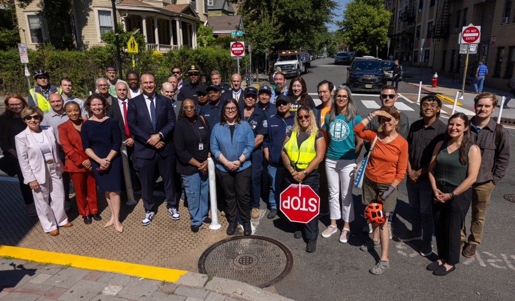
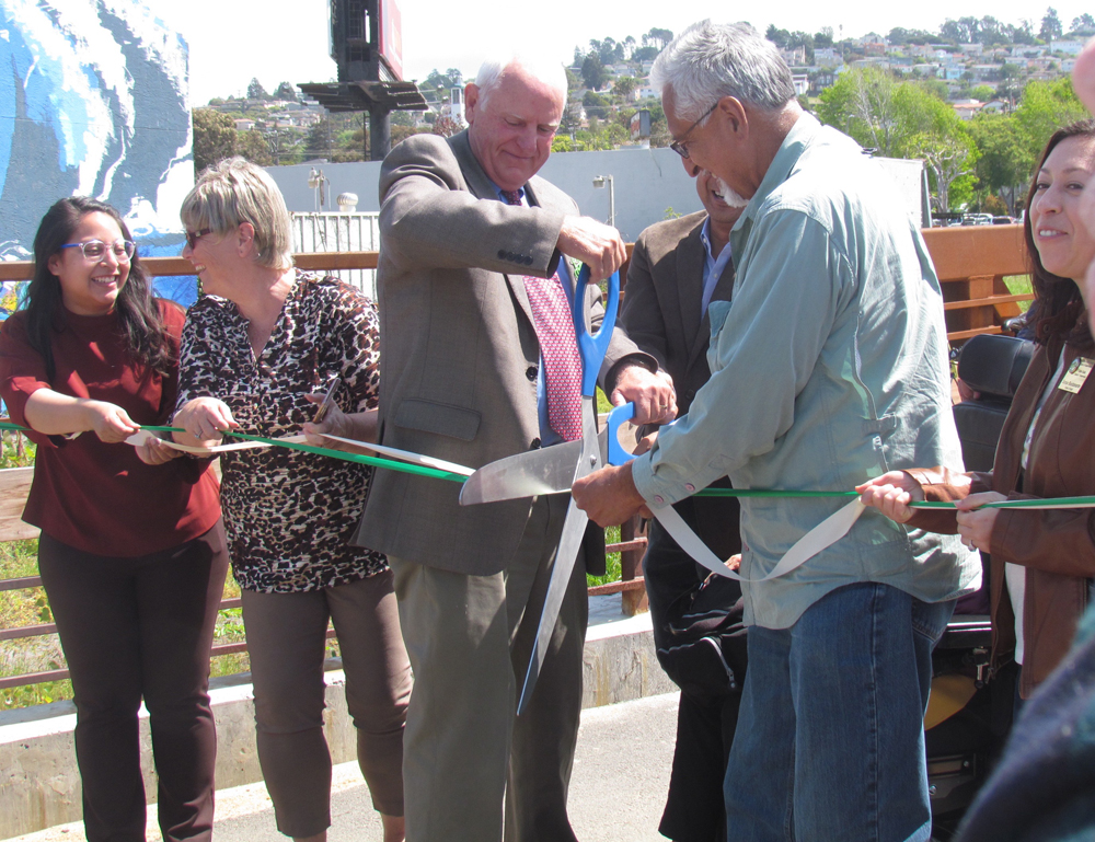
This morning advocates joined city councilmembers, mayors, and local legislative representatives to celebrate the completion of a critical improvement to bicycle and pedestrian connections between Richmond and El Cerrito with the opening of Baxter Creek Gateway Park, which connects the two greenways into one continuous band.
It includes nearly 800 feet of new off-street bike lanes, aka Class I trail, 475 feet of restored creek, a pedestrian/bike bridge, and a signaled pedestrian and bicycle crossing at San Pablo Avenue. The project spans San Pablo Avenue next to the BART track crossing and fixes a missing link in the East Bay’s bicycle and pedestrian network.
More photos of the opening ceremony below.
The project, managed by the City of Richmond Engineering & Capital Improvement Projects Department, was funded in part by Safe Routes to Transit and Urban Greening for Sustainable Communities grants, and Richmond Environmental and Community Investment Agreement funds. It was ten years in the making, and, according to Richmond Mayor Tom Butt, at many points along the way, “They said it couldn’t be done.”
Originally the parcel that includes the bike and pedestrian bridge over the creek was slated for “an ugly block of apartments” with the creek culverted beneath, he said, but the city wanted something better for this connection. The next challenge was building the bike and pedestrian crossing on San Pablo, where there had been nothing before–“The engineers said it can’t be done, can’t be done,” said Butt. Then there was work needed to restore the creek.
“And here we are today,” he said. “The greenway now extends from somewhere on the south side of Berkeley, through Albany, El Cerrito, and Richmond. It connects with the Bay Trail in Point Richmond, and eventually it will connect to the Richmond bridge and into Marin.”
“This will benefit hundreds and hundreds of people,” he said. “It’s a great, great project.”

Streetsblog has migrated to a new comment system. New commenters can register directly in the comments section of any article. Returning commenters: your previous comments and display name have been preserved, but you'll need to reclaim your account by clicking "Forgot your password?" on the sign-in form, entering your email, and following the verification link to set a new password — this is required because passwords could not be carried over during the migration. For questions, contact tips@streetsblog.org.