Tracking Slow Streets in the Bay Area
Note: GJEL Accident Attorneys regularly sponsors coverage on Streetsblog San Francisco and Streetsblog California. Unless noted in the story, GJEL Accident Attorneys is not consulted for the content or editorial direction of the sponsored content.
The San Francisco Bay Area Planning and Urban Research Association, with an assist from Streetsblog, has developed a chart of which Bay Area cities have ‘slow streets’ programs.
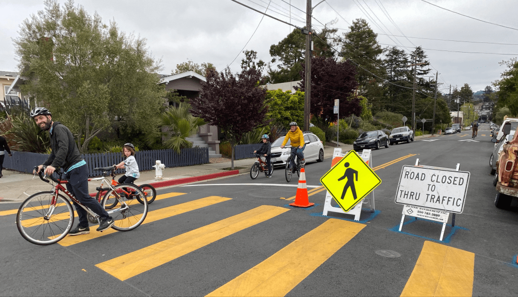
Started by Oakland in early April, the idea of ‘slow streets’ was to identify streets where thru traffic would be banned, limiting speeds so people could use the pavement for exercise during the time of COVID. Cities have generally approached these programs with a fluid, see-what-works approach, such as San Francisco, which dropped Holloway ostensibly because of emergency response time concerns. And Oakland updated its program to include “essential places”–slowing traffic on streets near stores and other essential services to help people stay socially distanced as they get supplies.
The Silicon Valley Bicycle Coalition’s Emma Shlaes told Streetsblog that San Carlos and South San Francisco are considering programs too “but haven’t approved anything yet.”
“We believe it is important to elevate the discussion surrounding what does and does not work about ‘slow streets’ programs–primarily, who benefits from them and who does not. We applaud the City of Oakland for their leadership in establishing an expansive ‘slow streets’ program and in listening, adapting, and implementing more and better policies to meet the diverse needs and wishes of their residents. We urge the rest of the Bay Area to follow their example,” wrote SPUR, in a comment about the chart.
The programs have been moderately to very successful–so much so that the concept has spread throughout the country. Even New York, which originally resisted the idea, now has an ambitious ‘slow streets’ program. The key seems to be maintaining flexibility and responsiveness to the needs of different communities, as Oakland did (as referenced by SPUR) with its ‘essential places’ modification at the request of residents in East Oakland.
If any city is missing, or this list needs updated, please let us know in the comments section below. And share your thoughts on how well ‘slow streets’ programs are working in different cities and neighborhoods.
On a related note, Google Maps has started to include ‘slow streets,’ as seen below:

Streetsblog has migrated to a new comment system. New commenters can register directly in the comments section of any article. Returning commenters: your previous comments and display name have been preserved, but you'll need to reclaim your account by clicking "Forgot your password?" on the sign-in form, entering your email, and following the verification link to set a new password — this is required because passwords could not be carried over during the migration. For questions, contact tips@streetsblog.org.