Oakland’s Saddest Bike Path
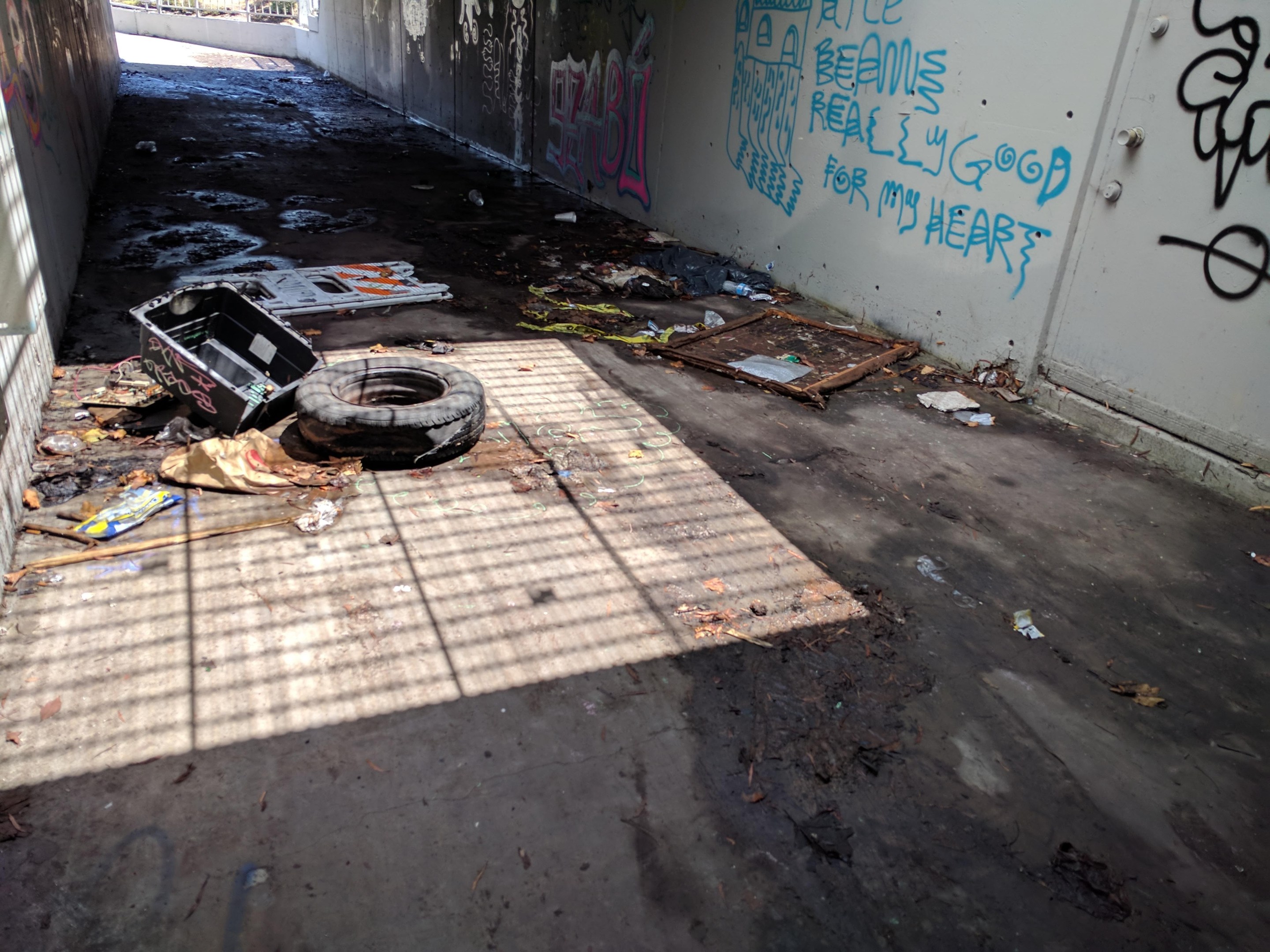
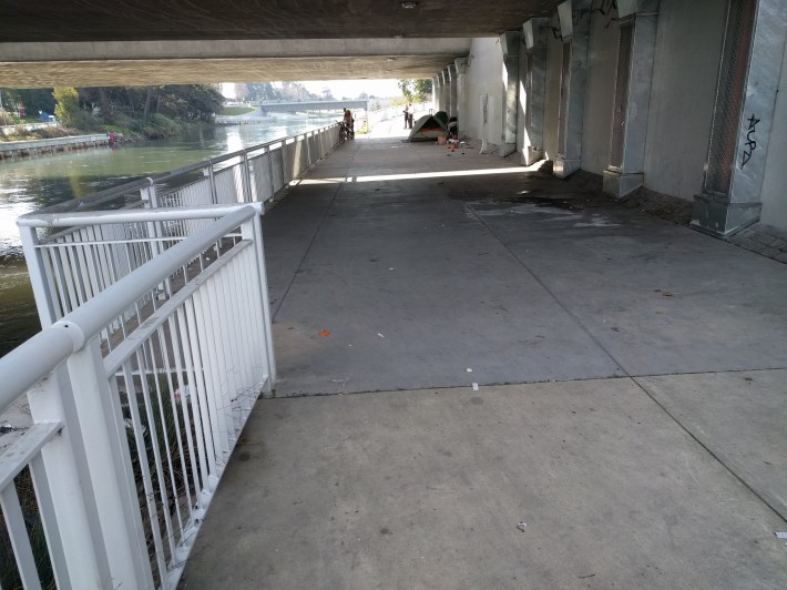
The channel bike path where it goes under 7th Street. All pics Streetsblog/Rudick
Note: GJEL Accident Attorneys regularly sponsors coverage on Streetsblog San Francisco and Streetsblog California. Unless noted in the story, GJEL Accident Attorneys is not consulted for the content or editorial direction of the sponsored content.
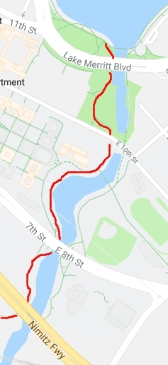
There is a bike and pedestrian path that connects Lake Merritt, the Jewel of Oakland, to 4th Street and Jack London Square. However, the City of Oakland, and the various other agencies responsible for maintaining it, have allowed it to fall into such disrepair that it is not usable.
Bike East Bay's Robert Prinz has been reporting the problem via Oakland's seeclickfix.com website, but to little avail.
From one of his reports:
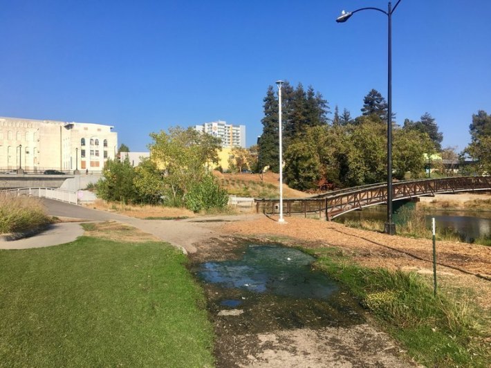
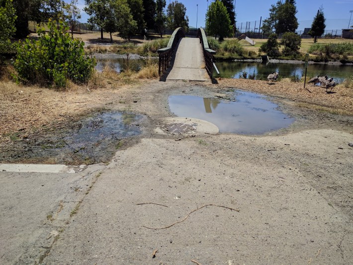
The path along the west side of the Lake Merritt Channel, by Laney College and just south of E 10th Street, has a big chunk of asphalt missing immediately west of the pedestrian bridge over the channel. This hole is constantly full of water for some reason, so it is both dangerous for trail users as well as unsanitary.
I don’t know who is responsible for trail maintenance here, but please follow up with them to ensure this is fixed and no longer a hazard.
Prinz's report is from August. The city has "acknowledged" the issue but nothing has changed. And, as seen in the lead image and the photo below, this isn't the only part of the path that is obstructed and dangerous.
Streetsblog spoke with Ryan Russo, head of Oakland's DOT, about the problem, but because it isn't a street, it doesn't fall under his purview (Streetsblog has emails out to the city and will update accordingly).
Other segments seem to fall under different jurisdictions, although it is unclear who controls what. "There are different agencies responsible for various segments of that path, with the section from 4th past the freeway via Caltrans, the part from there to the 7th Street bridge underpass via City of Oakland, and I think all the rest is via Peralta College," wrote Prinz in an email to Streetsblog.
"...this part of the trail that you're showing is considered a Connector Trail to the Bay Trail and not part of the Bay Trail spine," wrote Lee Huo, Bay Trail Planner, contact for Alameda and Contra Costa counties, in an email to Streetsblog. "Regardless of that fact, the Bay Trail Project is primarily a planning and coordinating organization and the construction, operation, and maintenance is the responsibility of a wide variety of private and public organizations."
Huo suggested contacting Diane Tannenwald with Oakland Public Works. But she also didn't know who was responsible for maintaining the path: "...there are a multitude of agencies that hold title to the properties in that area and a number of agreements that may/may not address maintenance," she wrote in an email to Streetsblog.
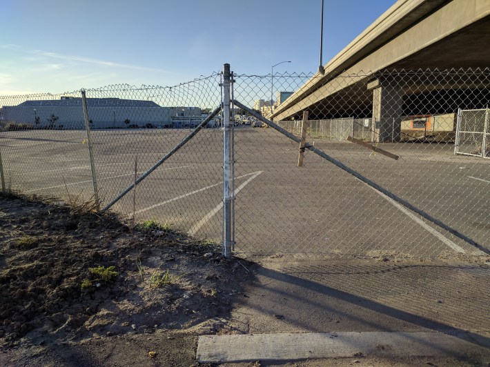
Most of the trail also has no lighting, so even if a cyclist wanted to wear rubber boots and carry a bike over the bad parts, it remains too dangerous to use at night. The portion under the Nimitz Freeway, which connects with 4th Street in Jack London, is especially frustrating. It is in decent physical shape but follows an inexplicably looping path around a big parking lot. This portion is like riding down the Death Star trench, since it is enclosed by giant fences for some mysterious reason. A cyclist is trapped in there until they are disgorged into an encampment where it meets 4th. There used to be a gap/cut through in the fence, but at some point it was closed off, preventing cyclists from taking a shortcut across the parking lot to 4th street (yes, Streetsblog has an email out to Caltrans too).

"Overall, the Bay Trail is mostly owned by governmental agencies such as cities, park districts, counties and such. In some cases, private landowners have been required to offer easements for the trail but they keep title to the land," explained Randy Rentschler, Director of Legislation and Public Affairs for the Metropolitan Transportation Commission.
This situation points to a systemic problem: planning and "coordinating" has to include designating how the infrastructure will be maintained and used long term. If planners simply design something and then walk away without also figuring out how things will be maintained in practice and how they can be accessed by the public from residential neighborhoods, what's the point?
There are some portions of the path in better shape, but they're not very useful given all the bad segments in between. There is also no obvious wayfinding to tell riders how to find and use this path, but--given the shape it's in--maybe that's a good thing. All of which is a terrible shame--a path connecting the lake to the thousands of residents in Jack London, running along a pretty waterway, and fully separated from cars should be one of the best bits of bike infrastructure in the Bay Area.
Prinz, meanwhile, hopes the channel path will get fixed when the "Lake Merritt to Bay Trail Bridge construction moves forward, which will be a while." On the other hand, if nobody is held accountable for maintaining it, Oakland may just get an even longer path full of cracks, holes, and garbage that nobody can use.
Stay in touch
Sign up for our free newsletter
More from Streetsblog San Francisco

Valencia Merchants to SFMTA: We Want Curbside Protected Bike Lanes
Valencia merchants association strengthens support for getting rid of the failed center-running bike lane and replacing it as soon as possible with curbside protected lanes
S.F. Fire Apologizes for Tweeting About Imaginary Bike Rule
There is no rule in California that says cyclists have to ride single file