Op-Ed: New Streets of Mission Bay/Dogpatch Treat Vulnerable Road Users Like S#!*
Streetsblog celebrated the Terry Francois protected bike lane through Mission Bay to Dogpatch back in 2019 as it was nearing completion. However, it turns out that was the exception: the badly designed, neglected bike and pedestrian infrastructure in San Francisco’s newest, growing neighborhood has consistently been blocked, neglected, and degraded. Guest author and San Francisco commuter Greg Rozmarynowycz emailed his thoughts and frustrations with subpar designs and implementations that continue to prioritize cars.
A recent tweet from SFMTA Director Jeff Tumlin celebrated progress on “quick build” protected bikeways in SoMa, and asked where to focus next. While the SFMTA’s efforts to quickly retrofit heavily used streets have proven largely effective, they stand against the colossal planning failure slowly unfolding a short hop over Mission Creek Channel in the shiny new Mission Bay & Dogpatch districts.
Some successes can be claimed with quick build projects at the margins (like the 3rd street bridge cycletrack) and the 2019 opening of the mostly post/parking protected cycletrack on Terry Francois Boulevard. However, a recent journey down the primary north-south bike route shows neglect, missed opportunities, and a planning process focused on cars and apathetic to micromobility. Many streets have been entirely re-aligned or rebuilt from the ground up, resulting in a grid with essentially zero miles of AAA (all ages and abilities) bike facilities, middling pedestrian facilities, and a fundamentally broken micromobility network.
Starting at the 3rd street bridge, and heading south along the temporary shared path, the first detail of note is how absurdly inefficient the bike route is in sum. It jogs back and forth in opposing directions multiple times on the journey south.
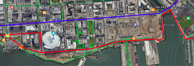
Arriving at the north end of Terry Francois Blvd, the cones, barriers, and paint marking the temporary cycletrack are so jumbled and worn away, it’s barely discernible at some points. Further south, the protective posts near Warriors Way have been ripped out and strewn in a pile since at least June. A southbound rider is basically dumped directly into opposing traffic without even paint to indicate movements.
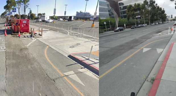
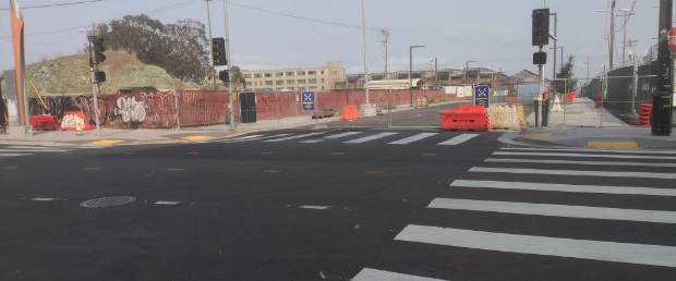
This street section adjacent to the Chase Center still lacks eastern sidewalks after two years, so pedestrians frequently walk in the cycletrack/gutter for a few blocks. As the sidewalk picks back up at 16th Street, bicyclists are greeted with a long-standing detour, routing around a closure near the end of the cycletrack, where drivers enjoy five (fully underutilized) lanes and pedestrians are shoved behind a plastic fence. The detour features a series of awkward turns down 16th St and Illinois, which in 2021, includes sharrows with no traffic calming.
Continuing down Illinois Street, the fun really starts. There are basically no traffic calming features the entire length of the street, despite new residences and the City’s celebrated Crane Cove Park. Active transportation access to this park is dubious at best, with inconsistent crosswalks, no corner bulbs outs, and sometimes no sidewalks, including directly adjacent to a massive new surface parking lot at 19th Street.
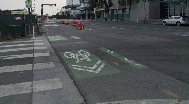
Aside from a small stretch of recently post-protected bike lanes between 18th and 19th, vast stretches of the rebuilt street feature door-zone bike gutters and/or back-in angle parking. The existing calming effect of frequent stop signs is being replaced by new traffic lights at nearly every intersection.
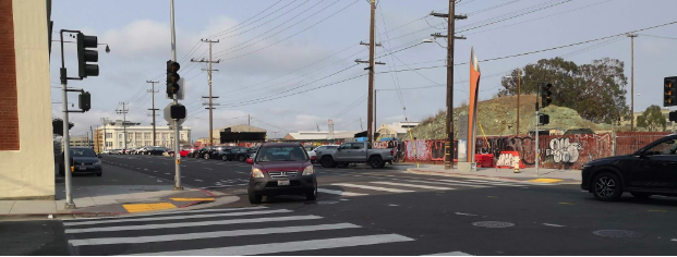
While some blocks are a couple years old, the madness continues to this day. As of writing, the City is about to take wraps off of a ground-up rebuild of 22nd street, which manifests basically no traffic calming of any kind, and ample room for drivers to speed and park.
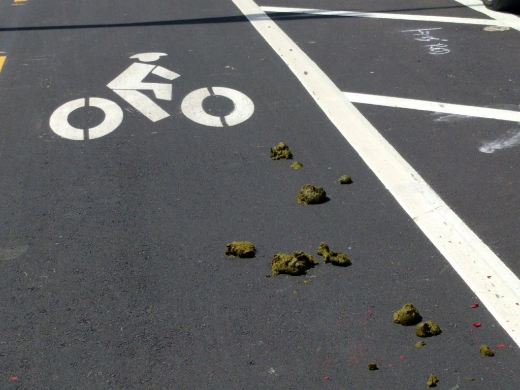
It would have been so easy to build separated bike paths throughout the two neighborhoods. Instead, the city has flushed a once-in-a-generation opportunity. Once again, San Francisco has relegated people outside cars to the margins by building suburban-style stroads. Officials will now celebrate slapping some paint and plastic sticks down in the next few years, but it’ll be icing on top of a stinky, poop-cake of transportation dysfunction.
***
Greg Rozmarynowycz is a software developer and sustainability & active transportation advocate living in Emeryville’s Triangle neighborhood. He’s a transit nerd, backpacker, home chef, and Midwest transplant living car-free since 2018. He cycles regularly through Mission Bay/Dogpatch for work and to go to his favorite climbing gym. His Twitter handle is @grzomarynowycz
Streetsblog has migrated to a new comment system. New commenters can register directly in the comments section of any article. Returning commenters: your previous comments and display name have been preserved, but you'll need to reclaim your account by clicking "Forgot your password?" on the sign-in form, entering your email, and following the verification link to set a new password — this is required because passwords could not be carried over during the migration. For questions, contact tips@streetsblog.org.