RSR Bridge Pilot Coming to an End – What’s Next?
Note: GJEL Accident Attorneys regularly sponsors coverage on Streetsblog San Francisco and Streetsblog California. Unless noted in the story, GJEL Accident Attorneys is not consulted for the content or editorial direction of the sponsored content.
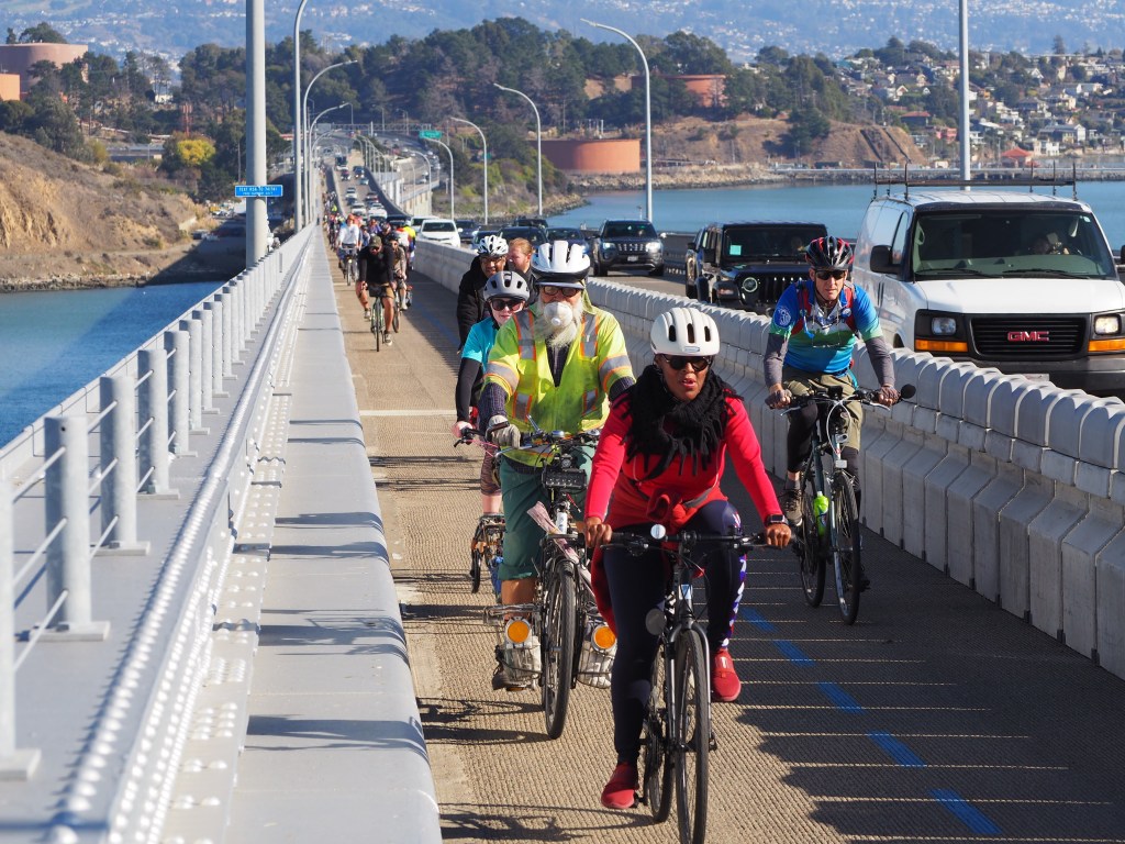
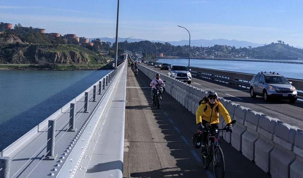
Nearly four years ago, after decades of advocacy from activists on both sides of the Bay, the bike path on the Richmond-San Rafael Bridge opened to great fanfare. Since then, there have been over 300,000 crossings by bike or on foot.
But the pathway’s continued existence is not assured. There has been pressure from lawmakers and business groups to turn the path on the upper deck into another car lane. People want to know, “What is happening with the bike path?” We’re here to answer your questions.
What’s with the internet ads and local news pieces about the RSR bridge?
The Bay Area Council, a regional business group with roles in the creation of BART and the Bay Conservation and Development Commission, has taken it upon itself to advocate for a third westbound traffic lane on the bridge. In service of this, they have created a front group called the “Commonsense Transportation Coalition” which sent mailers to residents of Richmond and paid for ads on Facebook and YouTube. Their website makes several inaccurate statements about the pathway, including a misleading claim that “The third lane of the westbound deck of the Richmond-San Rafael Bridge was closed to cars to provide for a pedestrian and bike lane along the bridge.” Before it became home to the bike path, the “third lane” on the upper deck had been a shoulder/breakdown area since the 1970s and not a travel lane.
Their campaign launched in 2021 and initially advocated closing off bike/pedestrian access until 11 a.m. every weekday. To their credit, they have since moderated this position by suggesting that a second moveable barrier be added to the bottom deck to maintain bike access. This option has its problems, which we will discuss below.
Why shouldn’t we add the third lane? Aren’t people stuck in traffic?
Morning traffic headed from Richmond to Marin is bad. There’s no doubt about that. The question is, “Would a third lane fix it?” The answer is complicated.
Importantly, simply moving the barrier over to make a third lane on the bridge wouldn’t solve anything, because there are only two “receiving lanes” on I-580 near San Quentin, meaning the traffic jam would just move from the approach to the bridge to the bridge itself. A 2021 study from the Transportation Authority of Marin (TAM) found that to see some congestion reduction benefits, I-580 would have to be widened, costing $70-90M. The Bay Area Council is pushing for this project. But while that would shorten trips for travelers headed north on US-101, these changes would increase commute times for those headed south on US-101 toward Larkspur, Corte Madera, or Mill Valley. To reduce congestion in both directions, an additional quarter billion dollars would be needed for a new freeway ramp.
But would that solve congestion forever? Likely not, as decades of freeway widening across California and the US have proven. When we widen highways, the congestion relief persists for only a short period before returning. This is because people change their behavior in response to changed conditions. Commuters who once drove to work early to beat traffic start coming to the office later. Folks who might have passed up a job in Marin decide to take it instead. Families choose a hike on Mount Tam instead of Mount Diablo. This phenomenon is called “induced travel” and it’s why the five-year, $1B project to widen I-405 in Los Angeles saw traffic return worse than before within just a few years.
Lastly, we don’t even know if adding 50% more cars to the upper deck (much less another four-mile concrete barrier on the lower deck) is feasible from a structural standpoint. With larger trucks and SUVs more prevalent on our roadways, and EV batteries adding additional weight, a 6-lane bridge would be under more stress than ever before. None of the recent reports evaluated the degree of strengthening to the bridge that a third lane would require, but we understand that Caltrans is evaluating that now.
What about the air quality in richmond? Is the bike lane causing the pollution?
This summer saw a wave of local news reports claiming that the bike path was causing pollution in Richmond. The Bay Area Council claims that “Traffic congestion caused by backup on the Richmond-San Rafael bridge is now the number one source (emphasis ours) of non-wildfire air pollution in the City of Richmond,” clearly implying that adding a third westbound lane would change that.
This claim surprised us. Could the bike path be causing all that pollution, even though bikes do not have tailpipes? We dug into it, asking the Bay Area Council for their source. They pointed us to this report. We reached out to the report’s authors and asked them if the BAC’s claim was supported by their study. They told us, in a word, “no.”
We want to be clear that poor air quality is a huge issue in Richmond, due to both the presence of the Chevron refinery and multiple freeways, findings that were made in the report linked above. Residents of Richmond suffer higher rates of asthma, heart disease, and low birth weight than state averages due to poor air quality. The solution to harmful emissions from a freeway isn’t “more cars,” which a third lane would inevitably lead to. The report authors lay out several air quality mitigation measures including electrifying truck fleets, increasing transit service, and planting trees. Notably absent from their list of mitigations is adding a third lane on the bridge.
What do the data show?
In the summer of 2022, Caltrans published an interim report on the bike path pilot (which you can read here). After the installation of the bike path, vehicle flow on the bridge decreased slightly during the peak period. Likely due to the shorter merge following the toll plaza, about 2.5 cars/minute, fewer can use the bridge.
Additionally, maximum speeds on the bridge are slightly lower than before, possibly due to the visual effect of a narrower driving space. As an unintended benefit of this, severe injury collisions are down significantly on the upper deck at a time when such severe collisions increased on the three-lane lower deck.
On the question of delay, Caltrans found that “Travel times to access the bridge from I-80 remain close to historical averages on weekdays, Saturdays, and Sundays,” and that reduced speeds on the bridge have only increased travel times “by less than one minute” compared to before the path’s installation.
This report used data through July 2022. A final report will be released in the summer of 2024 and will update these findings. MCBC will review in depth and report on it.
Will the bike connections on the Marin side ever get better?
One of MCBC’s biggest frustrations is the lackluster effort to provide ‘all ages and abilities’ access to the Richmond-San Rafael Bridge path from Marin. While Richmond has done a truly remarkable job of providing protected bikeway approaches, Marin has not done its part. Users are left deciding between a dangerous ride on East Sir Francis Drake past San Quentin or vying with heavy truck traffic on Andersen Drive. A project to complete the pathway on Francisco Boulevard East that received funding in 2021 still hasn’t even broken ground!
We believe that this poor infrastructure limits the use of the bridge path. We know that most people will only choose to ride bicycles for transportation if they feel safe from motor vehicle traffic. The current unconnected state of the bridge works only for strong and fearless riders but utterly fails anyone without tolerance for risk.
Happily, there are projects in the works. The half-mile gap in the Francisco Boulevard East is supposed to be fixed starting this year. And a plan to extend the Bay Trail past San Quentin to the intersection of East Sir Francis Drake and Andersen Drive is in the early stages.
If not a third lane, then what?
Advocates for another lane on the bridge propose spending a huge amount of money on it, between $100,000,000 up to a third of a billion dollars! What, we wonder, could be done with that money instead of another lane that will inevitably fill up. This could warrant its own blog post, but some ideas are:
- More frequent transit
- E-bike subsidies
- E-bikeshare on both sides of the the bridge, allowing multimodal commutes
- Peak-hour tolling/congestion pricing, to smooth out demand
Fundamentally, though this is not something that can be fixed quickly, the commute problem is a housing problem. A generation ago, just over half of Marin’s workforce lived outside of the county. Today that share is two-thirds. Many service sector, healthcare, and school employees simply cannot afford to live in Marin, and instead must endure long trips to work. If we truly care about the people forced to make 30-mile commutes to their jobs in Marin, the best thing we could do is offer them a home 5 miles from work.
What happens next?
November 2023 represents the fourth anniversary of the path opening and the official completion of the pilot period. That doesn’t mean the path goes away! There will be a presentation to the Bay Area Toll Authority (BATA) on Wednesday, November 8th, to update them on the preliminary results. Following that, Caltrans will complete its full evaluation report, due in June/July 2024, which will be followed by another meeting of BATA in the fall of 2024. At that point, a decision will be made about the future of the pathway.
Who decides?
This is a tricky question to answer, and one we’ve asked many times. The best answer we have gotten is that it will be a “joint decision” between Caltrans and the Metropolitan Transportation Commission (MTC). While Caltrans is somewhat of a black box, MTC is governed by a board of elected and appointed officials who can be lobbied, something we plan to do.
Why are we optimistic?
The state policy landscape has changed in the last few years. Importantly, a project to add a third car lane that would increase the total amount of driving (known as ‘vehicle miles traveled,’ or VMT) is now considered to have an impact on the environment under CEQA, the California Environmental Quality Act. Such impacts would have to be mitigated. This required mitigation will either make the third lane project less likely to move forward. Or it could at least ensure that bike/pedestrian access is maintained through a barrier on the lower deck.
Our commitment
Know that the Marin County Bicycle Coalition (MCBC) will work hard to ensure that 24/7 access on the bridge continues for people walking and biking. We realize that the corridor is a challenge. There are no simple solutions. But our publicly-funded bridges simply should not require an automobile to cross. Walking and biking are viable and important modes of transportation and should be treated as such.
Important dates
Here are a few dates (some exact, others rough) that you can put on your calendar.
- Wednesday, 11/8/2023 @ 9:30 a.m. – Bay Area Toll Authority Oversight Committee (link here)
- Saturday, 11/11/2023 @ 11:00 AM – 4th Anniversary Ride of the Bridge (link here)
- June/July 2024 – Caltrans releases final study of pathway pilot
- Fall 2024 – Bay Area Toll Authority Oversight final update
What can you do?
There aren’t any immediate opportunities for advocacy, but we will need your help when the time comes. To get our advocacy alerts on Richmond San Rafael Bridge, click here to request to join our Google Group, or join our Discord server by clicking here. The November 8th, 2023 meeting (linked above) will be an important time for people to demonstrate support for the pathway. The final decision will most likely happen in 2024, so be ready when we ask for help. Unfortunately, the final decision will ultimately be a political one. There are powerful players who do not see the pathway as an important part of our transportation system, and the only way we keep it is by outnumbering them.
***
Warren Wells is Policy and Planning Director with the Marin County Bicycle Coalition. This post originally appeared on its blog and is republished here with permission.
Streetsblog has migrated to a new comment system. New commenters can register directly in the comments section of any article. Returning commenters: your previous comments and display name have been preserved, but you'll need to reclaim your account by clicking "Forgot your password?" on the sign-in form, entering your email, and following the verification link to set a new password — this is required because passwords could not be carried over during the migration. For questions, contact tips@streetsblog.org.