Lake Merced Quick-Build Safety Project has some Good Sections, but Fails at Intersections
Note: GJEL Accident Attorneys regularly sponsors coverage on Streetsblog San Francisco and Streetsblog California. Unless noted in the story, GJEL Accident Attorneys is not consulted for the content or editorial direction of the sponsored content.
Construction is well underway on SFMTA’s Lake Merced quick-build project, an attempt to make it safer to bike along what amounts to a four-lane, surface-level freeway cutting off one of San Francisco’s prettiest spots from the rest of the city.
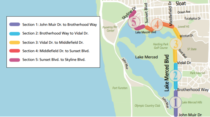
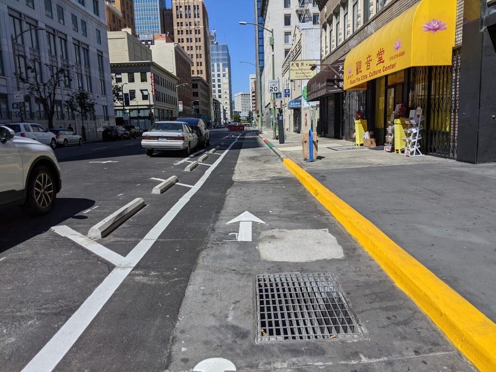
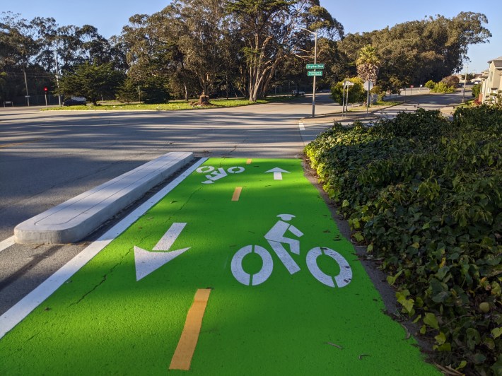
The good news: finally, SFMTA is using concrete in a major quick build. There are some very nice sections, such as this stretch by SF State (#3 in the map above):
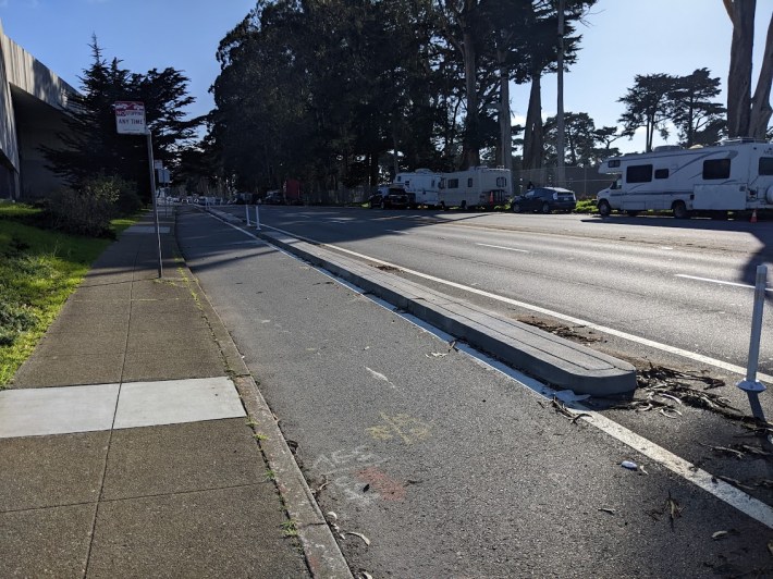
Unfortunately, as nice as it is to see concrete, the design falls apart at intersections. More on that in a few paragraphs.
Each section seems to be designed by a different team that wasn’t communicating with the others (or didn’t think it important to keep the designs consistent). Some of the sections are just a sharrow on Lakeshore Drive, the neighborhood-access frontage road.
Some sections are protected bike lanes on both sides. In other parts, cyclists are supposed to leave the bike lane and ride on the existing mixed-use path. And, on a good portion, it is a two-way protected bike lane on one side of the street — but on the far side from the lake.
The result is a hodgepodge of bike lanes that are safer than what was there before, but the overall design is confusing to bicyclists and motorists, especially at the intersections. Since work continues, some of this will get resolved, but as the Tweet and embedded video below from advocate “AgentAkit” shows:
“There is an issue with the bike lane being used as a turn pocket,” wrote SFMTA’s Michael Roccaforte, in an email to Streetsblog. “A transit boarding island will soon be constructed in this location which will prevent this from happening. The transit boarding islands are being built as soon as the concrete buffers for the bike lane are complete – and of the six transit boarding islands being built, we plan on prioritizing the island at State Drive so that it is built first.”
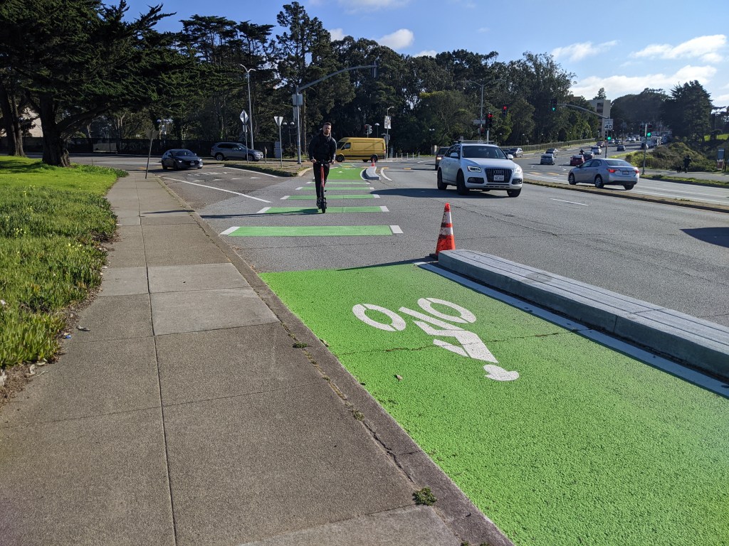
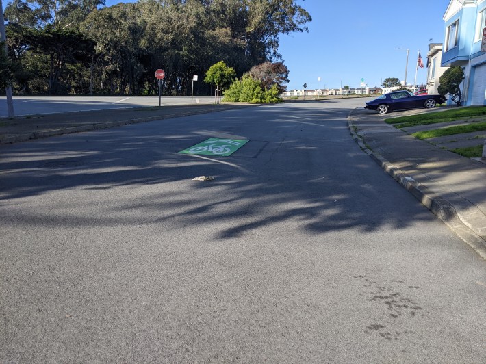
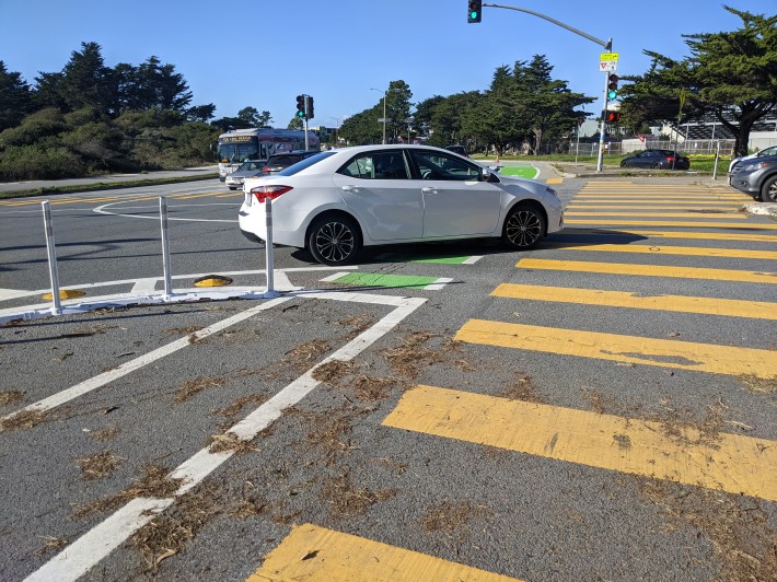
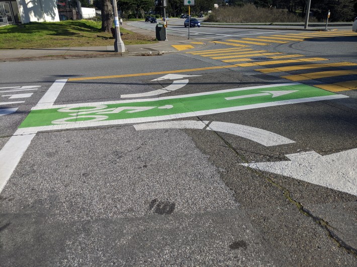
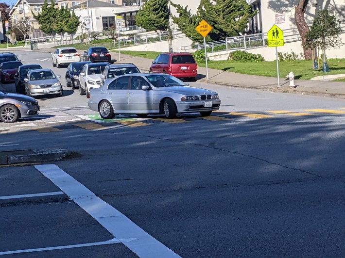
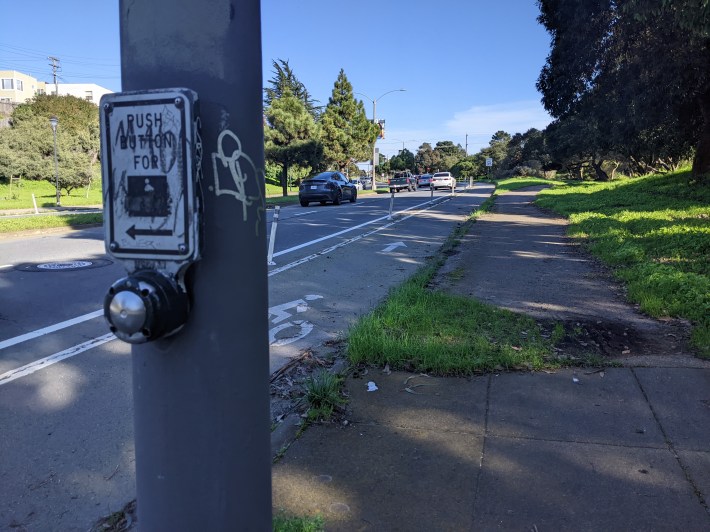
That’s good to know, but it’s a Dutch design principle that a length of bike lane is only as safe as its most dangerous section. And the intersections on SFMTA’s Lake Merced quick-build safety project so far are pretty bad. First of all, Lake Merced Boulevard, at least as currently configured, is four lanes wide; as Walk San Francisco discovered in a speed audit, 50 mph is common. And there are many deadly slip turns (see lead image and image below).
The only way to make the intersections safe is to close the slip turns, not figure out how to get cyclists across them, hoping that oblivious drivers notice the shark teeth and other yield markings and stop in time. Note the “yield” sign below, begging drivers to do what they’re supposed to do anyway — yield to cyclists and pedestrians in bike lanes and crosswalks.

“The SFMTA closed a slip lane from northbound Lake Merced Boulevard onto eastbound Brotherhood Way,” wrote Roccaforte. “At this location, the slip lane closure didn’t require rebuilding intersection to accommodate the turn needed for larger trucks and the 58 Muni line and was cleared by SFFD.”
That still leaves the many other slip lanes. Roccaforte explained that the ones at “… Font and Winston were more difficult to close without rebuilding the intersection and/or needing to signalize the right turn given geometries and frequency of transit. The slip lane from westbound Brotherhood Way to northbound Lake Merced Drive will be reconfigured and signalized as part of the Parkmerced project. Essentially, we closed and/or added traffic calming treatments to slip lanes where we could within the scope of a quick-build.”
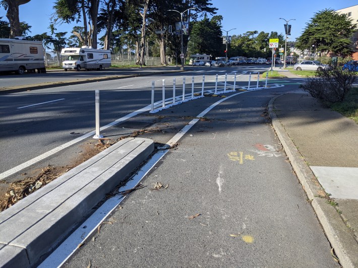
And while the long curb-protected segments are a welcome addition in this quick-build, given the width and speeds on Lake Merced Boulevard, this is a situation where Jersey barriers are more appropriate. But even those curbs drop out at intersection approaches, where they are most important to divert motorists who are trying to take a turn too fast. Instead, they shifted to the usual plastic posts that ask, instead of force, drivers to slow down.
Roccaforte explained that SFMTA will evaluate how the plastic and curbs are doing and re-evaluate. As to the decision not to use more robust concrete treatments in the first place (such as Jersey barriers) the explanation will be familiar to Streetsblog readers: “The community felt strongly that the corridor should aim to have a boulevard like feel and did not want to see K-Rail installed here.” The fire department, apparently, also wanted smaller curbs.
Community input is important, but only if the community has been educated as to the safety differences between the different options. Everyone wants the streets nearest to them to be safe and pleasant places to walk, to have a “boulevard like feel.” But how many people would prioritize that over people’s actual lives?
Furthermore, everything about the slip-turn intersection design, except the signs and paint, dictates that cyclists are supposed to yield to motorists, not the other way around. Notice in the lead image too how the slip turn is there to promote maximum speeds and car throughput (much like a freeway on-ramp) with a gradual turn and nothing to really force motorists to slow down.
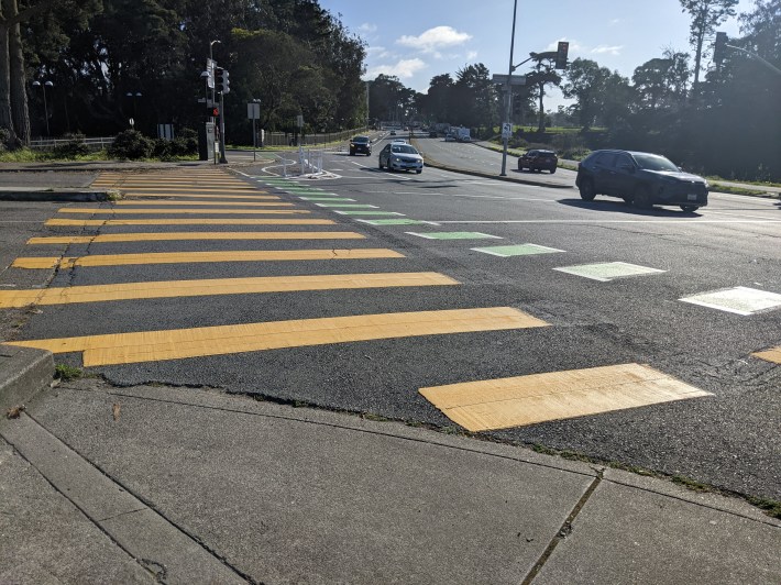
There are other aspects that just don’t pass muster. Take the intersection design at Middlefield Drive and Lake Merced Boulevard below, wedging cyclists between lanes of car traffic:
SFMTA is supposed to be building for “all ages and abilities.” Now imagine a child trying to go to the lake with a dump truck on one side of that bike lane and a big SUV on the other.
Another principle of Dutch design is to keep facilities consistent and intuitive. That’s not going to work with all these different styles of facility, including sharrows, mixed-use segments, one-way protected segments, slip turns, unprotected intersections, and bi-directional segments. Bidirectional bike lanes aren’t generally ideal because of the intersection dangers, but in this case, with the lake on one side, the obvious implementation was to put a bidirectional bike lane, protected by either a large median or a Jersey barrier, hugging the side of the lake. That’s what OakDOT did and plans to do more of around Lake Merritt. It’s what SFMTA did on the Embarcadero.
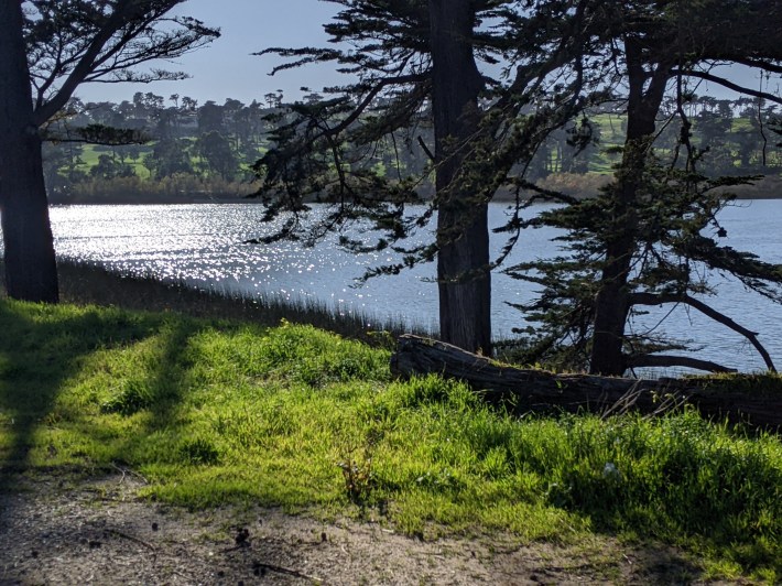
Besides being safer (by minimizing conflict areas with motorists because there aren’t any intersections) most cyclists would just rather ride along this:
Than this:
Apparently some of this comes down to coordination issues with Rec and Park. “There will be a southbound protected one-way bike lane (lakeside) in the future between Skyline and Sunset,” explained Roccaforte. However, “The SFMTA has held off on installation while Rec and Park undertakes a path widening project in this location. They will need the curbside area for construction staging and would damage the concrete buffers if we constructed this segment now.” One can hope that a sufficiently widened path can also accommodate and demarcate space for bikes.
But then what’s the point in the on-street facilities?
Wouldn’t it make more sense to work with Rec and Park and make a massively improved off-street path that’s wide enough to accommodate pedestrians and a separated, two-way cycle path? But of course that probably wouldn’t be a “quick” build.
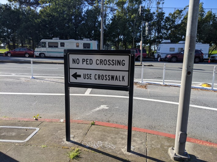
It’s also really disappointing to still see signs such as these (see image below) around such a jewel of San Francisco as Lake Merced. Surely, a higher priority should be put on providing safe pedestrian crossings — nothing tells pedestrians they’re unwelcome more than these signs:
Lastly, it’s outside of the project scope, but Streetsblog can only hope improvements to Brotherhood Way and other streets will make it less precarious to ride a bike to and from Lake Merced.
“Parkmerced will build a pathway on the northside of Brotherhood as a future phase of their work,” wrote Roccaforte. “[SFMTA’s] Livable Streets is currently working on the Sloat Quick Build, which will continue improvements/connections to Lake Merced Blvd. The SFMTA is also coordinating with upcoming developments like Stonestown and Parkmerced to make sure active transportation connections are a key part of the scope.”
Streetsblog just hopes the quality and safety of these paths won’t also be put to a community vote.

Streetsblog has migrated to a new comment system. New commenters can register directly in the comments section of any article. Returning commenters: your previous comments and display name have been preserved, but you'll need to reclaim your account by clicking "Forgot your password?" on the sign-in form, entering your email, and following the verification link to set a new password — this is required because passwords could not be carried over during the migration. For questions, contact tips@streetsblog.org.