Note: GJEL Accident Attorneys regularly sponsors coverage on Streetsblog San Francisco and Streetsblog California. Unless noted in the story, GJEL Accident Attorneys is not consulted for the content or editorial direction of the sponsored content.
A 21-year-old man was hit and critically injured by a motorist, reportedly driving a red Prius, at 19th Avenue and Junipero Serra Boulevard at around 3:15 a.m. Sunday. Early reports said the victim died from his injuries, but a spokesperson for the San Francisco Police Deparment, Michael Andraychak, said that was innacurate. "I spoke with investigators earlier this morning and the Ped is alive and still hospitalized," he told Streetsblog in an email sent this morning.
If the man dies from his injuries, he will be the first pedestrian fatality of 2020.
“Our thoughts are with this young man and his family,” said Jodie Medeiros, executive director of Walk San Francisco. "Walk San Francisco and the San Francisco Bay Area Families for Safe Streets stand at the ready to support the man and his family however possible."
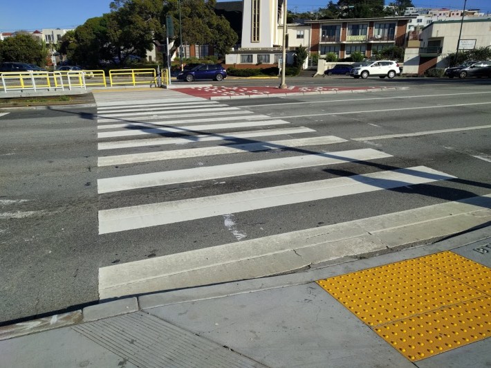
The intersection in question is part of State Highway 1, and, as such, is under the control of Caltrans. "The intersection where he was hit is notoriously dangerous with fast-moving traffic,” said Medeiros. “It’s right in the middle of where a 65-mph highway transitions into a neighborhood street, with thousands of students attending San Francisco State University.”
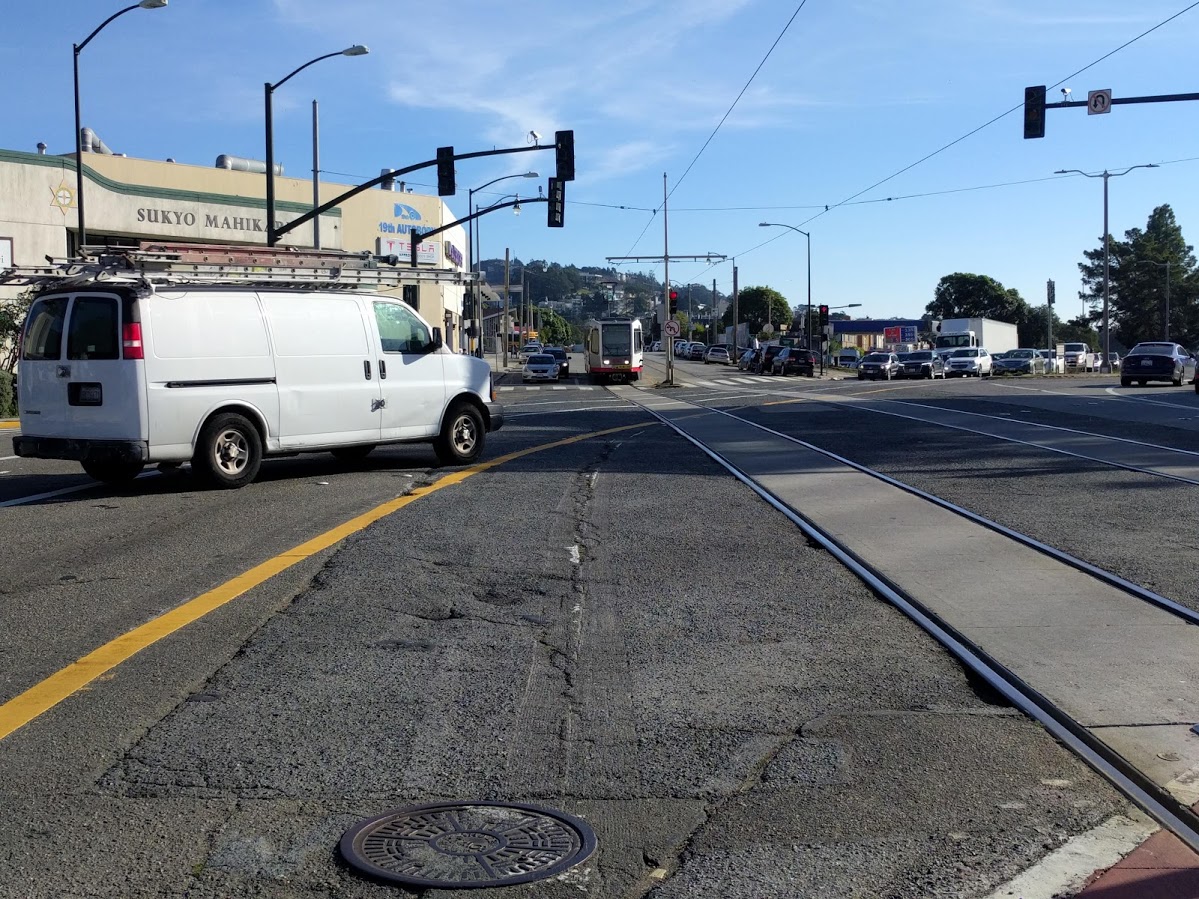
The specifics of the crash are sketchy and Andraychak said an investigation is underway. "We’re not 100 percent sure of where the collision took place, based on preliminary information, but we believe that it occurred somewhere between the Gas & Shop gas station and Parkmerced," wrote Erica Kato, a spokesperson for SFMTA, in an email to Streetsblog.
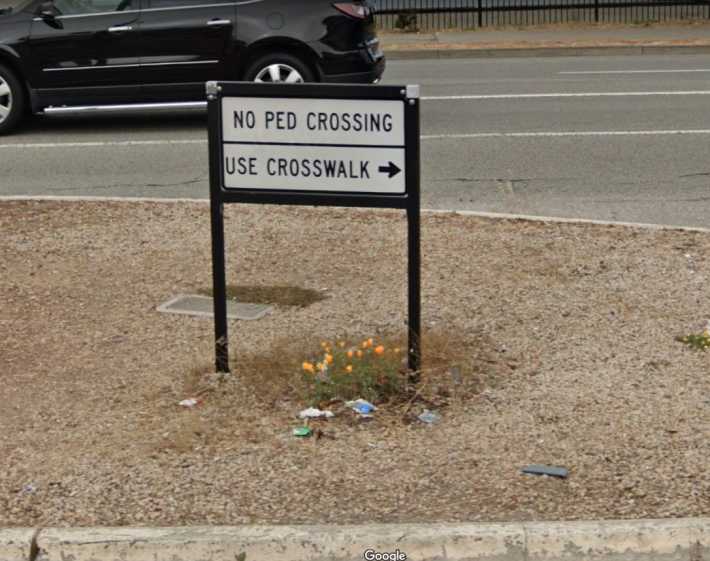
To "legally" cross 19th Avenue between those two spots, pedestrians are forced to wait at four different traffic signals, including the mid-street island pictured two images above. Kato explained that this "split crossing" was a project completed by the SFMTA in early 2018 to create a larger and safer pedestrian refuge away from Muni trains. "With the added railings and pavement markings, the project also reduced the frequency of errant vehicles driving into and getting stuck in the Muni trackway, thereby improving transit reliability."
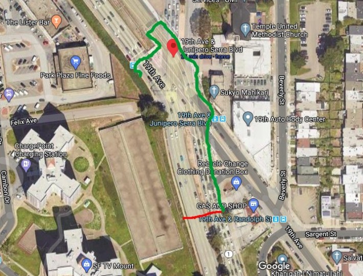
Fair enough, but it's hard to see why there can't also be a way to directly cross 19th Avenue near the Gas & Shop, where there aren't any tracks--unless Caltrans' only priority is to avoid a road design that would force motorists to slow to a safe speed. Instead, the design channels all pedestrians across a single crossing point on 19th (see drawing below, where red would be the most direct route from the Gas & Shop to the residential towers at Park Merced, and the green line is how the traffic signals and crosswalks route pedestrians).
As Walk SF pointed out in its statement about the collision, last October Governor Gavin Newsom vetoed the "Complete Streets for Active Living Bill" (Senate Bill 127) championed by Sen. Scott Wiener. S.B. 127 would have forced Caltrans to prioritize the safety of pedestrians and bike riders in their design and engineering--a change from current practice. Caltrans officials pushed hard against the bill, and made the nonsensical claim that it would cost $1 billion a year to make roads and intersections safe.
Streetsblog has asked Caltrans if they have any plans to improve safety or pedestrian access at 19th Avenue and will update this post accordingly.
“Our neighborhood streets need to be treated as such: with the speed limits, traffic enforcement, and street design needed to keep everyone safe,” said Medeiros in her statement about Sunday morning's tragedy.
UPDATE: Here is Caltrans's answer to "I'd like your response to the information in the release from Walk SF... They're putting this latest death pretty squarely on the unsafe design of Route 1, where it enters San Francisco. I'm familiar with the intersection where the young man was killed and I agree it is fundamentally unsafe. Does Caltrans have any plans to improve the intersections of 19th Avenue and Junipero Serra Boulevard?"
Response: Caltrans has a project, currently underway, to repave Highway 1 between the San Mateo County border and Holloway Street. In San Francisco During the same project, Caltrans will repave Highway 1 between Lincoln Way and Presidio Parkway. The section between Holloway and Lincoln will be paved at a later date as Caltrans awaits completion of a sewer replacement project and traffic signal project by the City of San Francisco. Under the same project, Caltrans is also upgrading curbs to comply with the Americans with Disabilities Act. Caltrans has a shared maintenance agreement with the City of San Francisco on Highway 1 also known as 19th Avenue in San Francisco. The City of San Francisco may have additional information on projects they are working on which could address pedestrian projects.
