Open Thread: Hayes Valley’s People Street. What Would You Pedestrianize Next?
Note: GJEL Accident Attorneys regularly sponsors coverage on Streetsblog San Francisco and Streetsblog California. Unless noted in the story, GJEL Accident Attorneys is not consulted for the content or editorial direction of the sponsored content.
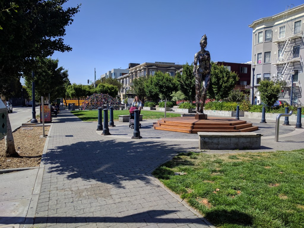
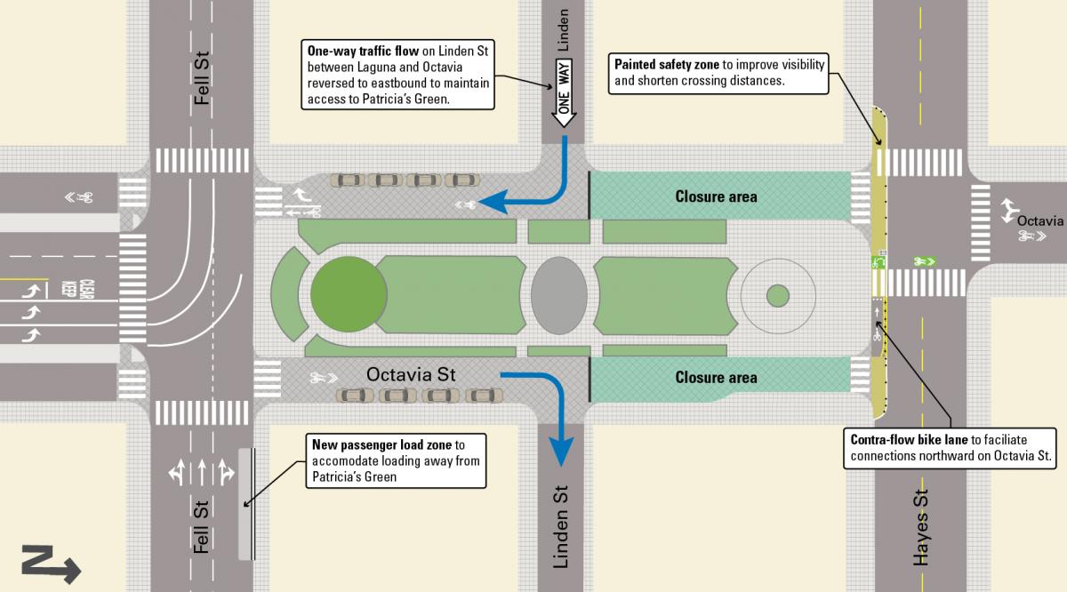
The SFMTA Board approved closing Octavia Street between Linden and Hayes, next to Patricia’s Green, to automobiles and trucks at its regular meeting yesterday.
From the SFMTA’s project page:
As part of the Octavia Boulevard Enhancement Program, SFMTA is advancing a proposal to close one block of Octavia Street – between Linden and Hayes streets – to vehicular traffic to create safer travel conditions around Patricia’s Green. The project is in response to long-standing requests from residents to calm traffic and create more public space around Hayes Valley’s central gathering area.
“We’re happy to see the streets fronting on Patricia’s Green become more people-oriented. That block is the green, sociable, and walkable heart of Hayes Valley’s commercial district, and prioritizing walking and cycling makes good sense,” wrote Livable City’s Tom Radulovich, in an email to Streetsblog.
Arguably, no other area has seen such a profound transformation, from the bad old days when the neighborhood was darkened and split apart by the Central Freeway, which was partially torn down after the 1989 Loma Prieta Earthquake.
Perhaps this bodes well for other, more ambitious car-free plans, such as Better Market Street. Advocates are also pushing to pedestrianize–create a ‘Woonerf’–on Valencia. “The City must do more to transform blocks or whole neighborhoods where residents need and want traffic calming, greening, or car-free public places,” wrote Radulovich. “City agencies seldom support bold moves to reclaim neighborhood streets, and it’s one of the reasons we’re making no progress towards our Vision Zero goal of eliminating traffic deaths and injuries.”
Where would you pedestrianize next? And what streets would you like to see turned into woonerfs, or streets where cars are guests, restricted to walking speed?
Walk San Francisco’s Marta Lindsey got the conversation started with a wish list sent to Streetsblog: Valencia between 15th and 19th should be pedestrian, bike, and commercial loading only. Stockton from Market to Geary (which was closed for the subway construction). ALL OF GOLDEN GATE PARK! Fulton from Market to Larkin (the new Civic Center Public Realm Plan is leaning this way), Larkin and Polk in front of Civic Center. The Embarcadero from North Point to Powell, and Jefferson from North Point to Hyde. Minna and Natoma between 2nd and Beale, which are next to the Transbay Terminal. How about pedestrianized streets near all of the new subway stations, including Chinatown?
What would you add to that list? Post below.

Streetsblog has migrated to a new comment system. New commenters can register directly in the comments section of any article. Returning commenters: your previous comments and display name have been preserved, but you'll need to reclaim your account by clicking "Forgot your password?" on the sign-in form, entering your email, and following the verification link to set a new password — this is required because passwords could not be carried over during the migration. For questions, contact tips@streetsblog.org.